Archive for category trips
Rain boat ride to Canouan
Today (Thursday) we hired Jude and his boat to take us up to Canouan so that we could take some water samples around some of the resorts. It as very rainy and windy, and quite a bumpy boat ride. Some highlights were a stop at Charlton for brunch (bake macaroni, salad, rice, Kingfish. That fish is pretty darn good. The interesting yacht I posted earlier was spotted, it is the Kamaxitha. The rain and the wind interfered with much picture taking, so did running out of battery power.
Union Island – testing kite and eating
Outside getting burnt at midday testing the parafoil and kite aerial photography equipment on Big Sands beach, north shore of island. Then wandering around Clifton (conch shell corrals for live conch holding, finding sea turtle bones), and in the evening giving 3 folk a ride to Chatham Bay (west end of island where their boat is moored, their blog here) and being treated to lobster, mahi-mahi (dorado), plantains, salad.
Another Union Island first for me – tamarind tree
We drove the road east from Clifton, through Ashton until the road ends abruptly after a steep hill. Back tracking a way we headed up a newly cut road in the hillside and had a look around. We found a tamarind tree, with pods full of the super sour seeds and pulp.


Arrived Union Island
Caught the fast ferry from St. Vincent to Union Island yesterday, arrived here about 6 pm. Spent some time today looking around the island a bit, checking out the cottage friend Stephen rented, and having lunch (conch stew and rice). A day of firsts for me – first time touching the water of the Caribbean, first time seeing a coconut palm, picking fallen coconuts (most were dry, one still a bit green and had water inside), first time eating conch. I am quickly turning from the whitest guy on the island to the pinkest.
Panorama of Clifton area this morning between rain showers.

My first coconut, cottage behind is where we will move to tomorrow.

First wading in the Caribbean – was a strong rip right here

Pink house on the hill where I am staying right now, taken from restaurant in Clifton.

Nice chicken grill set up

There a re a few impressive yachts around, but this one is especially interesting.

Cobblestone Inn, St. Vincent
After a quarter of the rum had gone, I got all “Hitchensy” and stood on the roof top patio in the warm humid air feeling world weary and bottle-wise.


Clouds and stuff
I’ve finally arrived in St. Vincent, all in one piece but for one bit of luggage lost by LIAT on last leg from Barbados to St. V (the bicycle, yes, I was humping a fekkin bike with me). Plane was a Dash 8, almost a bookend to the Air Canada Jazz Dash 8 I took from Victoria to Vancouver the day before, but this one had more legroom and a teeny bit shabbier. Not as much concern about cockpit door security too.
On Airbus 319 from Montreal to Barbados I got punchy and bored (understandable after the hell that was the red eye from Vancouver to Montreal). Suddenly I saw clouds. I mean “saw” them. Look, by that time my neck was sore from all the head-snaps of micro sleeps and I probably had moved on to an alternate realm of common sense, but crikey didn’t the clouds around Bermuda and on south look text book?
Now hold on, before I even got as far as Bermuda I had grabbed the GoPro to shoot what I thought was the last part of N. America I’d see on the trip. The flight line goes straight down past Boston and out to run over Bermuda and on to Barbados. I can’t be arsed to id this part of New England, but will post the riveting vid.
And then the clouds just south of Bermuda…it got even better as we closed in on Barbados, but even in my fevered state I knew that lots of cloud pics would, in the morning, seem silly


Trip – curtailed short trip in Sooke
I thought I could make a circle route coming back on the north shore of the Diversion and Bear reservoirs, but active logging and an unexpected gate foiled me. Ran out of daylight and camped in slash. Next day was raining and I had brought the wrong fishing rod so I had no real excuse for not coming home.
Still had skinny summer road tires on (Agilis 81). They look like train wheels.
August trip 2011
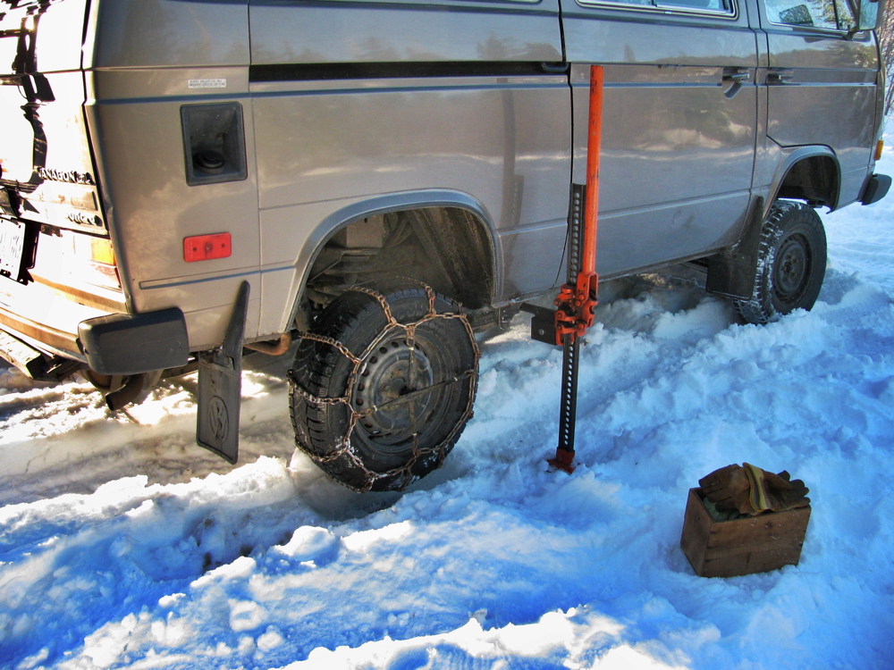
Back from a 2.5 week trip into the southern interior of BC. It was a bit of a rush to get the van ready for the trip, the last week or so of camperization was a mixture of success and compromise. I did not get the upper bunk installed in time, I hit a few snags that I will write about later. To add to the pre-trip frenzy, the day before we left I noticed the front outer CV boot on the driver’s side was ripped. Fortunately the local VW dealer had boots in stock, so the night before we left I put on a new one. It was a fairly straightforward job; jack up and support the van, remove wheel,undo the axle nut, undo the sway bar drop link on that side, remove the 2 socket head bolts holding the ball joint to the upper A-arm, let the spindle swing out, undo the inner CV joint, wrestle the axle out (tight), pull the inner CV joint off, pull the ripped outer boot off the free axle end, clean and repack joint, install new boot…. yadda yadda.
Next day we left, wife, son, 2 large dogs, and a borrowed canoe (my 18′ cedar canvas canoe was too heavy for the stop gap rack I had installed on rear of van). Here is the van at the Swartz Bay ferry terminal. It really does look like a Westy now, doesn’t it? And to my eyes, it looks a lot better than the other RVs in the line up.

On the mainland we headed east to Hope and then on to Manning Park. It has been a tradition with us to stop for a few nights in this park. While the campsites at Lightning Lake can be busy, it only takes a little bit of effort to get away from the other campers. The air is clear and with the elevation (+4000 ft) the nights are cool. I really recommend stopping here and exploring. Here is our campsite.


A black bear was around and it wandered through our campsite one evening (luckily our dogs were out on a walk with my wife) and again the next day it passed behind our site, this time the dogs did raise the alarm. Of course the camera was not handy. We did some canoeing in Lightning Lake, and I portaged the canoe to the next lake (Strike?) and we did some more exploring.

There is a trail around all of the lakes, I took the dogs for a look.

Plenty of Devil’s Club.

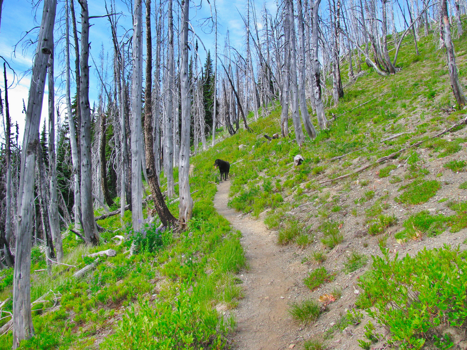
Next day I took the dogs on a hike up the Skyline Trail which leads from Lightning Lake up onto a ridge in the alpine. The trail goes through an old burned out area and the alpine flowers were still in bloom, and there were patches of snow around.


Then on the last day my wife and son paddled the canoe from the campsite over to the day use area where we loaded it on to the van. You can make out the burned trees on the Skyline Trail at the top of the ridge in the background. We met an older German (Berlin) couple at the park who were taking 2 months in a rented RV to tour BC. Nice folk and they really enjoyed Manning Park.

Then it was on east to Princeton, and from Princeton, north towards Merrit. The countryside is much drier now. Yup, that’s a nice maroon Vanagon Westy heading this way.

We were heading to Kentucky-Alleyne Provincial Park. It’s a busy and popular park and we started going there when our son was young, so we went back for old time’s sake. The lakes are kettle lakes, with no real water in flow apart from snow melt, and the lake level has been dropping for the last 10 years. So now the lake shore is about 30 metres further out than when we first went there. When we arrived, we could not get a lakeside camping spot, so the first night was back up on a site on a ridge between the lakes.

A lot of the impressive Ponderosa pines have been killed by the pine beetle epidemic. Next day we moved to a lakefront site and did some relaxing.

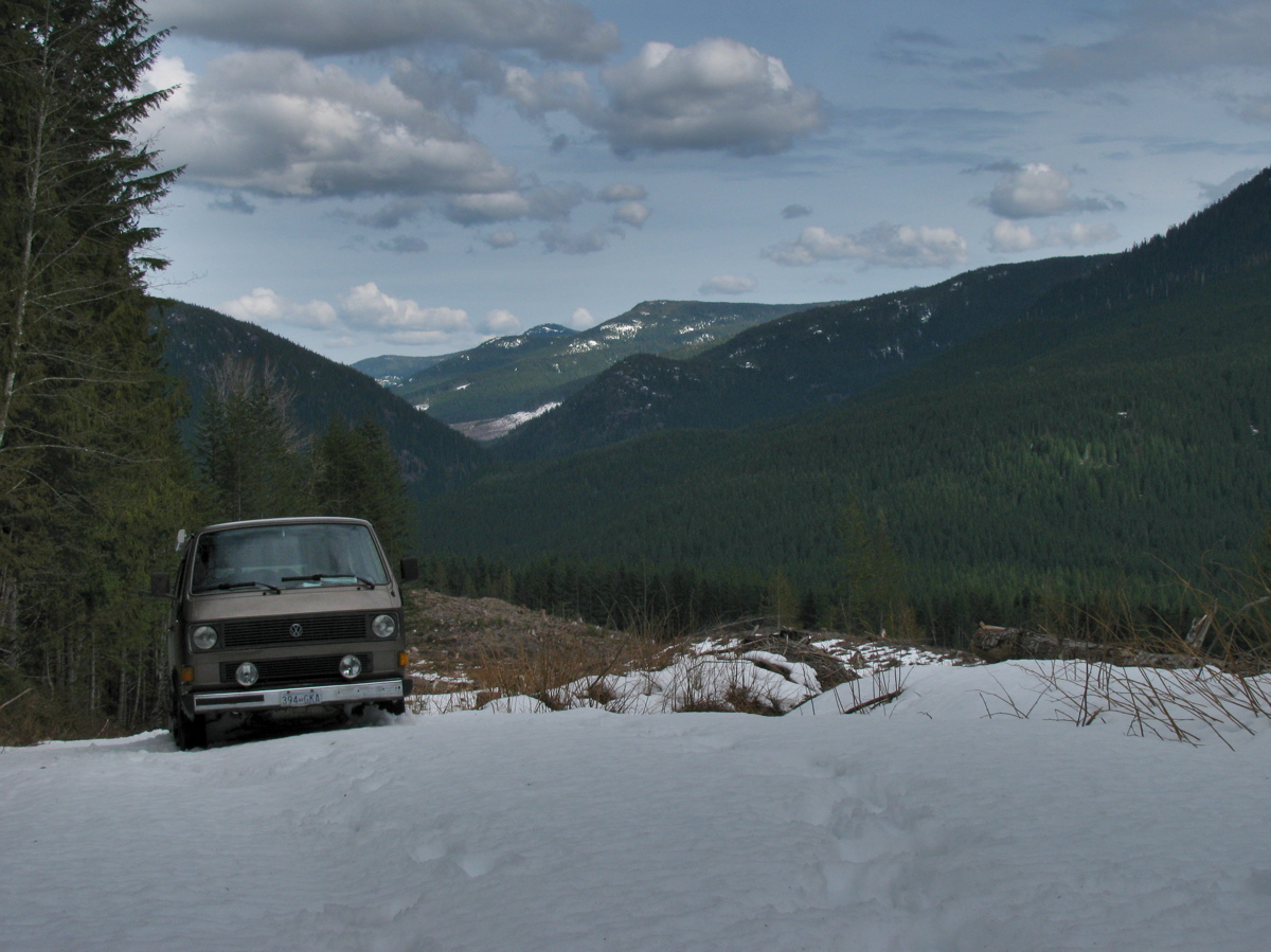
We ended up spending a few days here, with one trip into Merrit for supplies. Then it was on north to Kamloops and then further north following the North Thompson River to Little Fort. West from Little Fort (and up a 10 km 8% hill which forced the van down to 2nd gear, the old engine is tired but it did not over heat) to Bridge Lake, then south on logging roads to Scot Lake. There is a Forest Service campsite here and it is another one of those places we first camped at when my son was a toddler. We did not stay at the campsite proper, but up on a hill about 200 meters west, over looking the lake.


Compare the last picture with this one taken a few years ago when we were using the old faithful ’82 Westy.

We stayed here for 6 days, fishing, exploring, canoeing, reading. Sandhill cranes were calling, but we only saw some when a couple flew over one evening, coyotes were about, making noise and exciting the dogs, most of the Lodgepole pines around were killed by the Pine Beetle, but lots of new pines were coming up. The Spruce trees (and of course the Aspens) were mostly unaffected.

Here you can see the tell tale pitch extrusions from the beetle affected trees.


And another picture of the van, the cloudy day when we left. I have to say, coming from the damp coast, the climate around Scot Lake was wonderful. The air was clear, the sun hot (30-33 C ) and the nights cool (2 C at 7 am). There was absolutely no dew on the ground or the van in the mornings, something I found amazing.

I had my gold pan with me and one day I thought I’d see what was in the coarse sand by the side of the lake. I struck iron! I can reveal the secrets behind panning for iron, send me $9.95 and I will detail the simple but clever method to extract gram quantities of this amazing metal 🙂

I couldn’t resist taking a picture of one of my tires. Good old Michelin Agilis 81, crap in mud or snow, but great for the dry and they are a very tough and durable tire.

Another goofy pic which led my son to declare me a “doofus hipster wannabe”, making a simple pasta sauce with shallots, garlic, sun dried tomato sauce and pimenton, and the computer.

We left Scot Lake the way we arrived, back south to Kamloops then east to Armstrong to visit friends. Then back west again, passing this nice collection.


Back through Kamloops and instead of heading south there (Coquilhalla Hwy) I decided to head on west to Cache Creek and head down the Fraser Canyon. I like the stretch of road between Kamloops and Cache Creek, and sometimes you see things of interest.


In the Fraser canyon we were held up for an hour by a tandem trailer that had spilled its load of lumber. I don’t know if anyone was hurt, a helicopter did fly off from the scene.

Was another chance to take a picture of the van.

And the CPR railway was on one side of the river, the CN on the other side (lots of history here). A few model trains passed by during the hold up 🙂

Then it was a mad dash to the coast and the ferry. The delay caused us to miss the 9 pm ferry to the island, and there was no 10 pm sailing… so we took the 10:45 pm sailing to Nanaimo (further up the island from where we live) and drove down the island to home, arriving at about 2:30 am.
The van ran great throughout the trip with one exception. We had about 1.5 hrs of bucking and hesitation driving south from Scot Lake. A fresh fill up of gas solved that. Previous fill up of fuel was with 10% ethanol blend, I wonder if that had anything to do with it?
June weekend trip with 3 Vanagons
This last weekend I went on a short trip with 2 other Vanagon owners. Explored a bit of the south Island and camped one night at north end of the beach at Port Renfrew.


Trip – Pavillion north on secondary roads
Courtney on the Vanagon list asked about the back roads north of Pavillion. I’ve travelled around that area a few times and here is a brief description of route and some pics. This is all form memory and google maps to jog my old mind, I apologise in advance for any mistakes.
You leave paved roads near Pavillion, up and west through the village.
The road climbs moderately until you get onto the bench lands. The road when I travelled on it was dusty and in places muddy. I can see how it could be quite messy and difficult in wet weather. Follow the meandering road as it heads roughly northward toward Jesmond. The Fraser will be to your left, down out of view, but the other side is visible. Then the road turns north east, away from the Fraser towards Kelly lake. There is a small campsite at the lake, Downing Prov. Park. Continue on the Jesmond road, through forest and you might come across a road branching off to the west. I think its the first road on the left. If you want take this road for a more scenic route.
That road goes through forest then down towards the Fraser, steep (25%) and narrow. Once out in the open the road turns north, following the Fraser. The Big Bar Creek cable ferry is down there. Spectacular view across the river, colourful eroded hills on the other side. Follow that road north along the Fraser, sage brush, cactus, dusty roads, rolling up and down until you get to Big Bar Creek.
We then turn north east up Big Bar Creek until we get back to Jesmond road. Turn left and drive north. You’ll get to an intersection, to the right (east) will take you to Little Big Bar lake (forestry campsite there, was nice until the trees cut down due to pine beetle kill) and further east is Big Bar Lake Prov. campsite. But we are heading northwest, on and on until we get to the Dog Creek/Canoe Creek road. Turn west and down that valley to the village of Canoe Creek.
Now we are back at the Fraser and I have some pics of just north of Canoe Creek.


And then you come to the suspension bridge across the Fraser.


If you cross the bridge you head northwest through the Gang Ranch and finally end up at the Williams lake to Bella Coola at around Lees Corner. We have taken this route to get to Nemiah Valley, a very worthwhile trip. But Courtney wanted to stay on the east side of the Fraser and head north to Dog Creek and further on to Alkali Lake. So don’t cross the bridge, drive north on the dusty road – and in places the dust is like talc – and you will get to both destinations.
Some more info on this area here, “Vanishing Jesmond” and here “Bicycling High Bar road…“
Another logging road trip
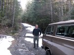
This time with visiting Vanagon mailing list pundit David B. We headed to Port Renfrew, then north on that paved road to Lake Cowichan. From there it was logging roads to Nitinat and finally Sarita, a dry sort and booming ground on the south shore of Barkley Sound. Next day we headed west to look at the Pacific at Pachena bay, then north east to Port Alberni and got to see some nice machines behind the scenes at The Alberni District Museum and Historical Society , the Maclean Sawmill museum, and a quick peek at 2 Martin Mars water bombers at Sproat Lake. Then back to Victoria on civilized roads, stopping to look at the big Douglas Firs at Cathedral Grove.
The pics are a mix of mine and David’s.
Gordon River trip
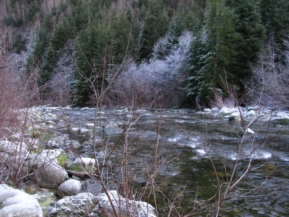
Last week my son and I headed out to explore a bit of the Gordon River watershed. The river starts close to Cowichan lake but flows southwest to Port Renfrew and the Pacific. We headed out from home to Port Renfrew then made our way “upstream”. This is the first bridge across the river, near Port Renfrew. Yes, the water was clear and this colour.


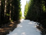
We headed on, exploring various logging spurs to see if we could find a camping spot that had a view, and had some snow. The problem we encountered was that when we found snow on those spurs, it was heavy corn snow, got deepish quickly (20 – 30 cm) and with the steep grades we really couldn’t make much headway.

We ended up at a spot in a recently logged area, about 50 meters below where the snow started.


Well, we had a bit of a view and no shortage of table material.

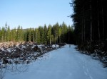
A word about logging in this valley. I’m guessing most of the watershed, was logged by the middle of the last century. It would have been mostly Douglas Fir and Western Red Cedar, big trees. Now what you see is second growth, Doug Fir, Hemlock, some small cedars. The biggest stumps I saw were about 60 cm diameter. That section in above picture had around 50-60 growth rings. Here are some pic of the recently logged area, showing some old grey stumps from the first cut.


Next day we headed on, again being foiled by steep snow covered spurs, and we decided to try to get to the trail head for Mount Sutton. We found the access road on the north side of the river to be choked with alders. This road starts at the site of the old Gordon River logging camp, which at its peak (1950?) was one of the biggest camps on the island (google map ref). Pretty well nothing remains of the camp now, but if you dig around this site you can find some info and pictures of how it used to be. One strange relic remains, a Mk III Cortina under a fairly large section of cedar log.


You have to be alert for logging trucks, there was about one every 10 minutes.

We headed back west, “downstream” and explored the road that, on the map, leads to the Gordon River Caves. It was another steep and snow covered spur, but we did manage to find a small waterfall and have lunch.


Further west we drove up the north side of the valley, again through logged areas, up steep (measure 29 degrees on one section) spurs, and again foiled by heavy snow. Saw elk tracks though.

We backed down a few meters and found a room with a view.

And some old wolf scat.

It started to rain that night, and the next day. We drove east, “upstream” and came out to civilization near Honeymoon Bay at Cowichan lake. One benefit of traveling on active logging roads is that they are graded often.

It was a fun trip with a few more dents added to the syncro.
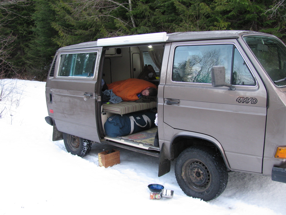
Jan 2/3 2011
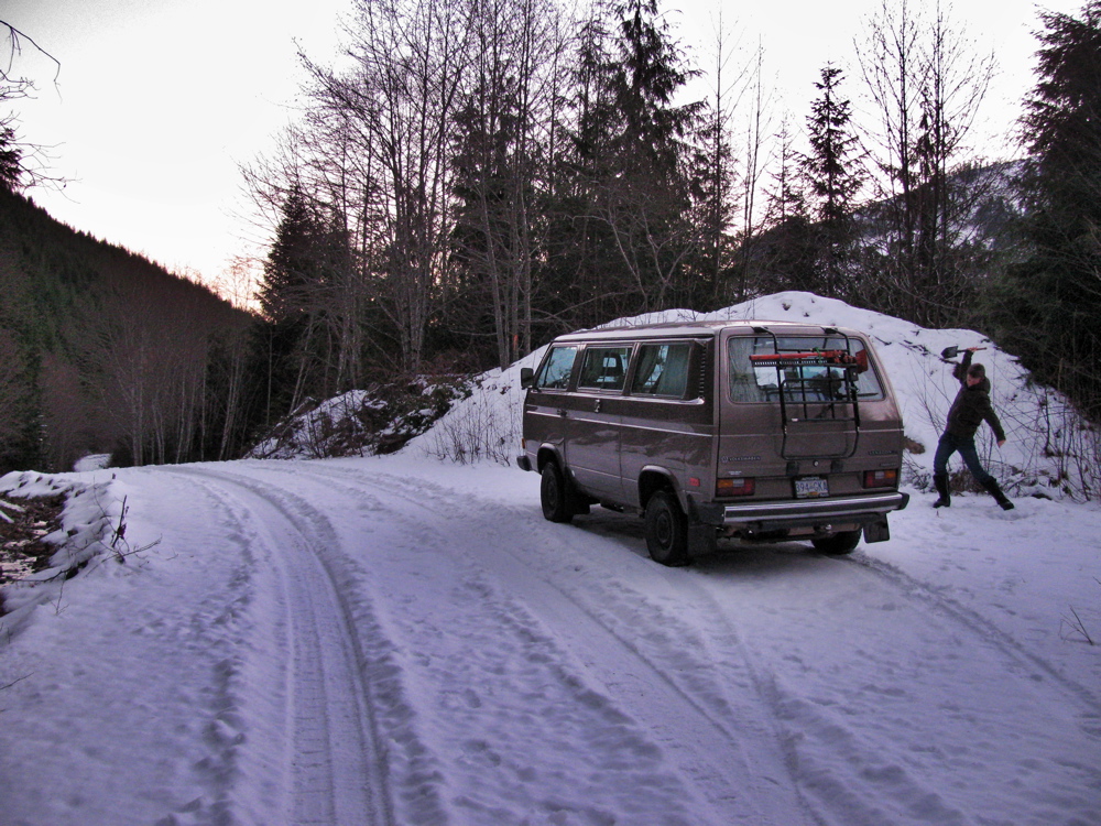
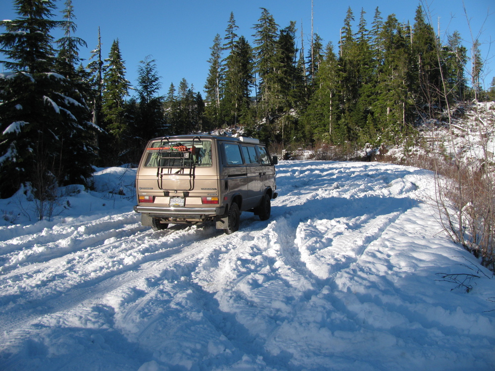
I”m just home from another overnight trip, with my son this time. I switched tires to the Nokian CS set and hoped to do a tire comparison, but the snow at spot where I had camped 2 nights before had softened and so i really could not honestly compare the tires with the Vredestein Winter Comtracs used before. We decided to move on, and we ended up camped on a pretty dismal part of Granite main logging road (I had got stuck just a little further up this road 2 days before).
Here is the google map ref link for the camp spot on road. The sort of sideways heart shaped logged logged area to the west of the green arrow (“campsite”) is where we skied to the next day.
google maps ref
On the way to that spot we had to drive past Port Renfrew . By the way, you might know Port Renfrew as the southern entry point to the west coast trail.
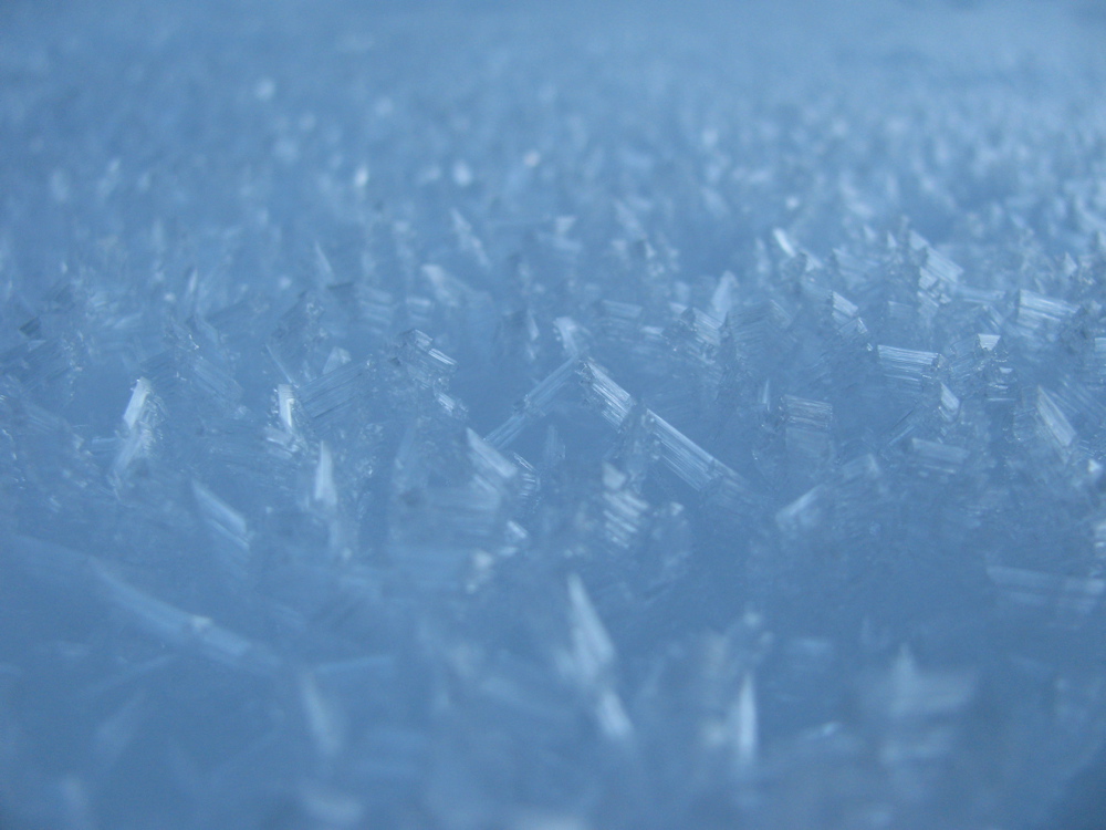
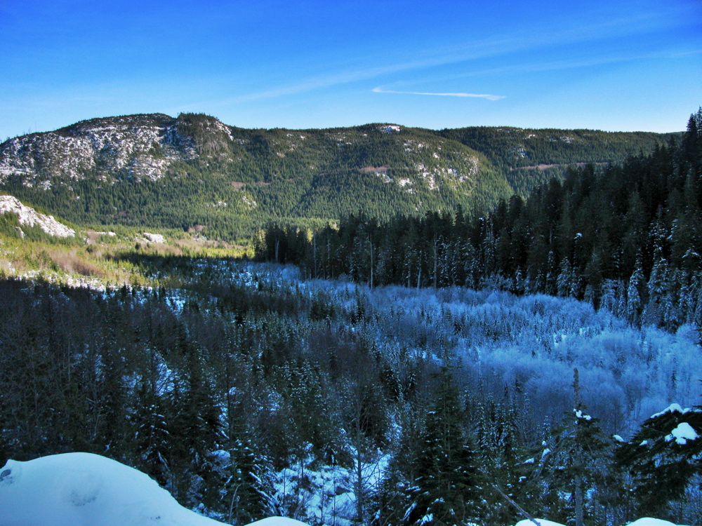
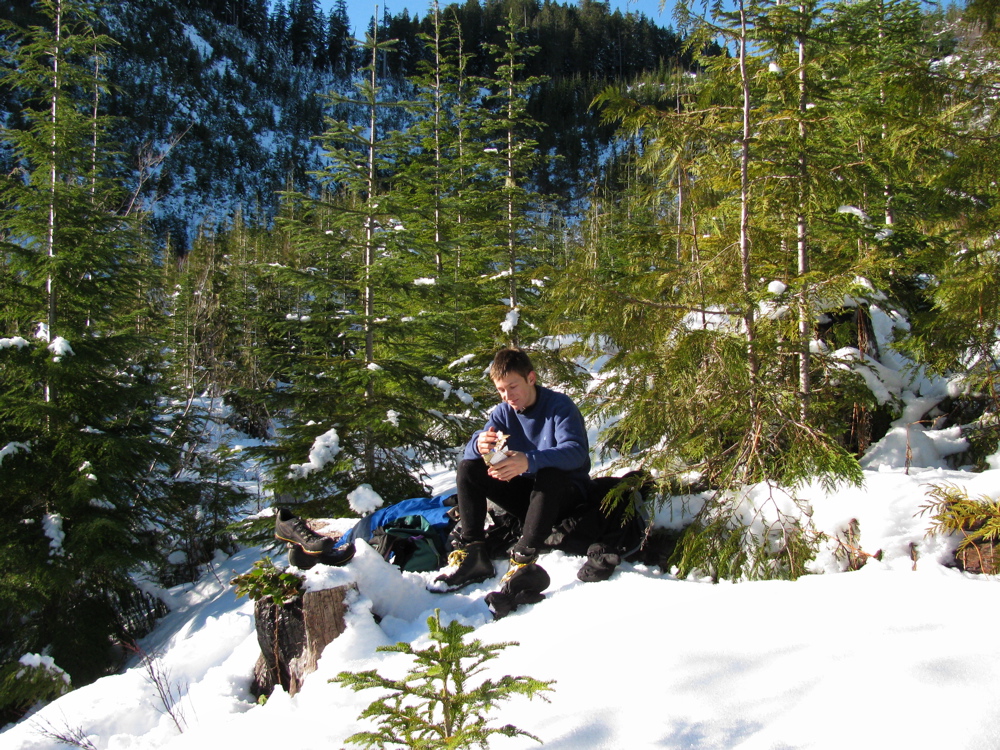
It looks almost tropical, not typical, in the first two pics. The eastward looking shot is where we were heading, not much snow visible. We went up “Granite Creek main”, not quite as far as where I got stuck previously and decided to camp overnight by the side of the road. Next day one of us decided to sleep in. Then on to slog along logging road to the heart shaped cut block seen on the google map ref. The snow was heavily covered in rime/hoarfrost, and the area was mostly second growth with a few reminders of the size of trees there before. Looking back to where the van is parked, near the base of that vague diagonal line at the left of the picture, then looking forward at the cut block… pretty close to a 45 degree angle, hard work cutting trees on that, eh? Then found some sun to have some chocolate and on back to the van. We headed home via Cowichan Lake, just as I did the trip before.


End of December quick trip
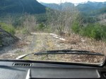
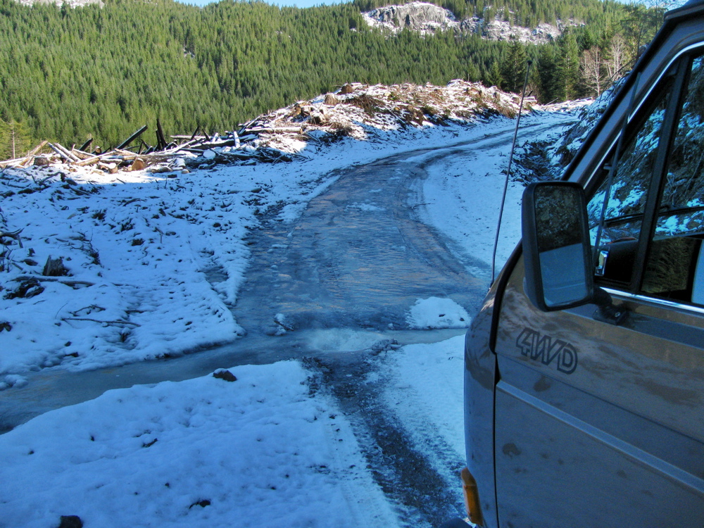
Just back from an over night trip around the south tip of Vancouver Island. Starting point of the slideshow is the one overlooking a gravel pit, tiny dot in the ocean is an optimistic surfer. Left the paved road at China Beach day use area and then headed up northish towards San Juan ridge. The snow is old and hard, and icy underneath. Spent the night up there (48.47573 N 124.06610 W), the jury rigged platinum catalyst heater helped to keep van interior above zero. Next day, defrost inside of windscreen and then back down to paved road and on westward to Loss Creek. Up the road alongside the creek/river, getting more brush scratches on the van, found someone’s hunting camp and then 100 metres further the road is out. So back out to pavement, on past Port Renfrew and on to road heading to Cowichan Lake. I took a look up Granite main logging road as far as I could go, saw shotgun shells, got stuck in the snow, saw wolf tracks, and came back down to paved. Further along the road went up logging spur mentioned in the April trip report. The road too steep and slippery to be able to get to where we camped before, came across a pretty tough obstacle, lots of ice. Back then to the main road and on to Lake Cowichan then back down the island highway to home.


End of August trip
Back to blogging, catching up… here is short trip report I posted on the Samba about recent trip. Back from 6 days of exploring Nitinat and Klanawa watersheds on Vancouver Island. Started with us heading to long time fav spot on Nitinat river. Stopped the van to check on access trail and found it to be well blocked. We were pretty disappointed, and then more so when the van would not start. I discovered that the red/black ignition wire had come adrift from starter solenoid, and on the syncro its a bear to re-attach. Light was fading so we managed to push the van back up traill a bit and then push start. We headed to higher ground, up Worthless creek logging spur road, to about 500 m elevation and camped over looking Nitinat river valley. Google map ref Pics show low clouds around around 8 next morning. 
 I’m sure some of you know what this is:
  After a lot of cursing I managed to get wire onto solenoid, and we headed down and then north to the Klanawa watershed. We were looking for a nice secluded riverside spot, and went down a lot of old dead end spurs, most of them with alders overgrowing the sides, so the van got a lot of scratching and rubbing. no one else on the roads there, maybe due to the fire restrictions? Who knows, but we stayed away from “central main” logging road which I think gets most of the traffic to Bamfield. We ended up at an ok, but not great spot by a bridge on Tsucowis river/creek, right where Gorge creek enters. No traffic went by us when we were there (infact we didnt see or hear another vehicle for the 3 days in the Klanawa). Google map ref
  Then on to explore more of the Klanawa, heading west, almost to pacific rim national park boundary… we thought we might be able to get access to Blue lake, but no luck, road that might have done it was blocked on purpose by large cedar log, active logging not far away (logging right up to park boundaries.) And again, more fruitless spur road exploring (btw, lots of berry laden bear poop around).
  We were getting really frustrated and finally, after a long, and again, failed attempt to get to a map target (this time Dorothy and Arthur lakes) we headed back toward Nitinat. On the way we stopped at Flora Lake forest service camp site, just for a look… Years ago we had discounted this site as too close to “main” roads and very dark and buggy. But this time, it was sunny and no one was about. So we stayed a night. The lake was lovely, but the forest around was still buggy despite the recent dry weather, and really looked like “Mirkwood”.
 Next day back into Nitinat valley and west to the village of Nitinat to get some gas. Then eastward, back up the river and we found a road down to the river. It seemed like a popular spot for locals, road was clear of brush and there were signs of camping. But no one else there and we set up camp. We spent a couple of days there. You can see the trail from the main road, and it ends at the top of the google maps ref, at the wihite gravel bar on the inverted V of the river. Google map ref Further upstream you might be able to make out the rocky “falls”, we walked up the river to do some fishing there, you can see the large trout in the clear water, quite amazing. No luck landing one, but some fun had hooking then loosing 🙂

 Well that’s about it. It was a real shakedown trip for the van, the roads were pretty harsh in spots. Scratched van, right hand side mudflaps hit and loosened from body, front right bumper strip lost, couple of dents here and there, sort of par for the course. No real trouble apart from starter wire except some periods, when van hot, of bucking and jerking on part throttle and acceleration. I looked for all the usual suspects but found no smoking gun. It went away after we gassed up in Nitinat, so for the time being I am putting it down to bad gas. Oh, and the Dometic fridge worked flawlessly 🙂
Weekend trip in April
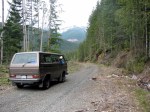
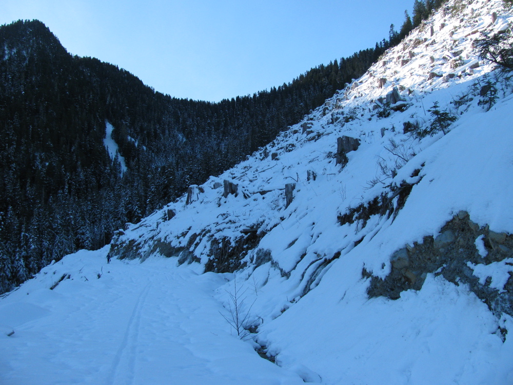
Went on a quick overnight trip with my son. Ended up on a logging spur road between Cayacuse and Port Renfrew.
Then on to Port Renfrew and back around to home. Snaps below, note: roads were steeper, and snow deeper than they appear in the pics 🙂
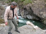
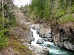
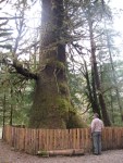
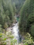
The big Sitka Spruce (Harris Creeks spruce, and Harris creek also shown in the rocky sided gorge pics, taken at different points on the creek) is bigger than it appears. Base of tree as wide as the Vanagon is long.
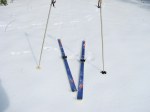
Hey you trendy modern free heel skiers, don’t laugh at my mismatched poles and 80’s vintage TUAs with those wimpy bindings.
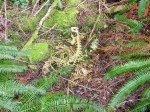
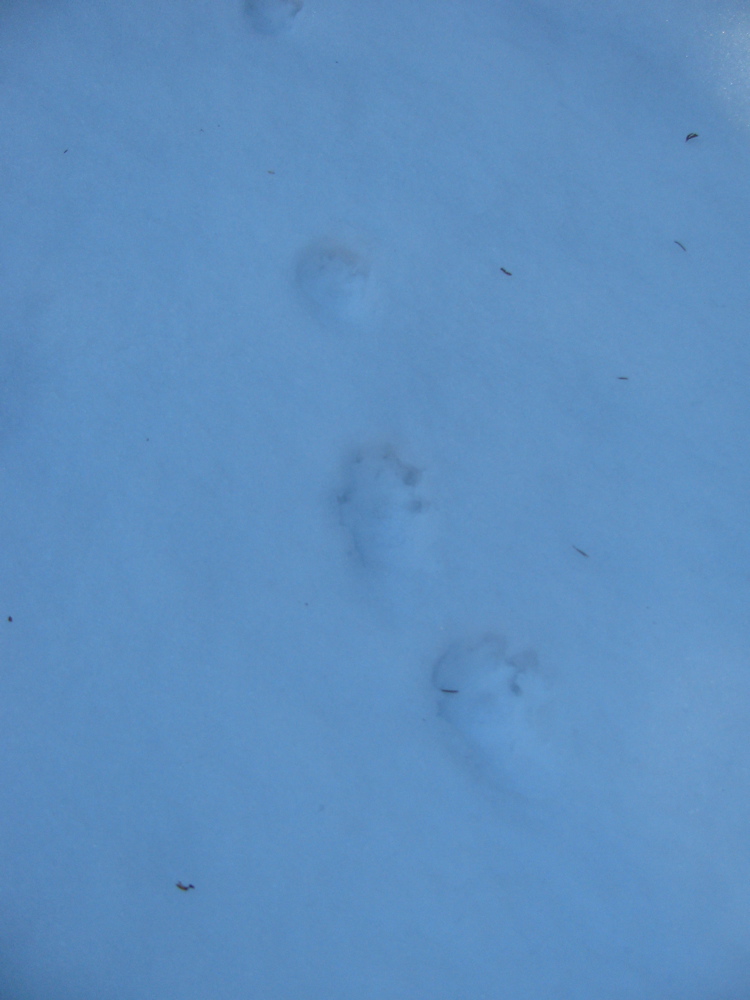
Oh and one more thing, skeleton pic… we found this just off a logging road. Looks like 2 skeletons in that pic, a third was a few feet away. No legs or skulls.
Update: looking at skeletons again, I’m guessing Black Bear. Lack of feet and skull good clues too.