Archive for category trips
Trip – Klanawa again
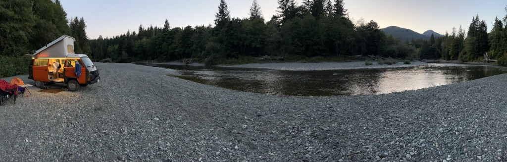
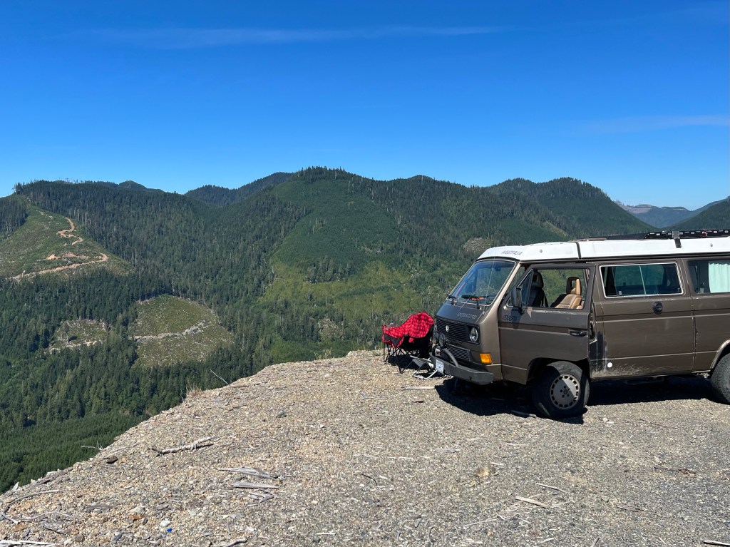
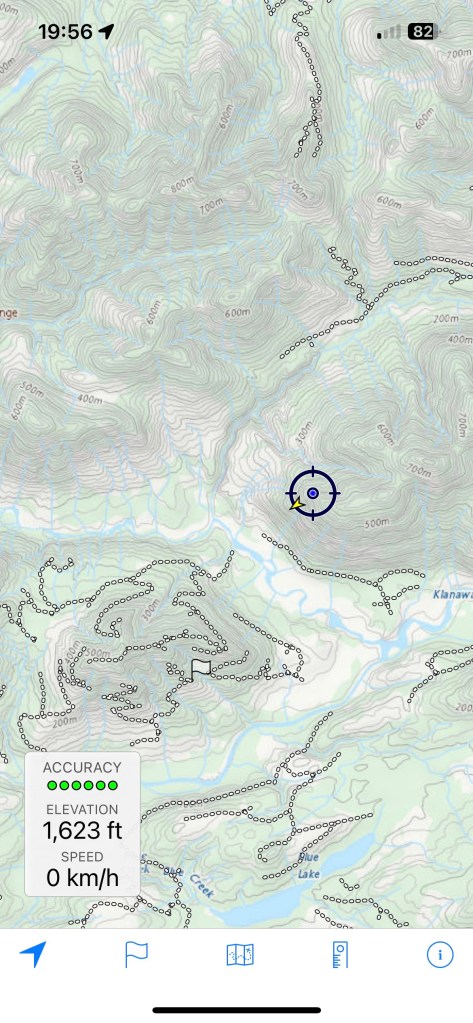
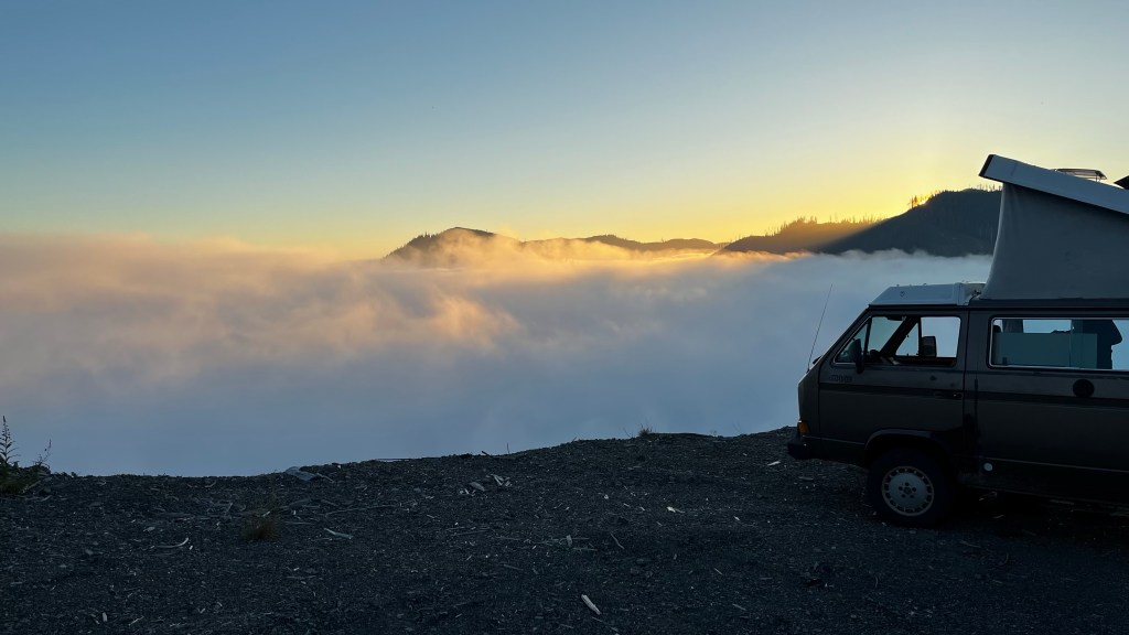
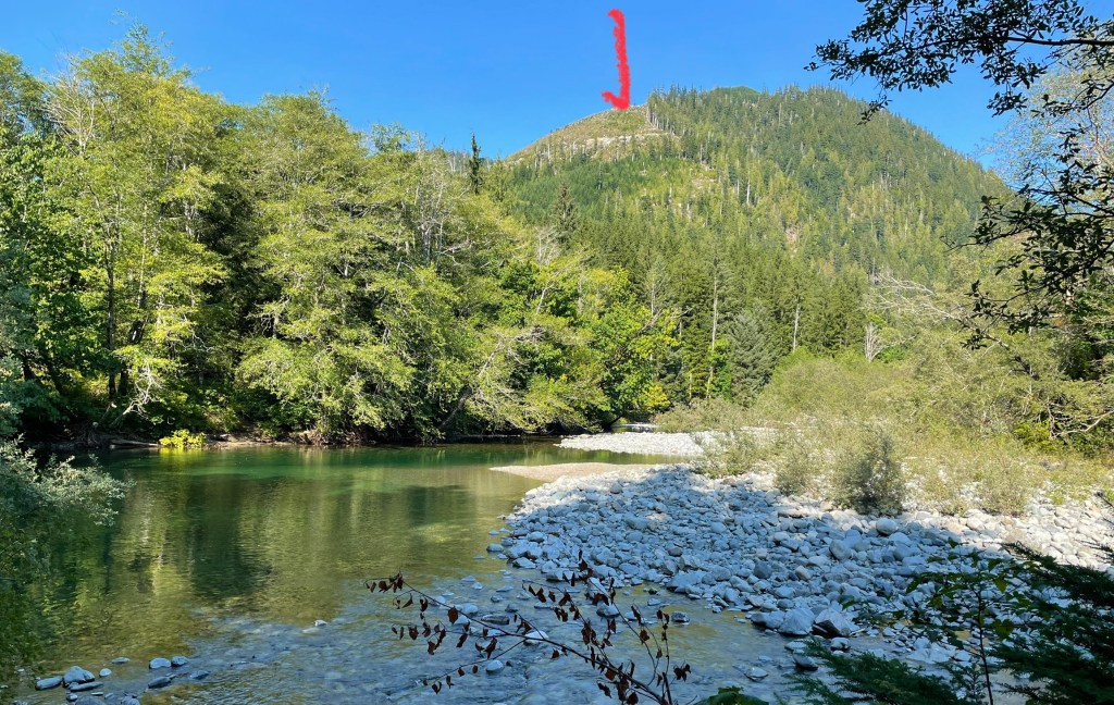
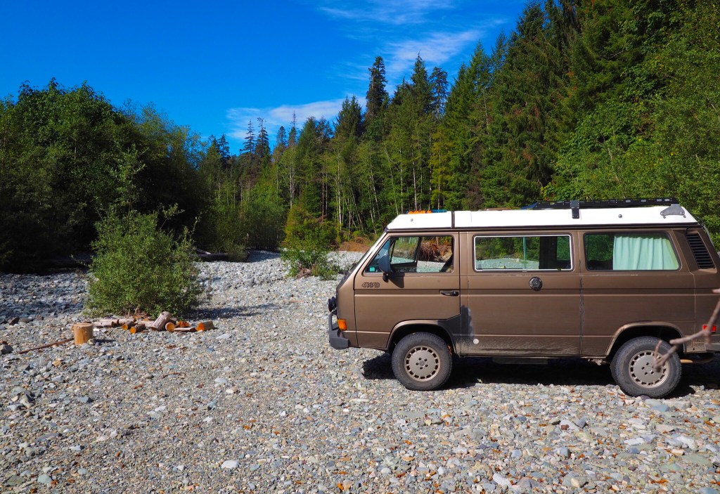
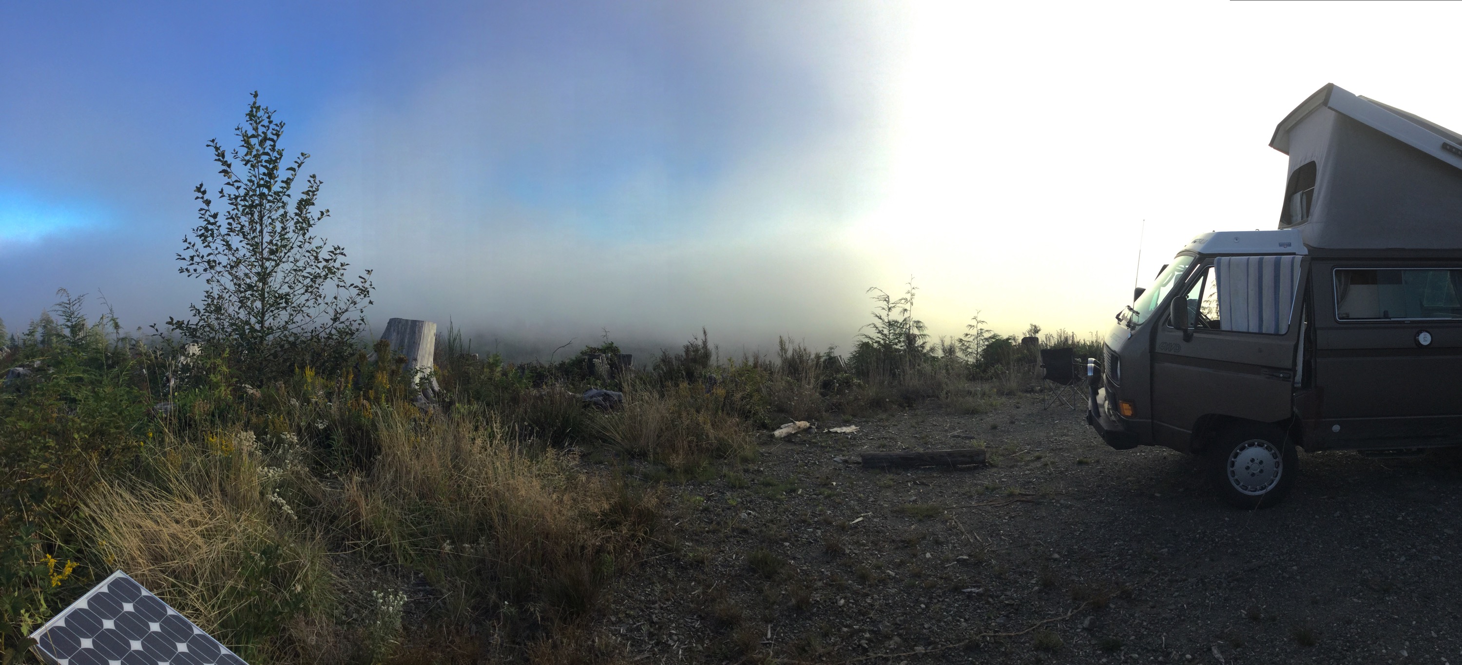
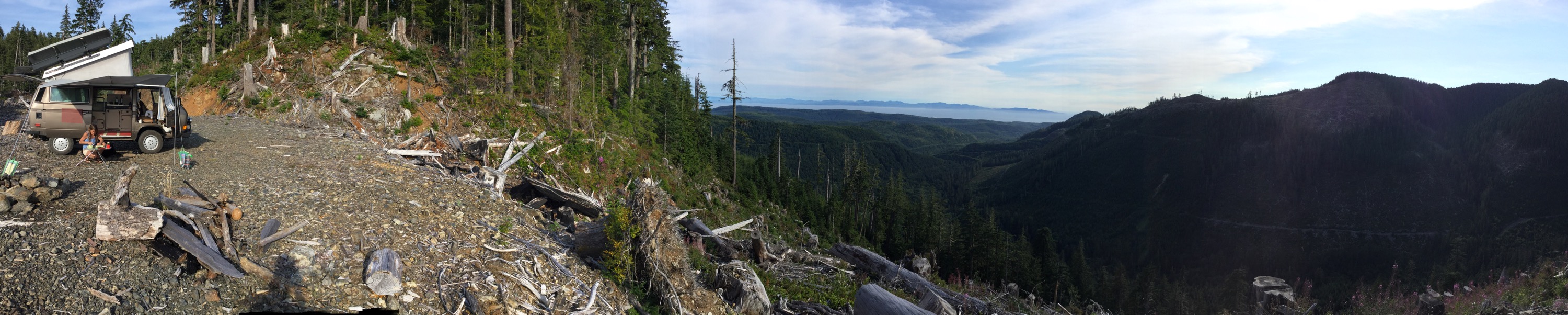
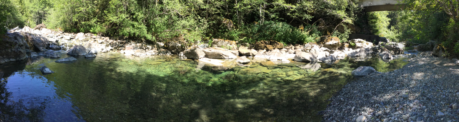
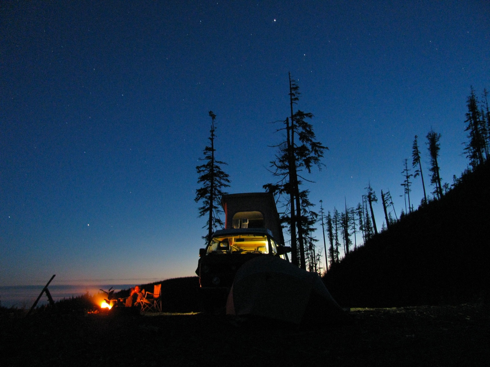
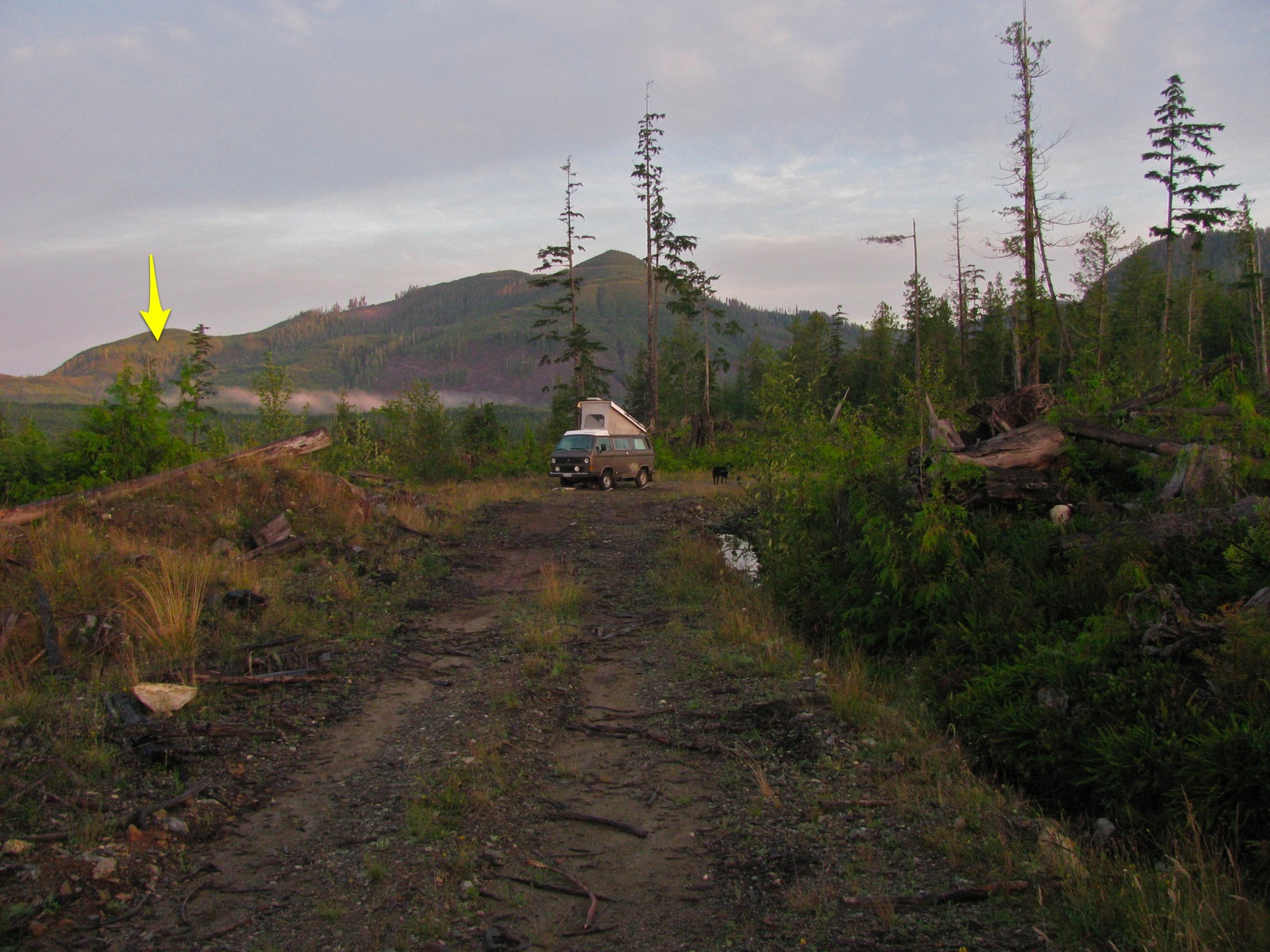
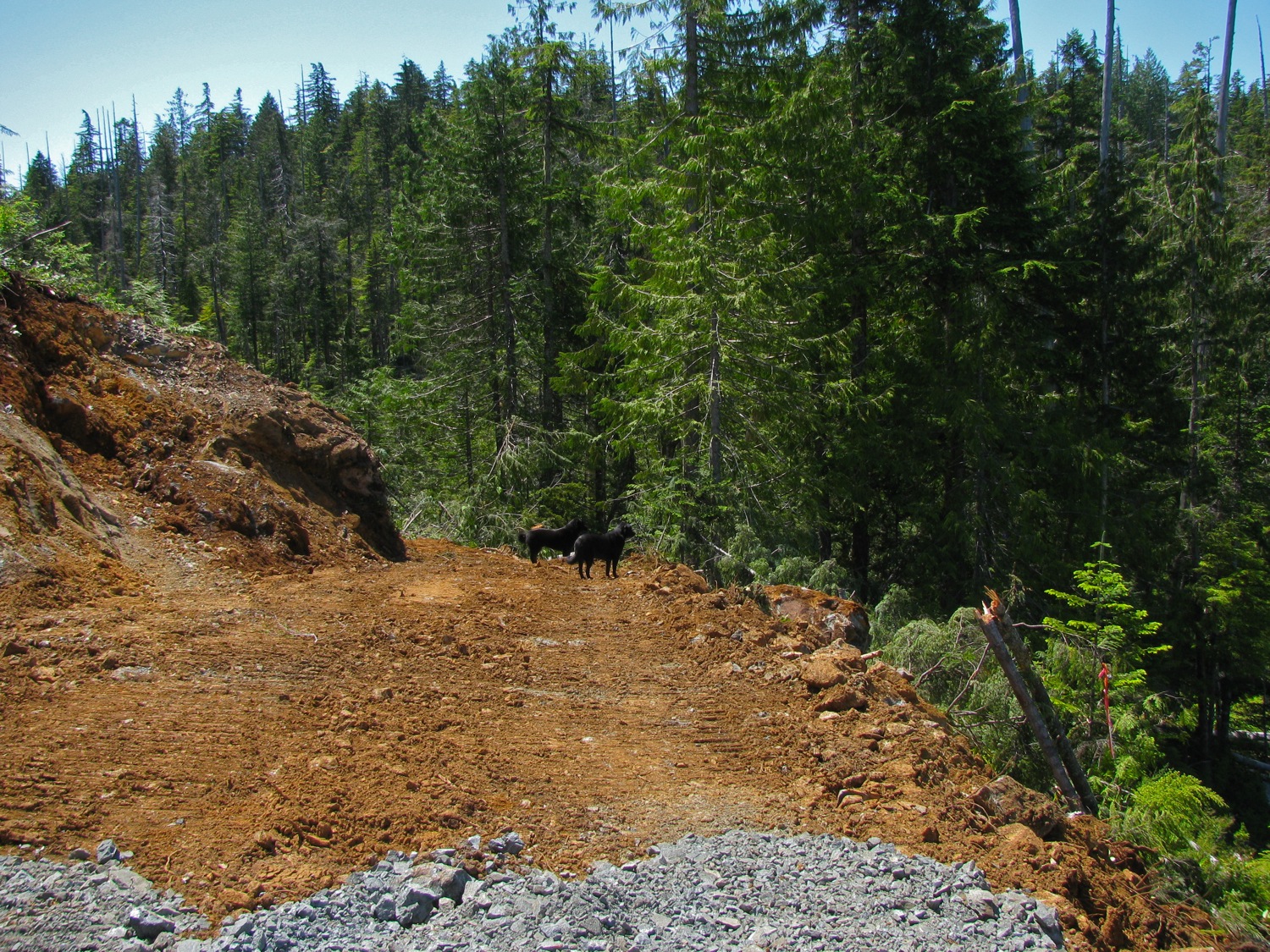
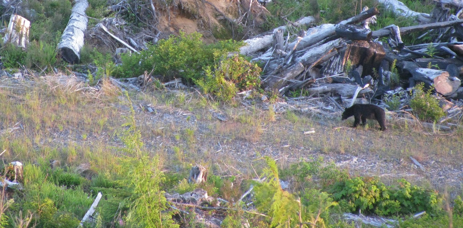
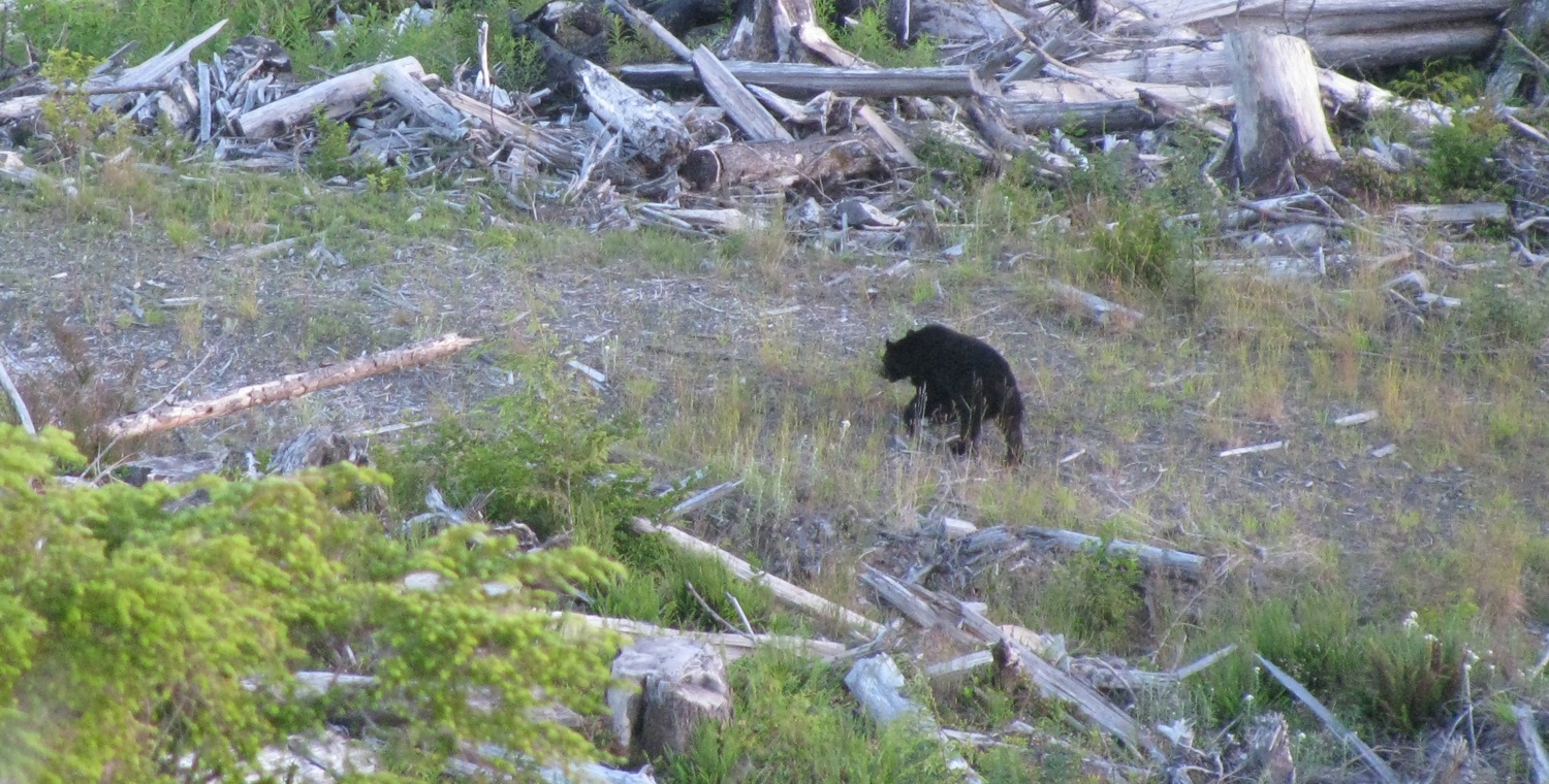
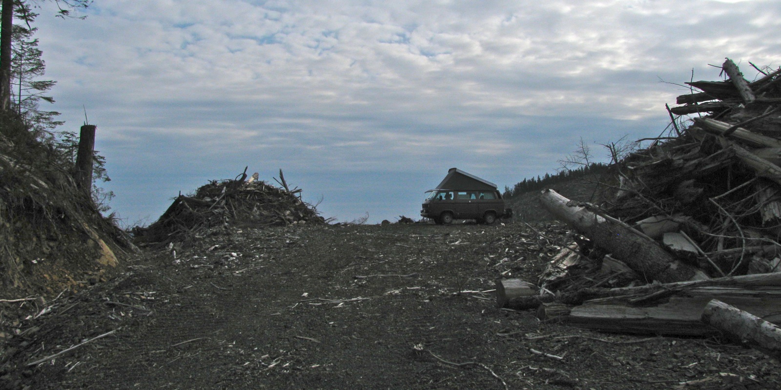
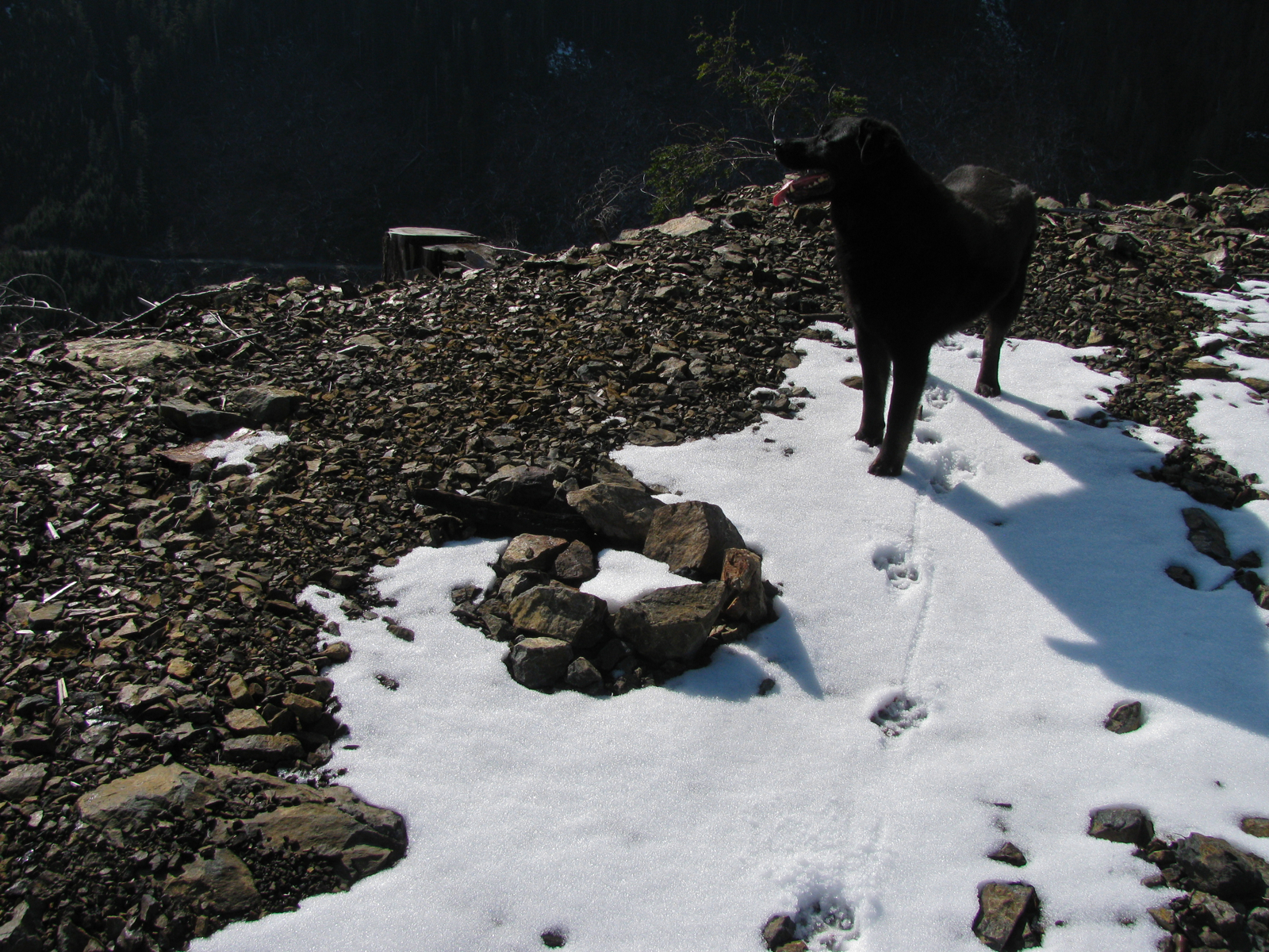
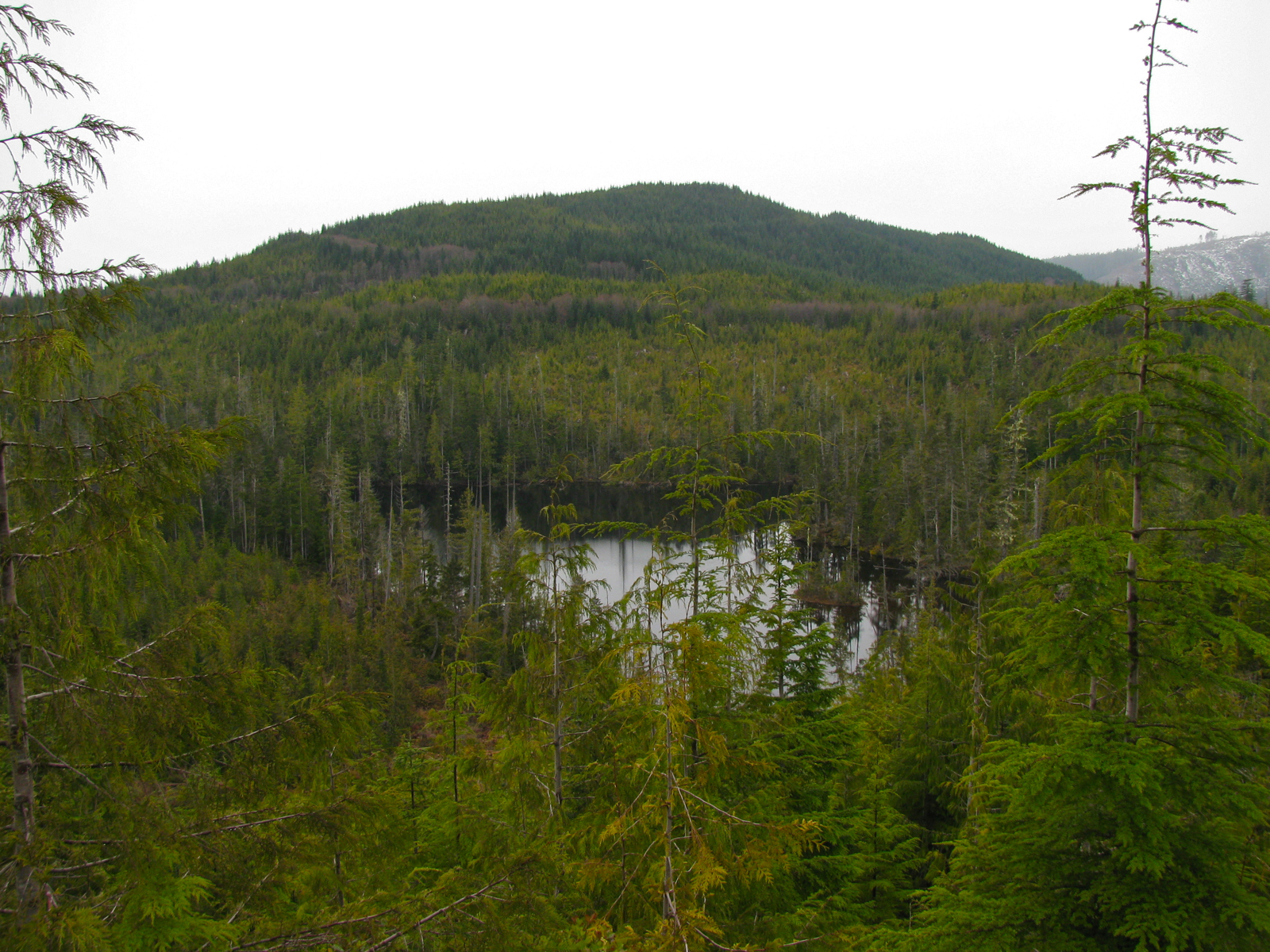
Couple weeks ago we took a week long trip to the Klanawa. First night was on the nitinat though, just upstream of the bridge. Then into the Klanawa valley, exploring a bit, finally settling at Tscowis creek. A campsite that we’ve used before. For some reason it doesn’t sit well with me. Dunno why. Nice creek which is always cold, the nearby logging road not busy. I dunno, I just prefer other spots. Anyway, two nights there then off exploring and with the idea of camping up ona hill over looking the Tscowis. I’ve marked a pic with arrow locating the high spot seen from Tscowis. Also I’ve included a map grab.
Lovely being high. Could see the pacific when the fog wasn’t in.
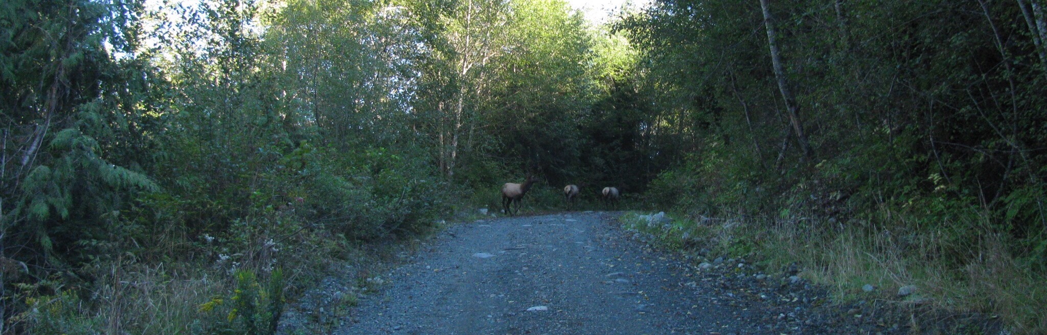
Saw couple of bear, some young elk, and Vauxs Swift ( at the high spot)
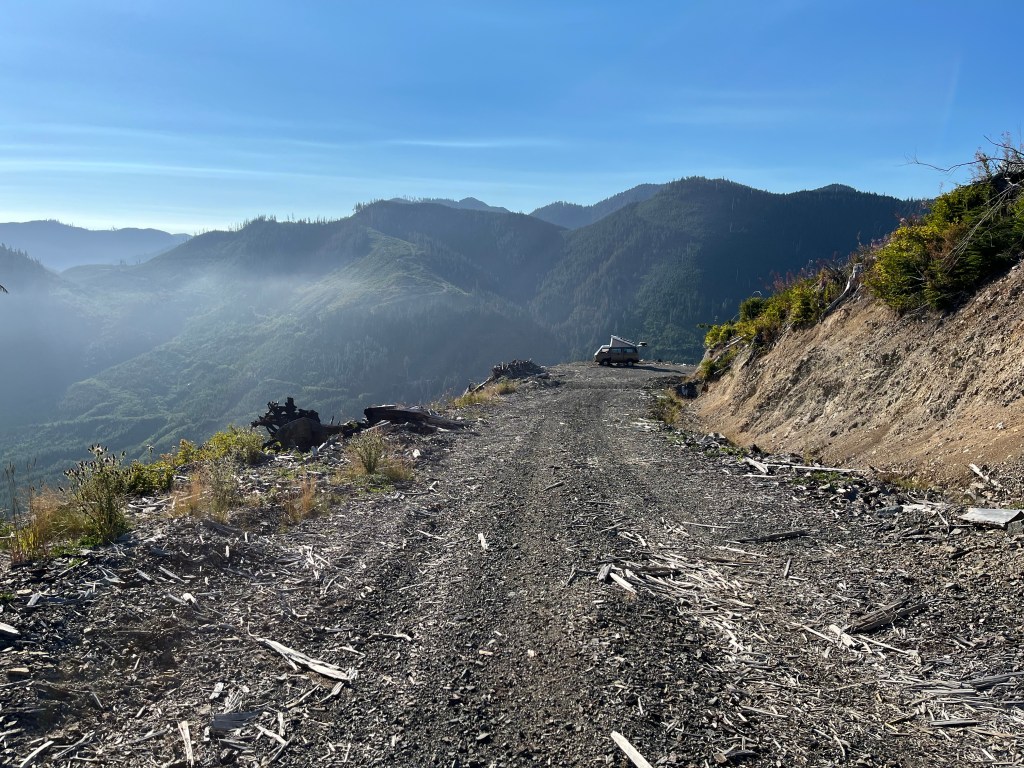
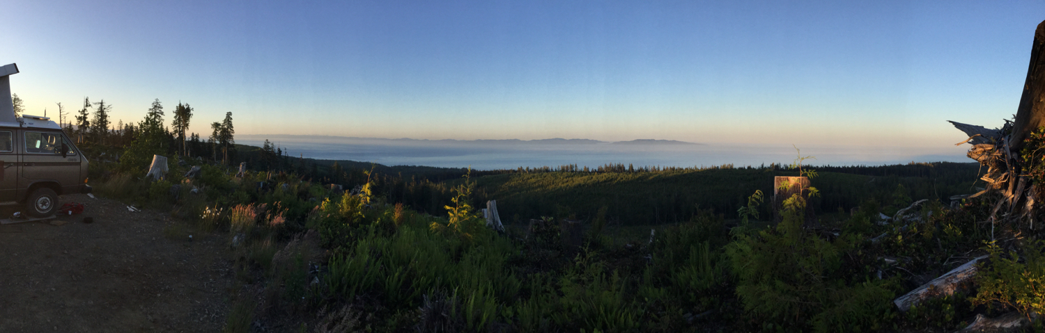
End of week the smoke from fires in the interior of BC came in, high up. Next day though the smoke was low, hazy and aromatic.


Trips – mostly Klanawa
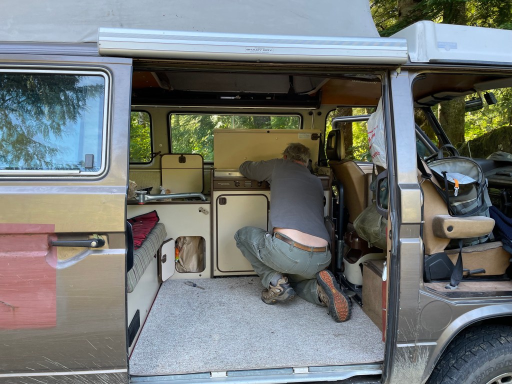
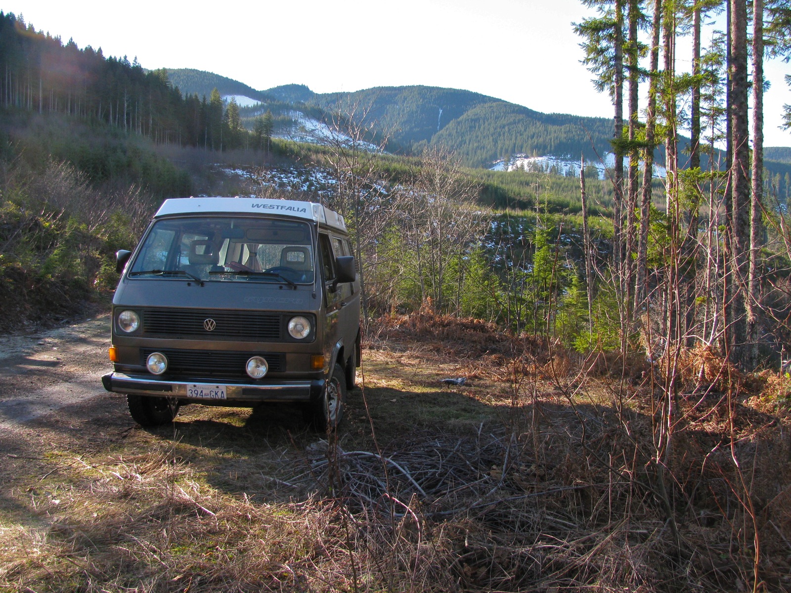
The day after fixing the coolant hose problem we went on a trip. Of course, I was nervous. Maybe foolhardy to go off on such a trip , out of cell coverage, long walks to get help, without doing a better shake down of the van. A 35 year old van. But off we went anyway 🙂
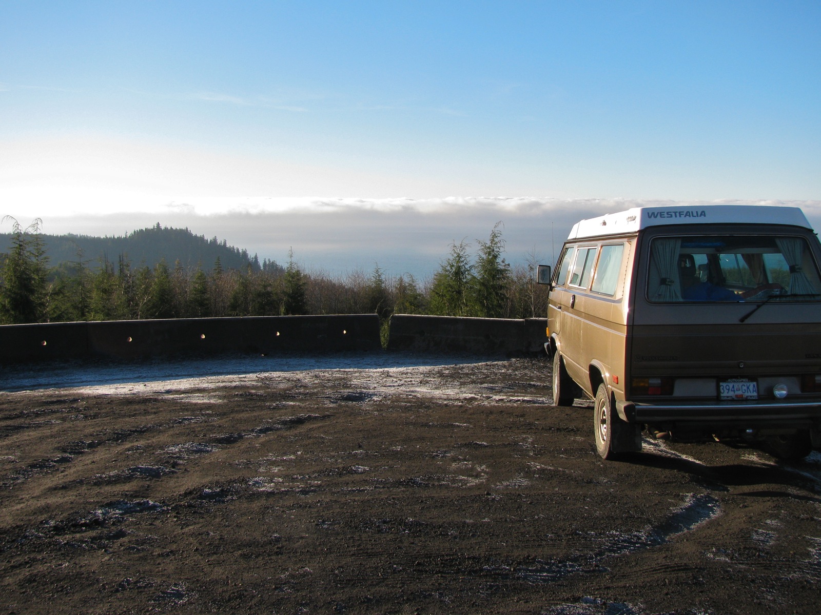
Headed to Port Renfrew on the off chance we could get through RCMP roadblocks and get to our favourite spots northwest of the town.
There is a big logging protest in the area, as of writing I think there have been over 800 arrests of people protesting the logging of one of the last remaining old growth watersheds, the Fairy Creek watershed.
Wikipedia entry here:
https://en.wikipedia.org/wiki/Fairy_Creek_old-growth_logging_protests
We got stopped by a private security roadblock well south of the bridge over the Gordon river. The stated reason for the roadblock was road work further on. Yeah, right. Very uncommon to hire private security when doing road work. Makes my blood boil just thinking about it.
Turned around and headed to Cowichan Lake via Harris main ( also know on as Pacific Marine Road. This road is paved and a popular part of a circle route back to victoria via Cowichan.
At the lake we headed west on the south shore road , and back onto rough gravel. Onward west, and into the Nitinat watershed. Nipped down the wee road to check out Nitinat river falls camping area. We’ve camped there a couple times before, but there were others there this time and so we headed back on main road, onward to the bridge across the Nitinat , and looked for spur road that we had gone up 10 years ago…
I took wrong spur and ended up on the south side of Worthless Creek, road got steep. Nothing we aren’t used to, steep enough to have to use G gear on the syncro, and ease through a couple of ditches across the road.
Here’s the approx location.

Yes, that’s Nitinat lake in the distance. We could even make out the kite surfers ( binoculars ).
You might think us crazy, but we love having a view even if it’s on a rocky logging road.
The marine fog, low cloud, the next morning .

Off again Klanawa Main. Oh btw, passed Flora Lake and the forestry campsite. Pleased to see the campsite has been fixed up again. Few years ago we saw the access road washed out.
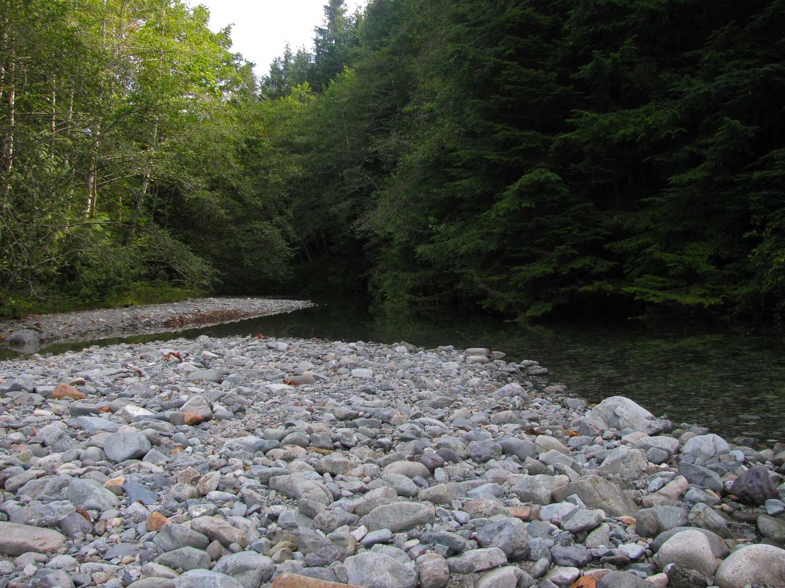
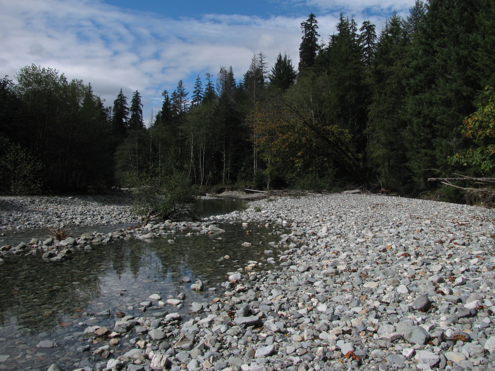
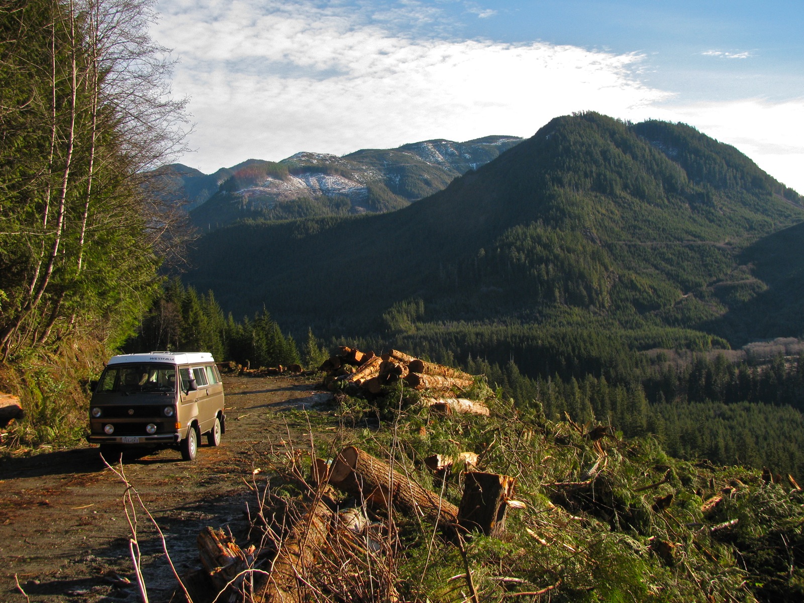
Then down Klanawa main logging road. Stopped at a spot on the upper reaches of the river. We have stopped here on other trips, lunch spot. As expected the river at this point is dry. Forst pic looking upstream, second downstream. And yes, others have been here and left fire pits on the gravel.

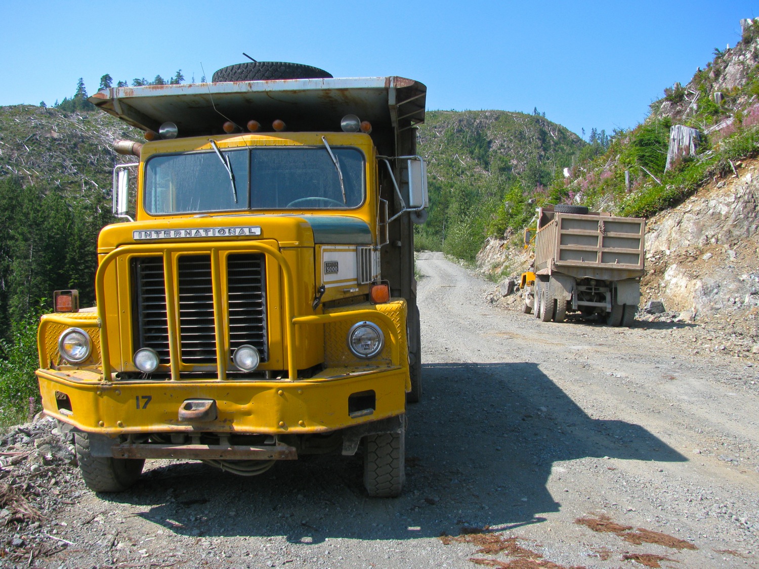
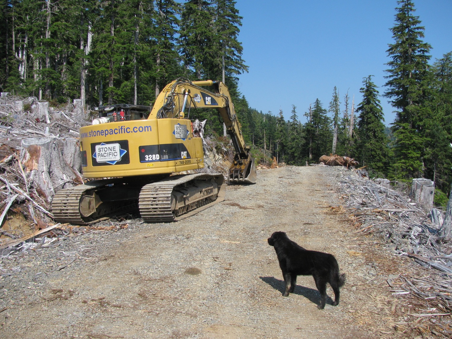
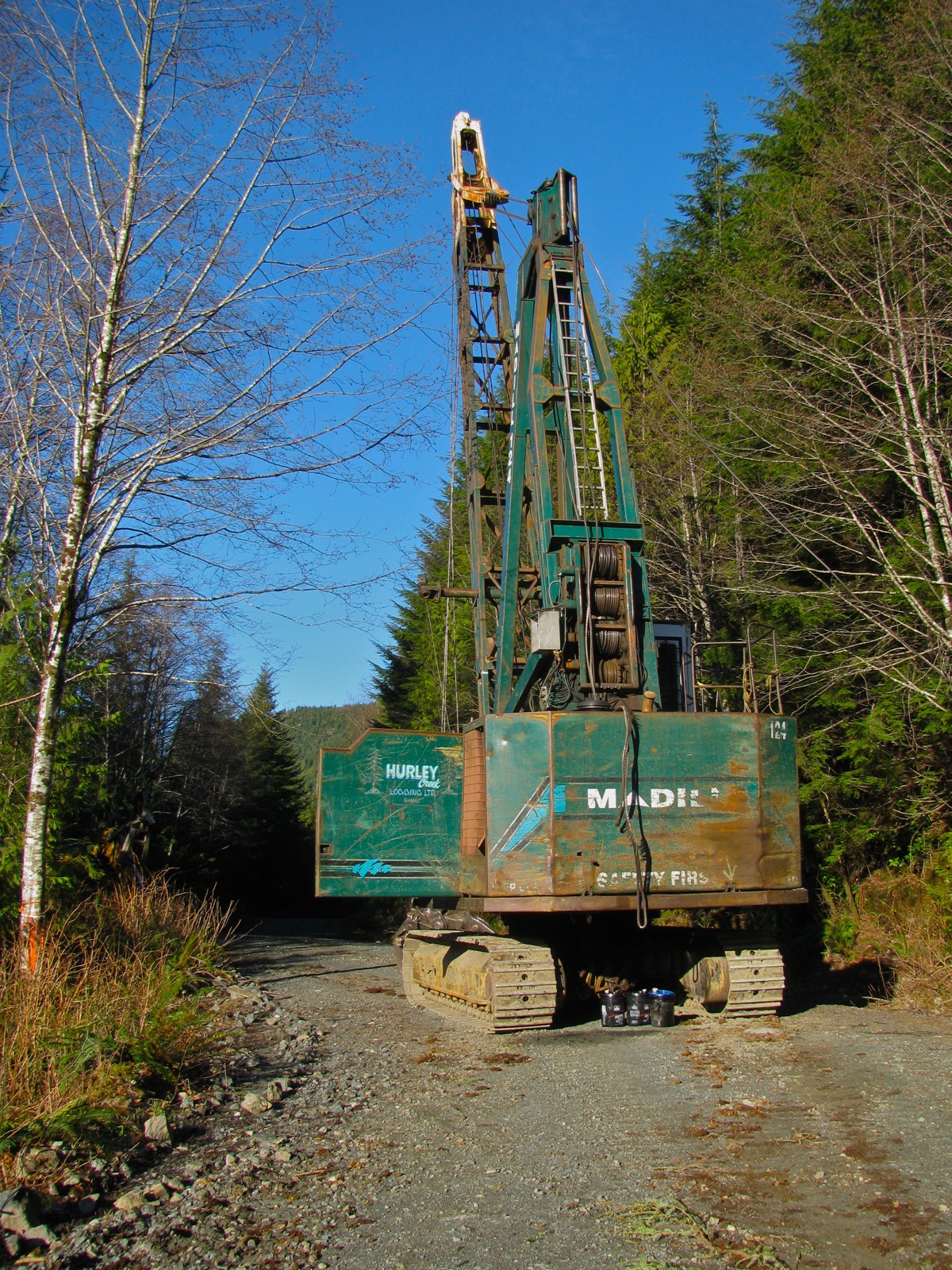
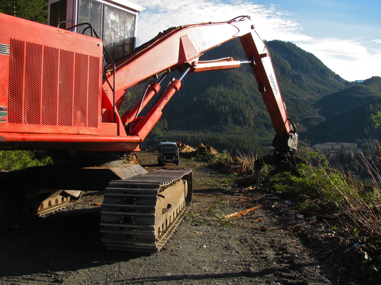
Further on down we came across some helicopter logging. Erickson by the look of it.
https://ericksoninc.com/aviation-services/timber-harvesting/
Sikorsky Skycrane, I was surprised. I knew they were used for this, and have seen them used on the mainland some years ago. But to be honest I didn’t think they still were in service.


About a minute and a half round trip, from picking up logs to dropping them and return.

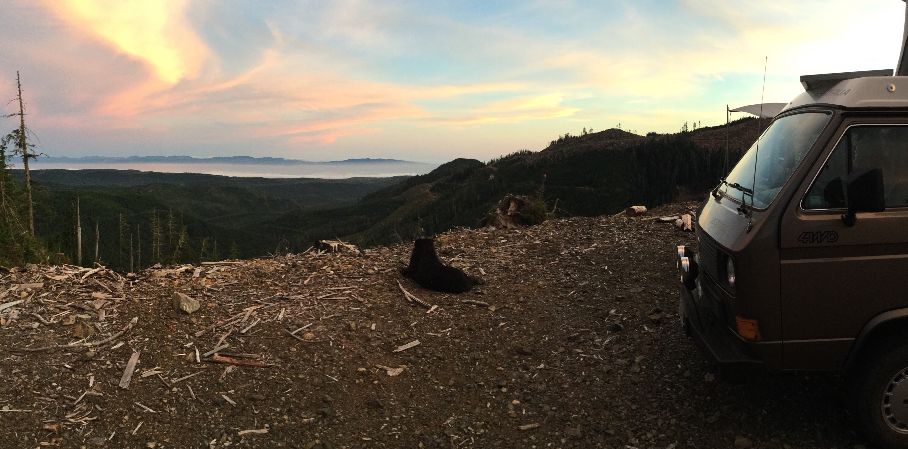
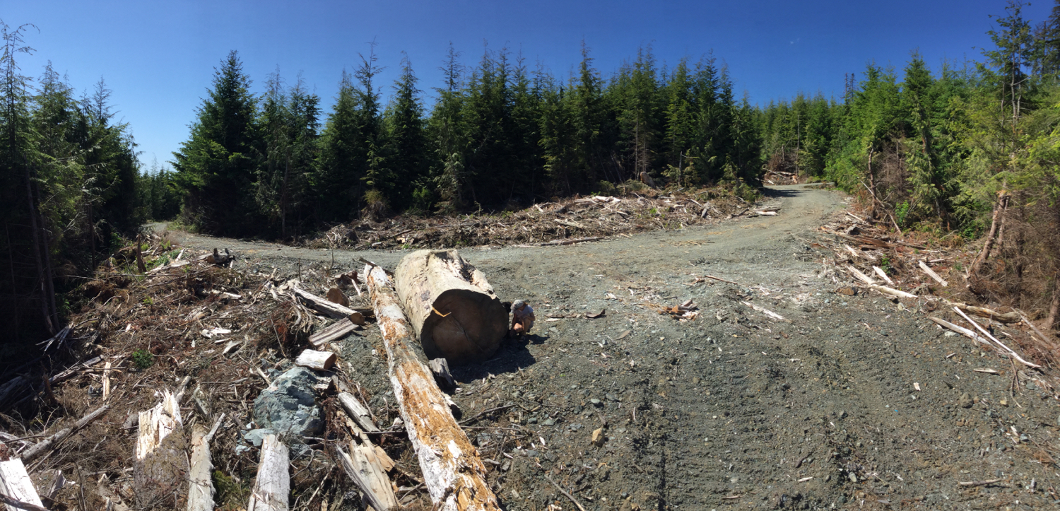
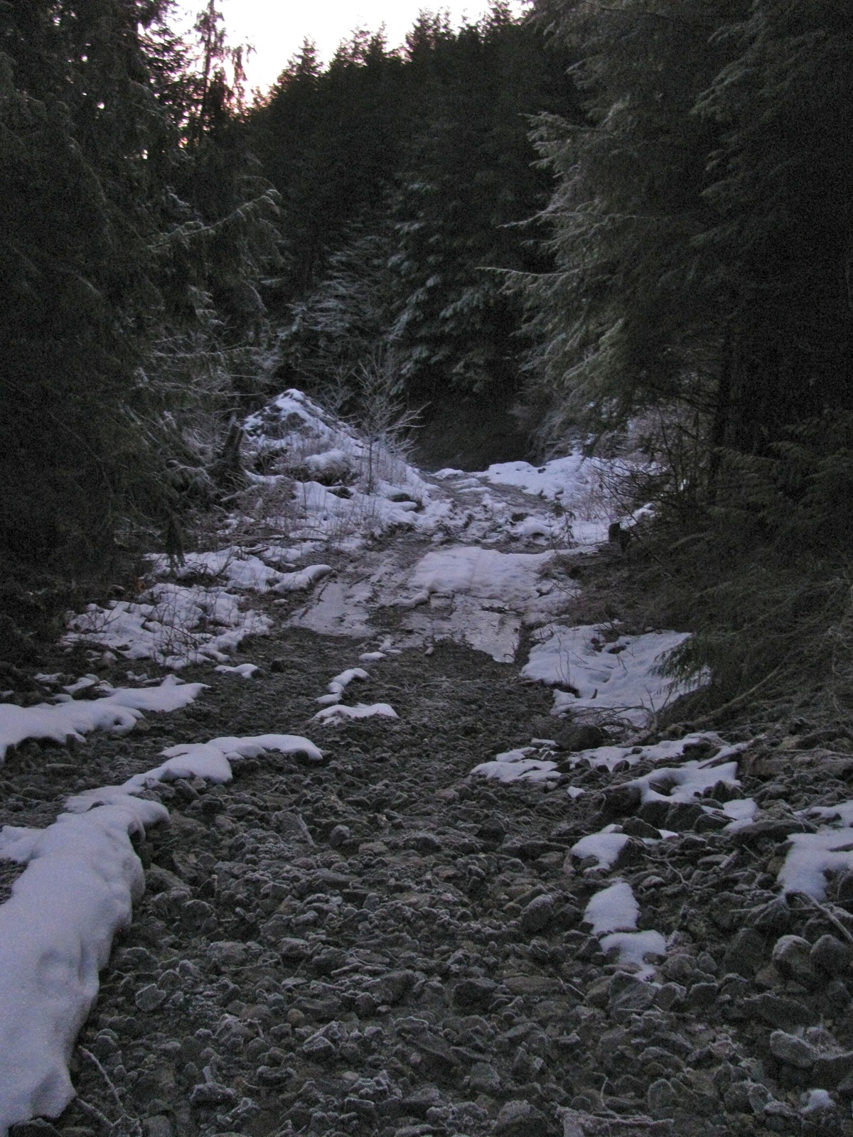
Then onward down the river to find on of our high view point camping places ( shown in other posts labelled Klanawa). Passed the Tscowis creek campsite, no one there, but we wanted high. First try we found the road trenched, de activated. Damn. Then onward again and found that Darling main road is washed out close to Klanawa river.

Then back track to get the the other end of Darling main, found some interesting things and also found road to another high spot choked with alder. Tried to drive thru but gave up after about 100 m.
So then back up Klanawa main to little lake we have camped at a few times before. And it’s been logged on one side!
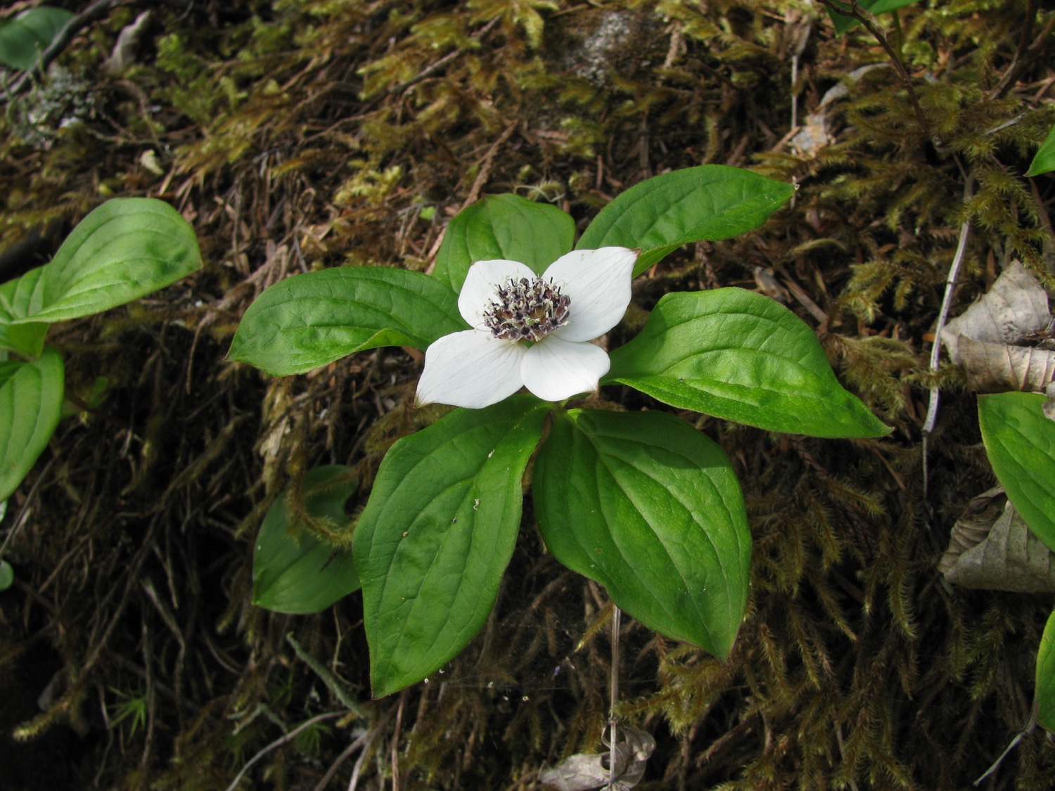
That kinda spoils the ambience. Interestingly though, found some sundew plants there, never saw them at that spot before.


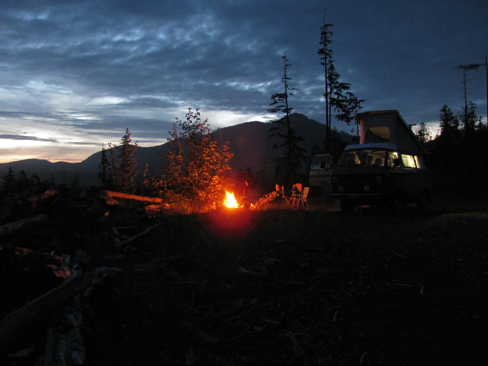
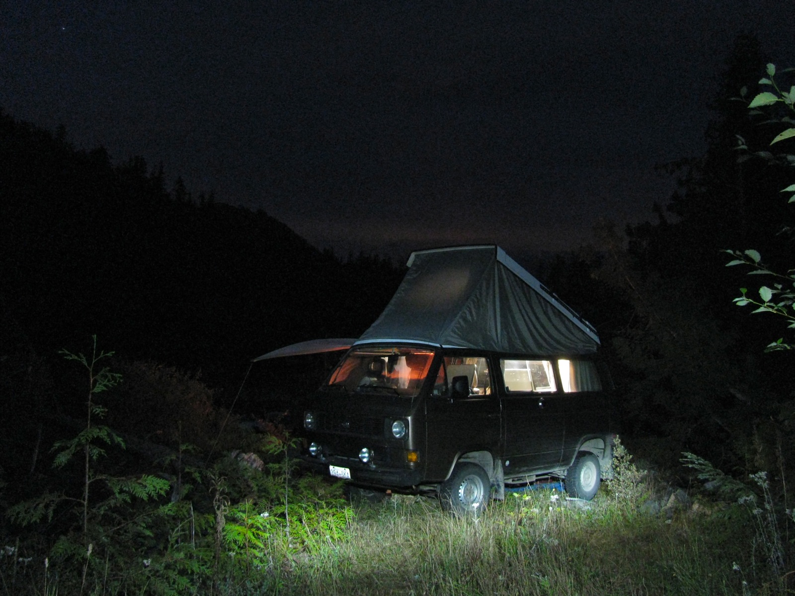
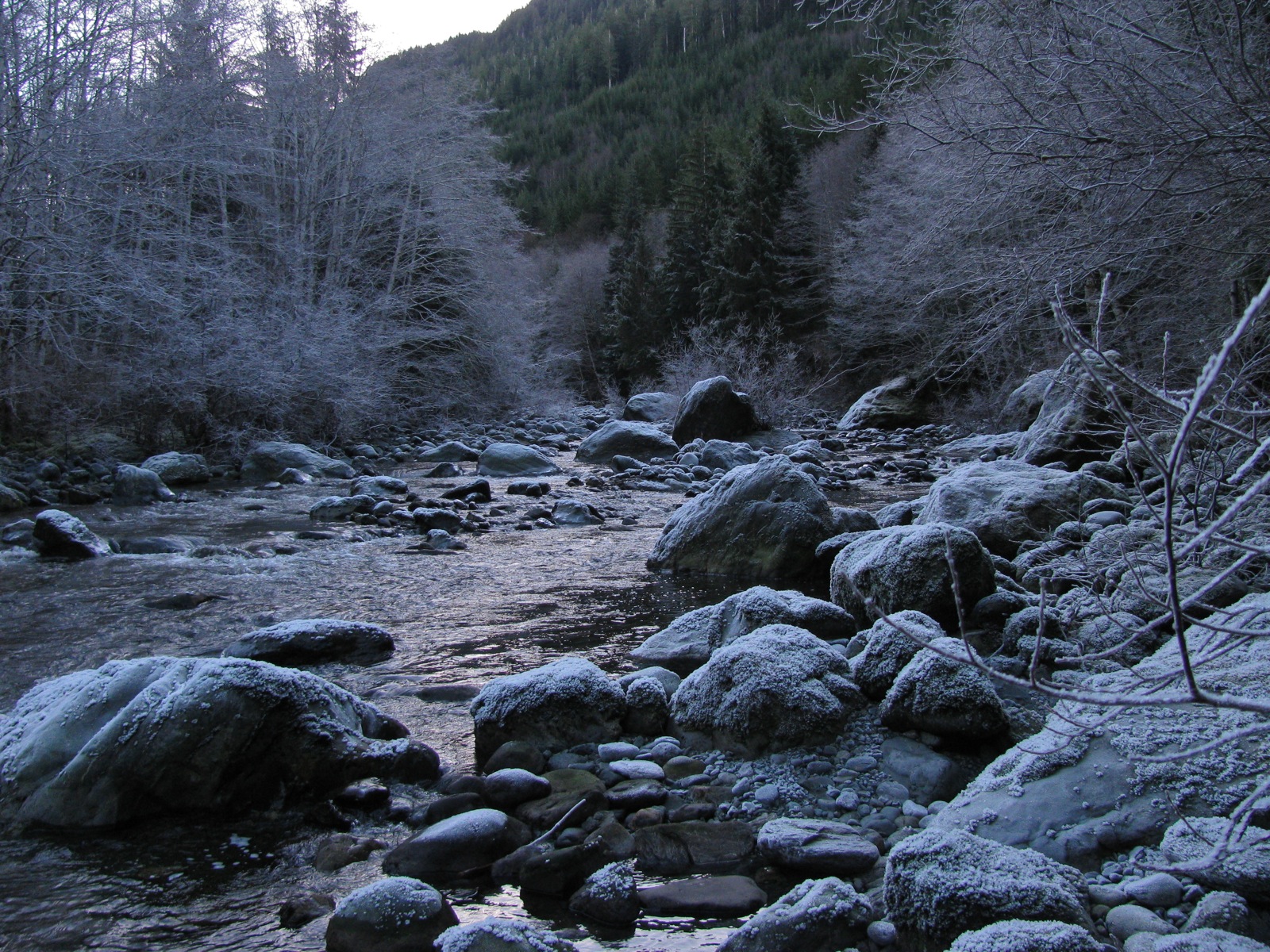
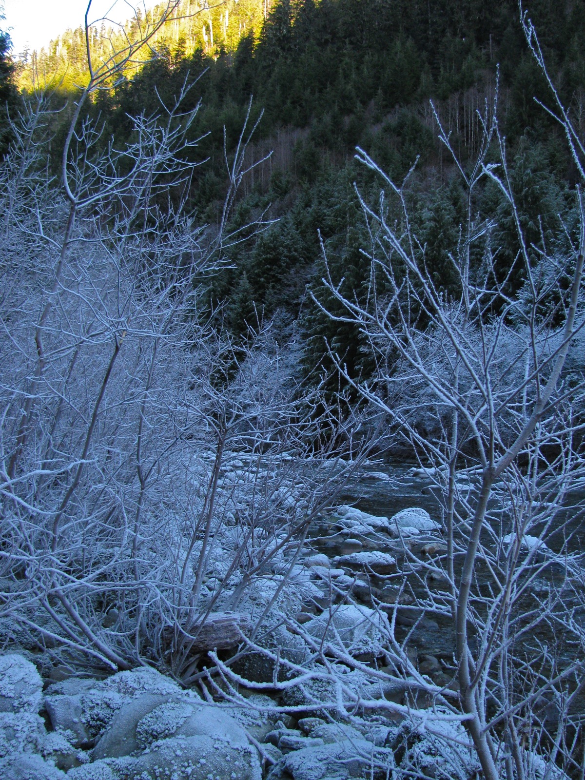
So back again to the Tscowis site.
It wasn’t that bad. Very little traffic on the road nearby. Mind you the creek is unusually cold. We haven’t been there at any time when the water is bearable for more than just a quick dip.

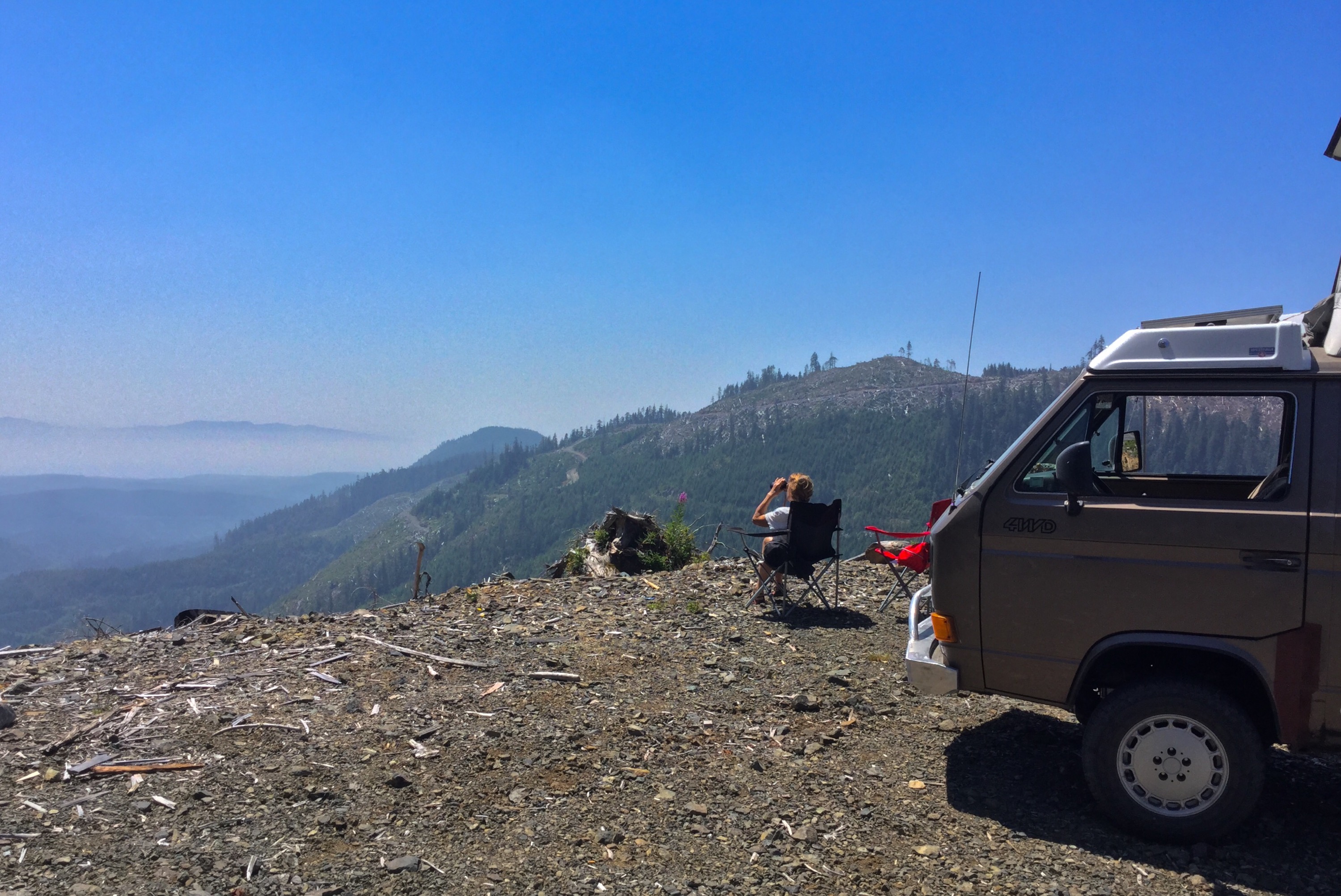
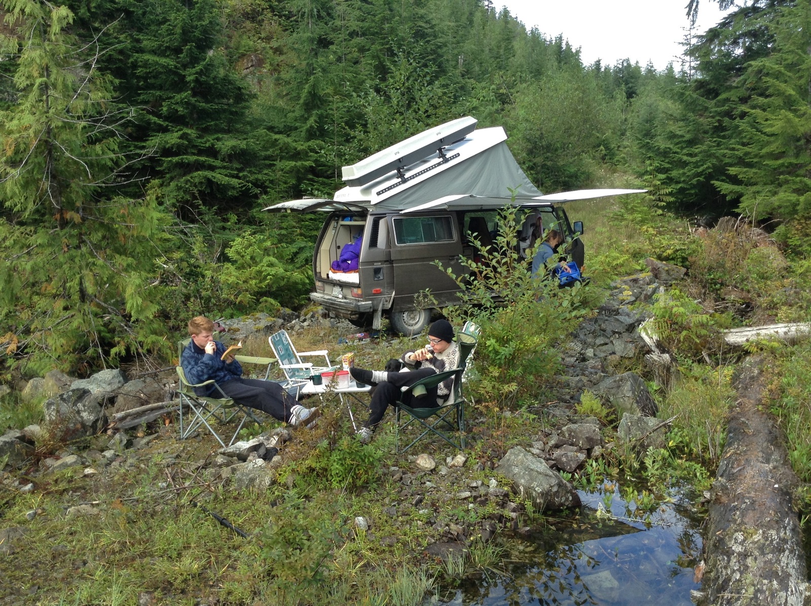
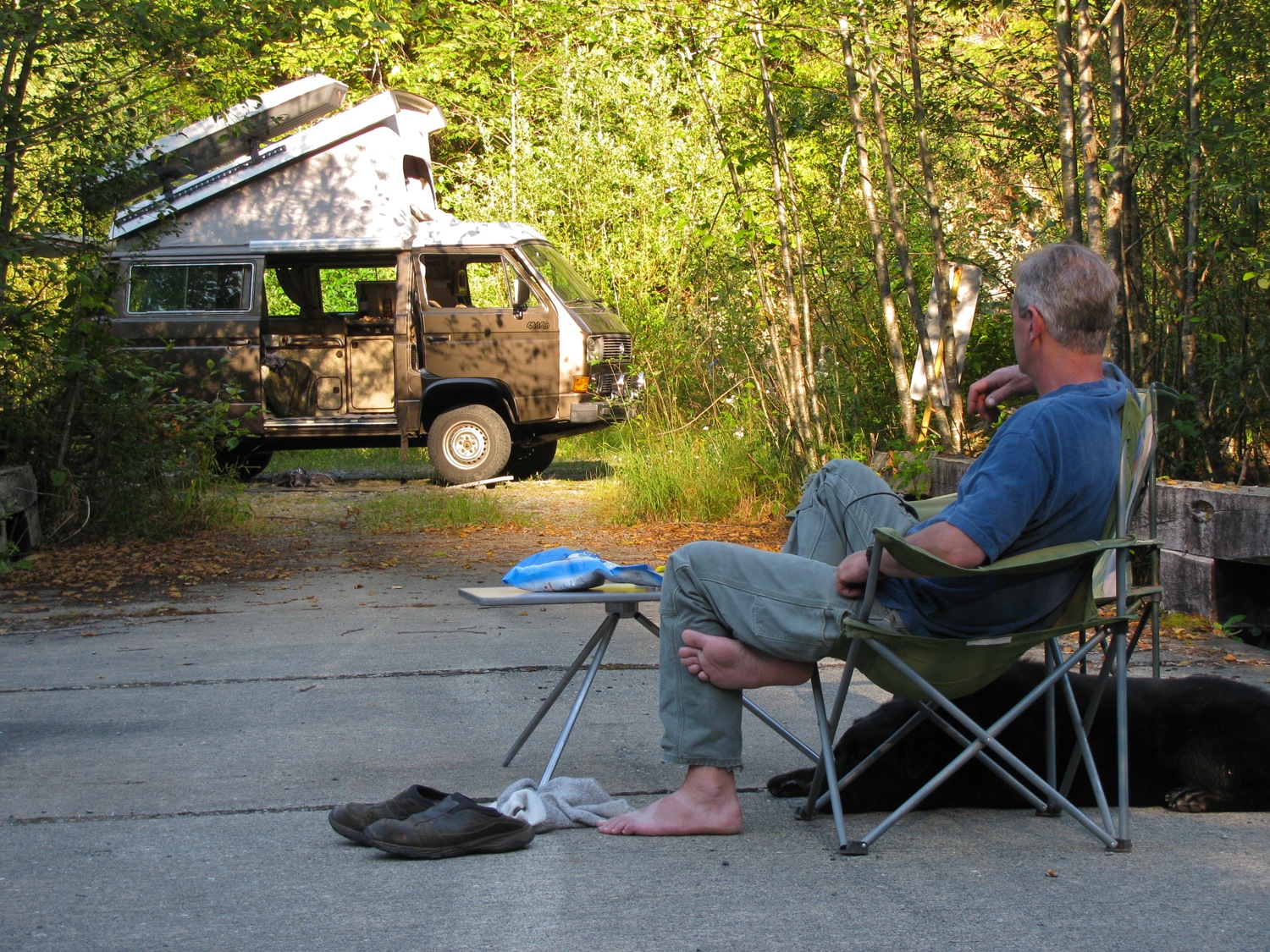
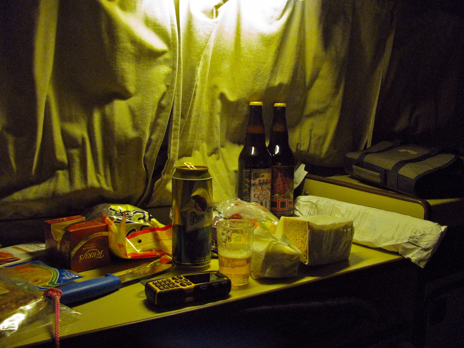
Spent two nights there. Did nothing but read,eat, drink, lounge.
And one more thing… first night on this trip noticed the fridge not working well. It was lit, but not cooling. Just like what happened on last trip , last year. I posted recently that I had cleaned the burner jet and the fridge was working great at home. So I figured the jet was partially clogged again. I’m thinking the bumpy roads is stirring up some contaminant in the propane supply and causing this blockage at jet.
I pulled the fridge after we got to Tscowis. Cleaned the jet the best I could, and back in it went. Fridge lit and worked like a champ! Close to showing plumbers crack here.
Return trio to home uneventful. Went back via Cowichan lake and Duncan. All in all about 550km.

Vanagon – July weekend
Doesn’t get much better than this


Vanagon – almost foiled weekend trip
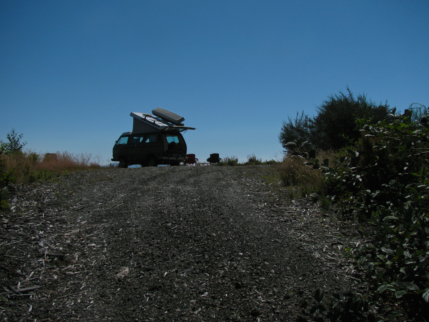
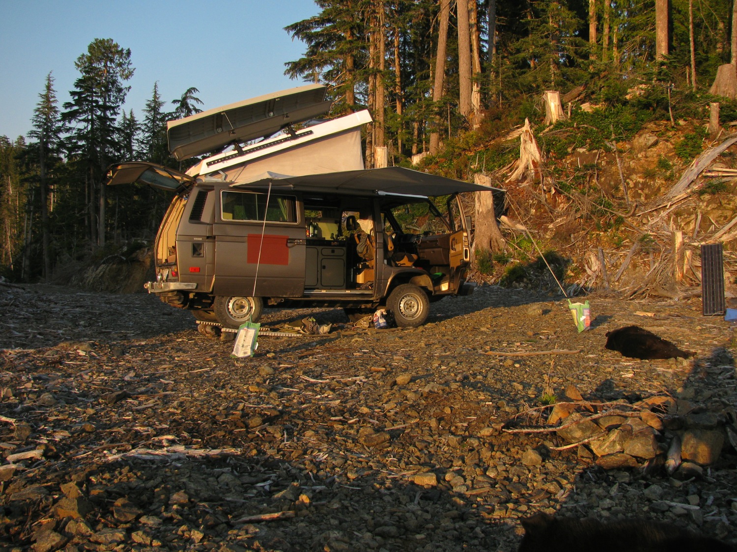
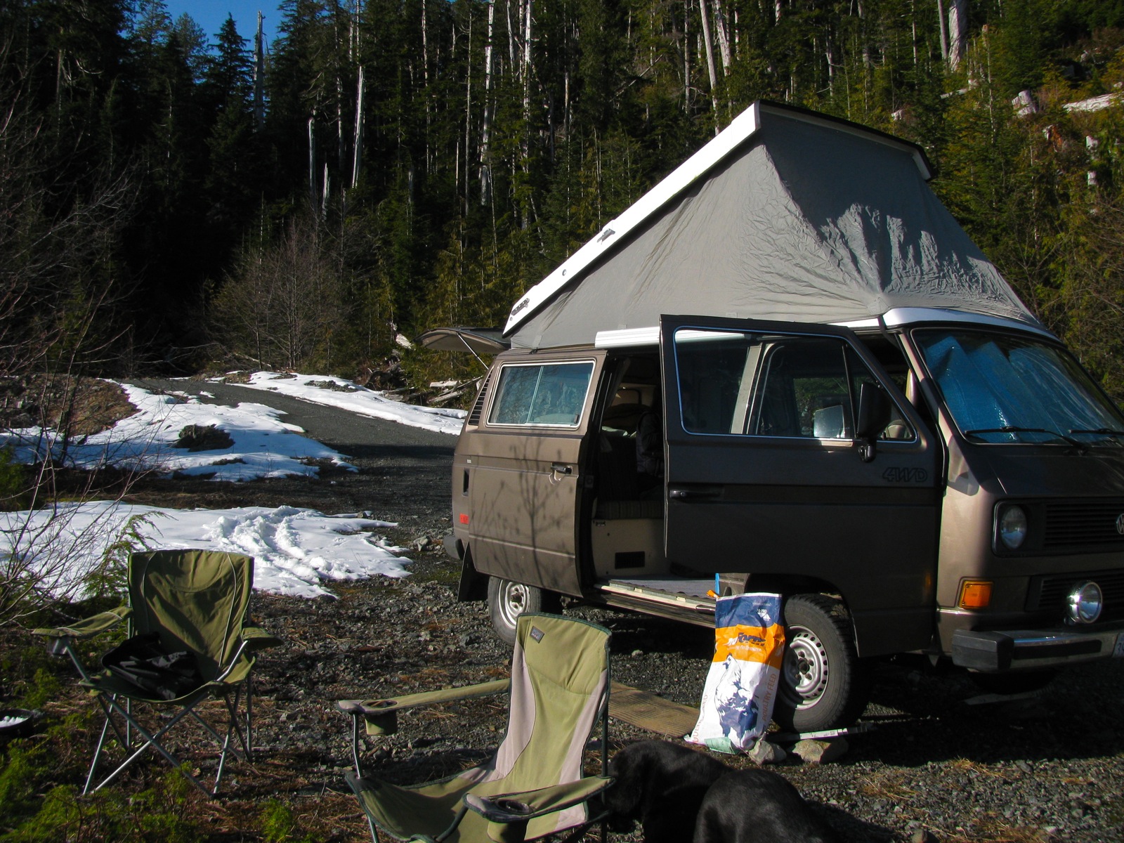
Finally, we were able to take off for a weekend trip to one of our favourite places. Weather was to be hot and dry. Packed up Saturday morning and headed out. Alternator light started to glow before we got out of town. Shoot, it came back to me that when I did an alternator overhaul this last winter I made a mental note to replace the brushes soon. Mental note got lost. Had a spare voltage regulator in the van (used, but brushes still workable) and swapped it in. That solved that but then the van started to run oddly. Idle would drop and engine die, ran a little rough. We headed to Simons house to use driveway and I poked and prodded connections etc. Moved the O2 sensor wire away from a spark plug wire. That’s all I could do. Headed back home and the van ran fine. Took the chance and turned around and continued trip. Engine ran well for the rest of the trip. Sooner I put in a new motor the better, it’s so frustrating to trouble shoot this old engine and wiring.
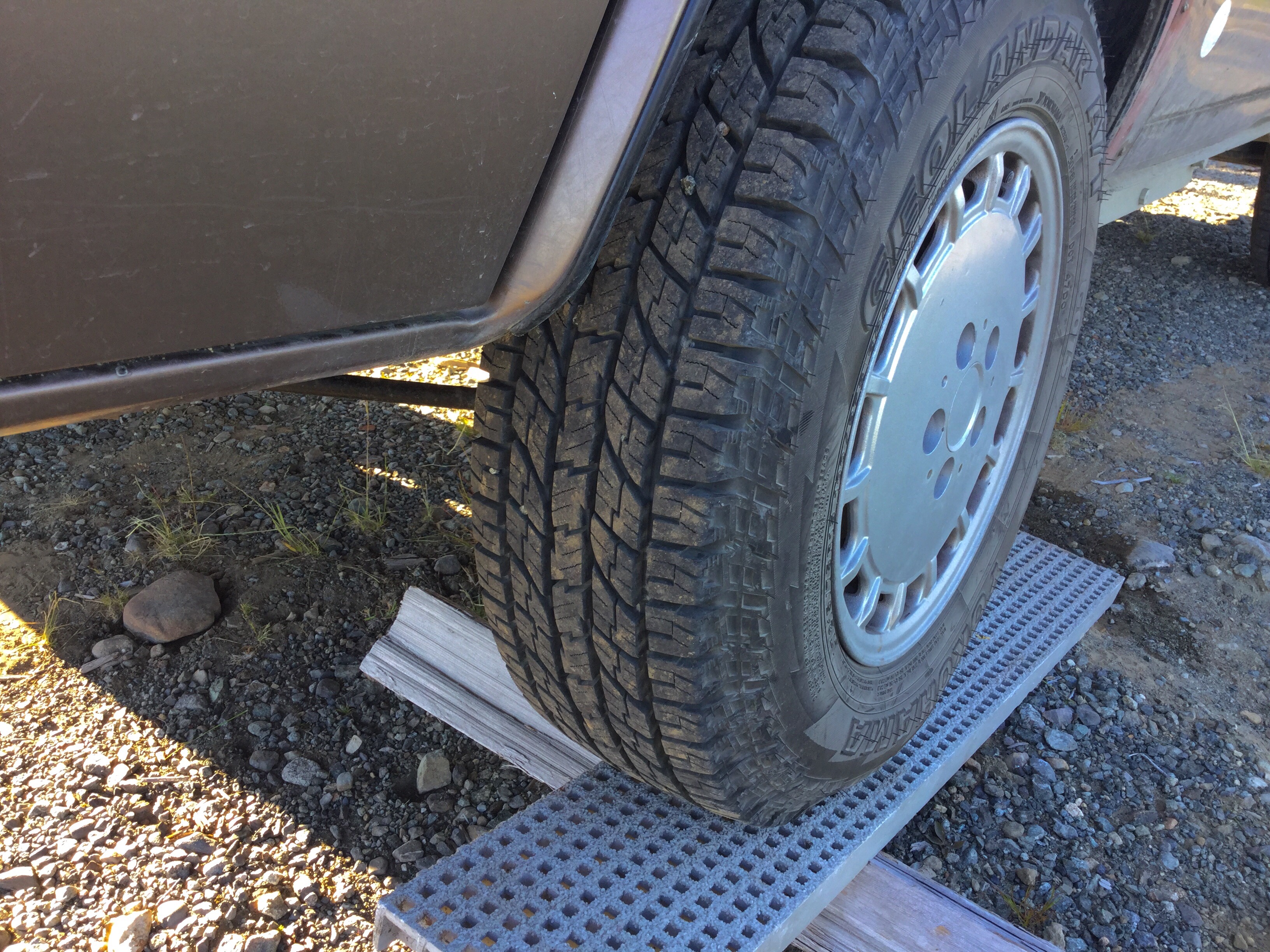
I bought new tires last week. I was running Yokohama Geolandar ats, 215/70 15. New ones were the replacements for the ats, the Geolander GO15. And I went for largest ( some say to much ) that you really should put on the van with stock motor, 215/75-15. Was expecting more of a performance hit than I actually felt. Yes, I did have to downshift on hills that previously I hadn’t needed to, but this was much more apparent on the pavement, not so much in the logging roads ( travelling much slower on those roads).
The ride quality of these new tires are very much better than the old ones. Yes, a little louder on the pavement but smoother ride and on rough roads they soak up the harsh bumps way better. Great grip on loose stuff, and I didn’t notice the lugs getting cut by sharp rocks.
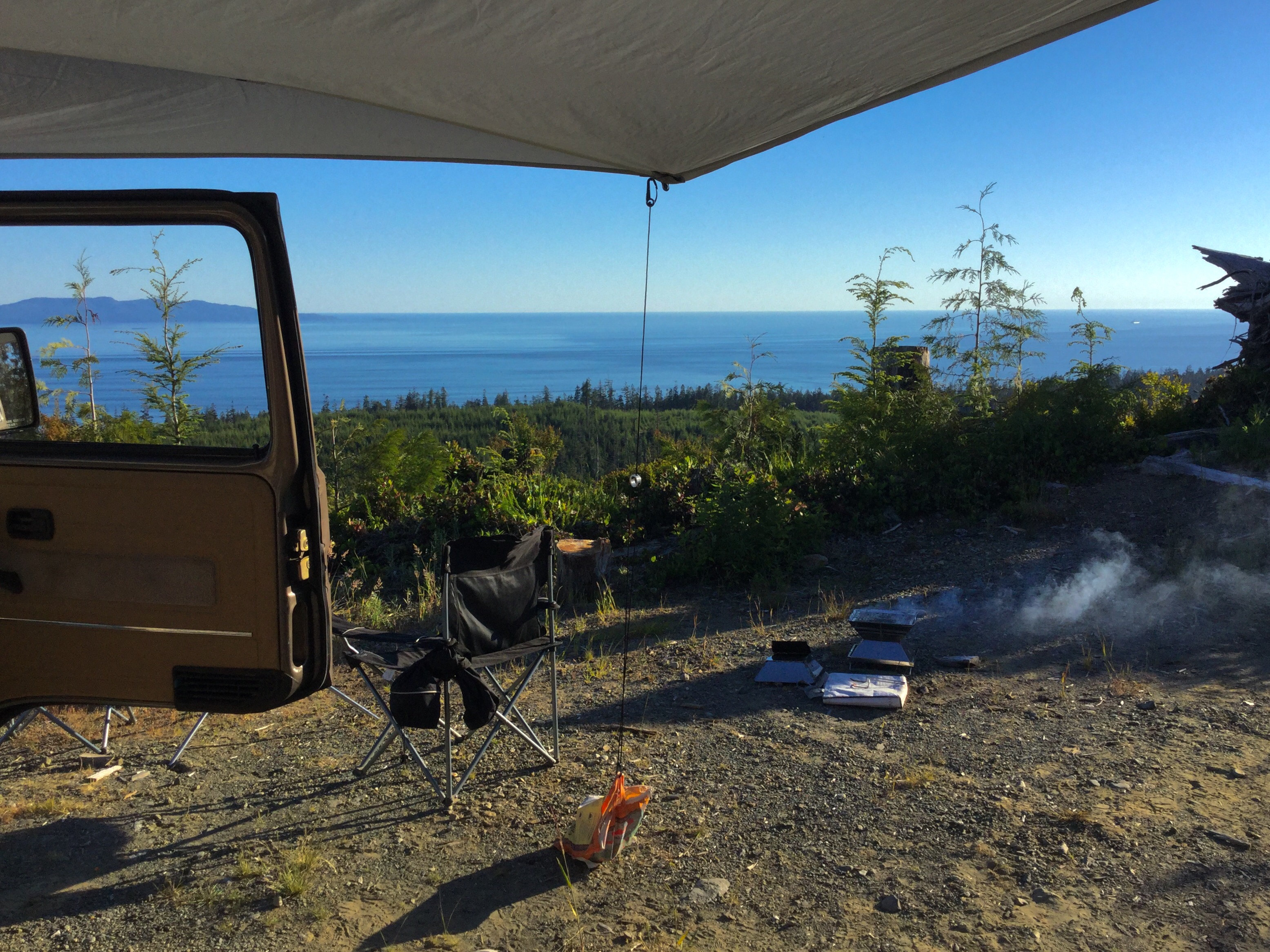
Shade temps were hitting 30-32 C when the breeze dropped. Sun intense, no fog on the ocean ( oh that will come in July and August), just perfect.


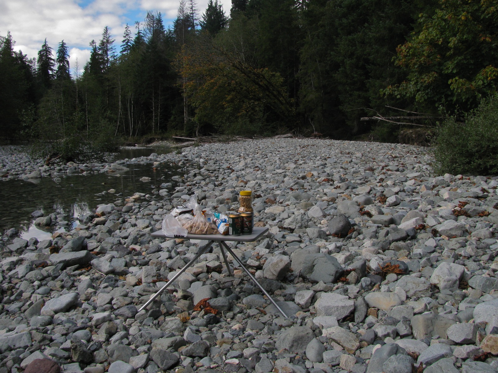
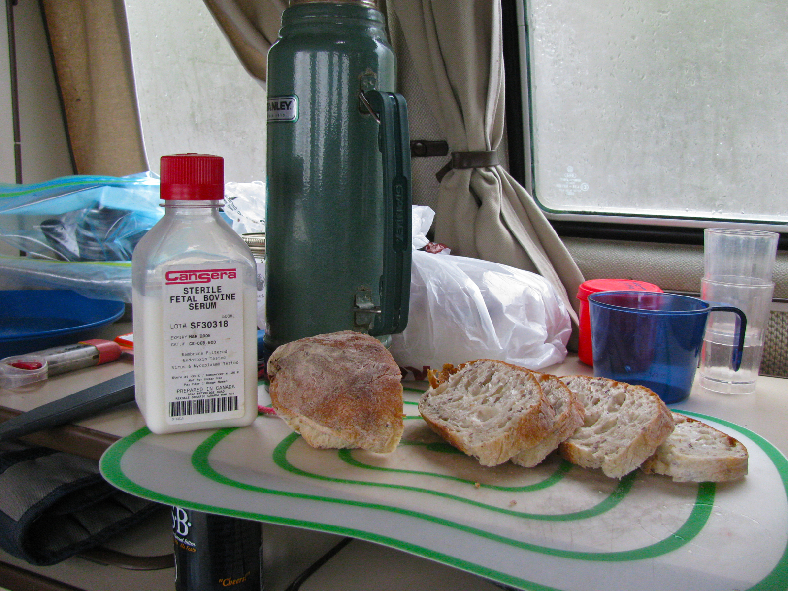
Brought the large westy table with us, and it works on the Swellegant™ table mod even better than the smaller table. I’m telling ya, it’s one of the best things I have ever invented.

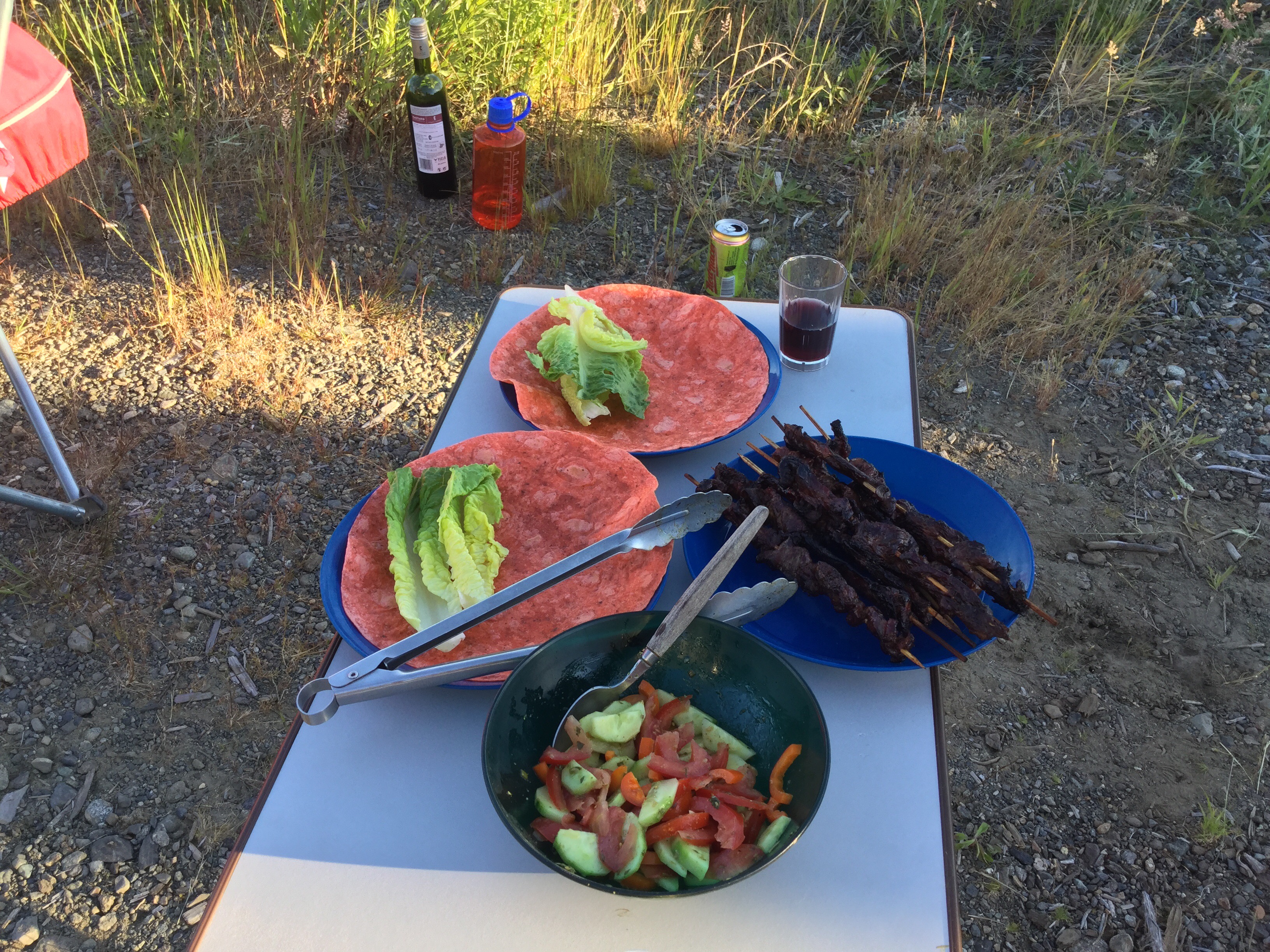
Dinner was marinated thinly sliced skirt steak on skewers grilled on the Ecoque.

With salad and wrap.
Magnets holding a reflective tarp over part of the side of the van to give the fridge a fighting chance.

If you look towards the horizon, just to the left of that awning guy line, and if you could fly in that direction, the first land you’d encounter would be New Zealand. Amazing eh?
We pretty well just sat, read, drank, ate, enjoyed the view, looked at the marine traffic. Saw no bears, elk, deer. Nighthawks were there though, and a couple of rufous hummingbirds that really liked the red campchair.
Some pics from Simon’s trip
Some of the pics Simon sent from his last trip.
Simon writes:
“We had a great time, through Washington, Montana, Wyoming, Idaho, Oregon, Washington, and home to the island. Altogether maybe 5000 KM? (I wasn’t tracking it). Only a couple of minor issues with the van; my electric locks went funny one day into the trip and so I disconnected them and went manual for the rest of the journey, also my window wash nozzles weren’t spraying, figured out it was a kink in the line at the pump, had a fun time fixing it with a lighter and a golf tee in cold campground in Yellowstone.”


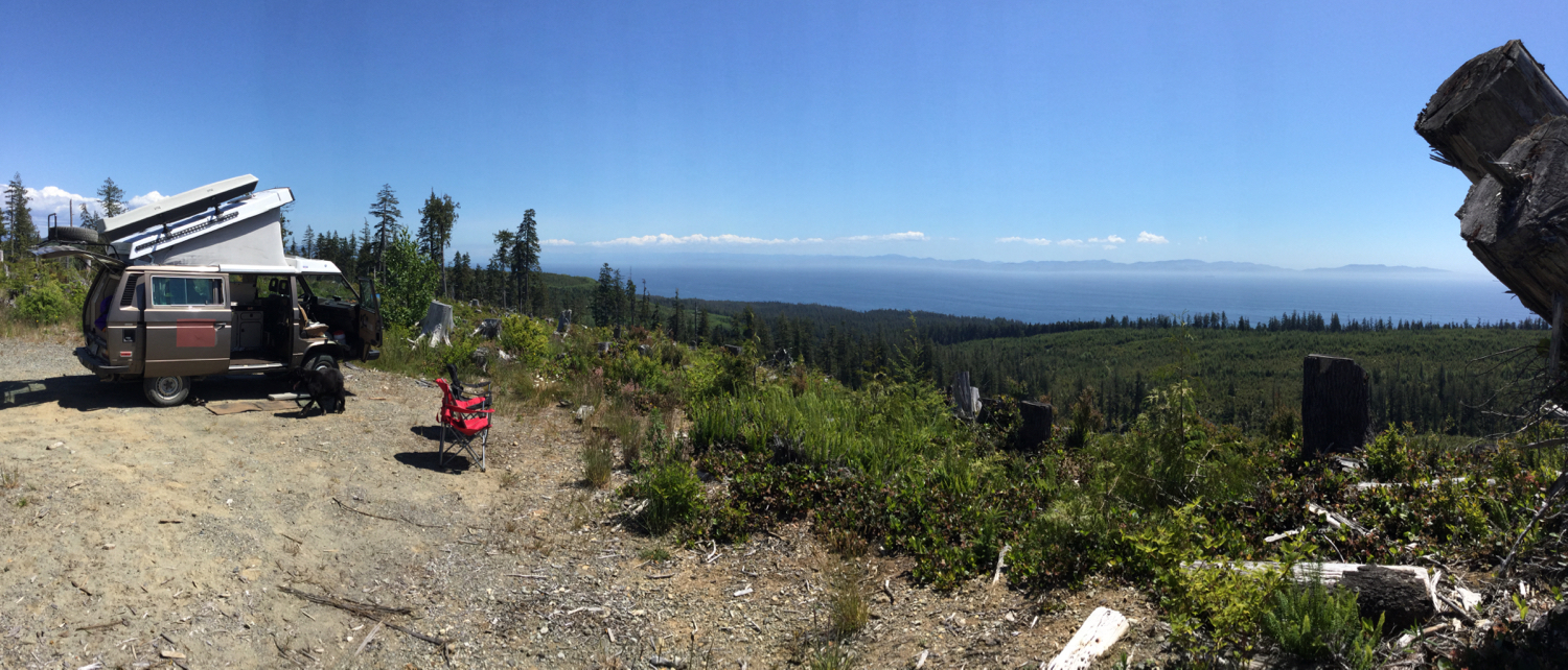
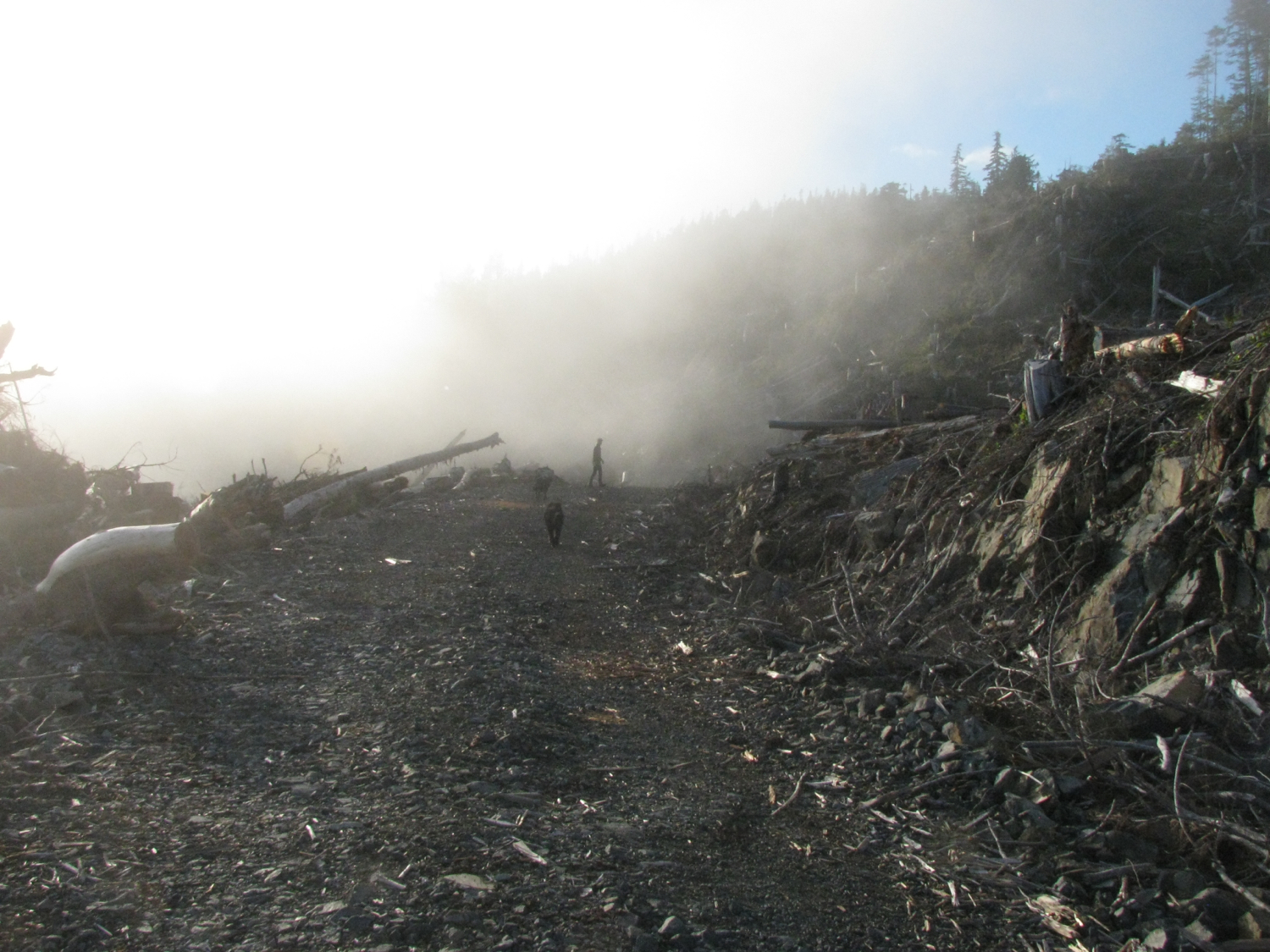
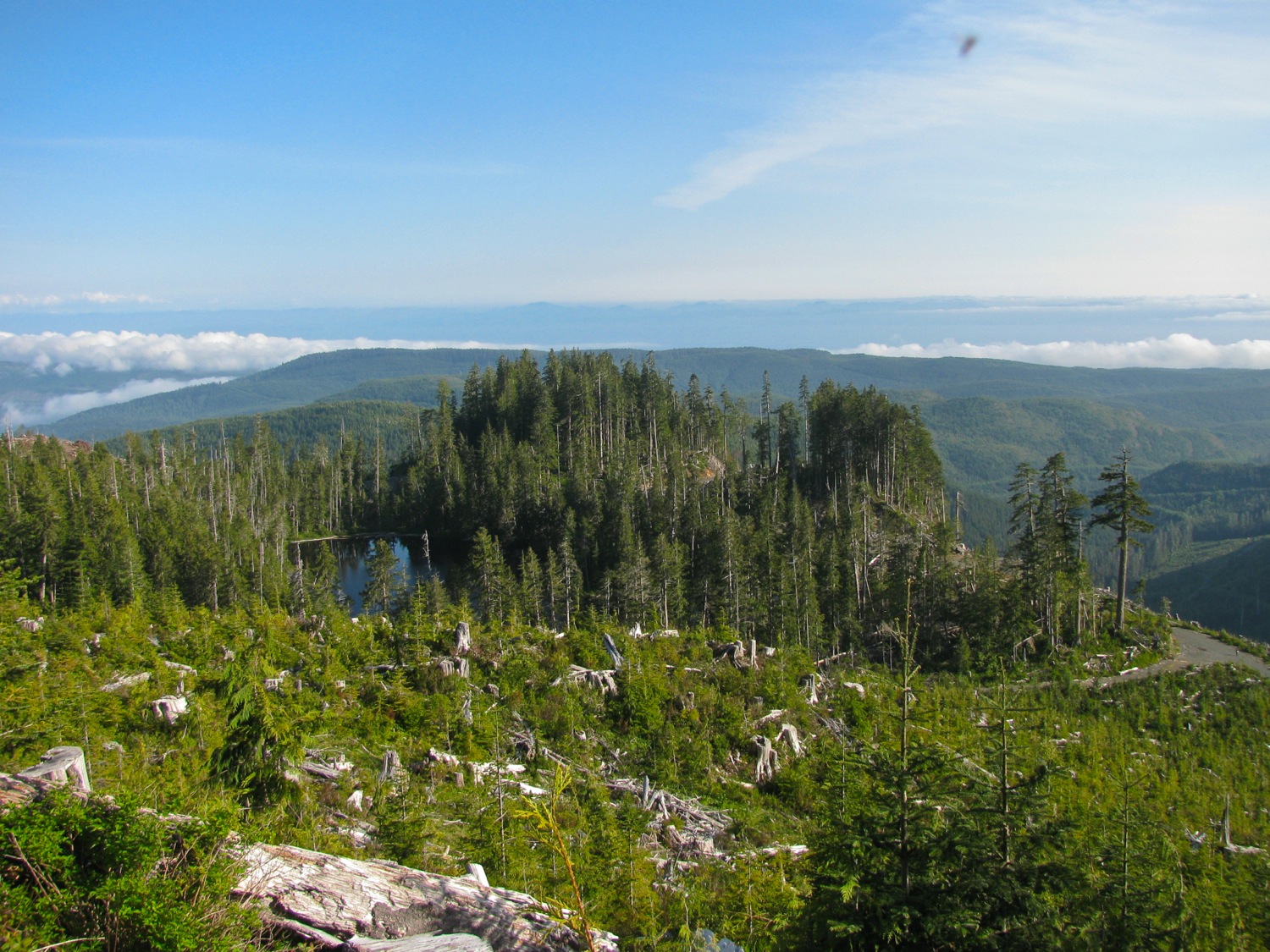
Trip – fogust in the Klanawa valley
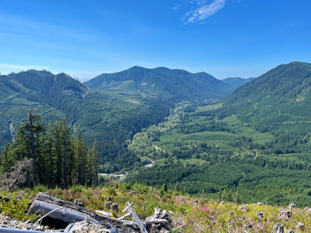
Quick report on a four day trip into the Klanawa valley here on Vancouver Island. It’s the main east west valley between Nitinat watershed and the Alberni Inlet. We like this watershed despite it being extensively logged, you don’t meet many other travellers and it has a few special spots. We’ve exported this area a few times, “Klanawa” and the search box on the right will bring up previous posts.
First night was at a small lake. You have no idea how good it felt swimming in that lake after the 3.5 hr hot and dusty drive. Ok it’s hyperbole, but jeez it felt good.

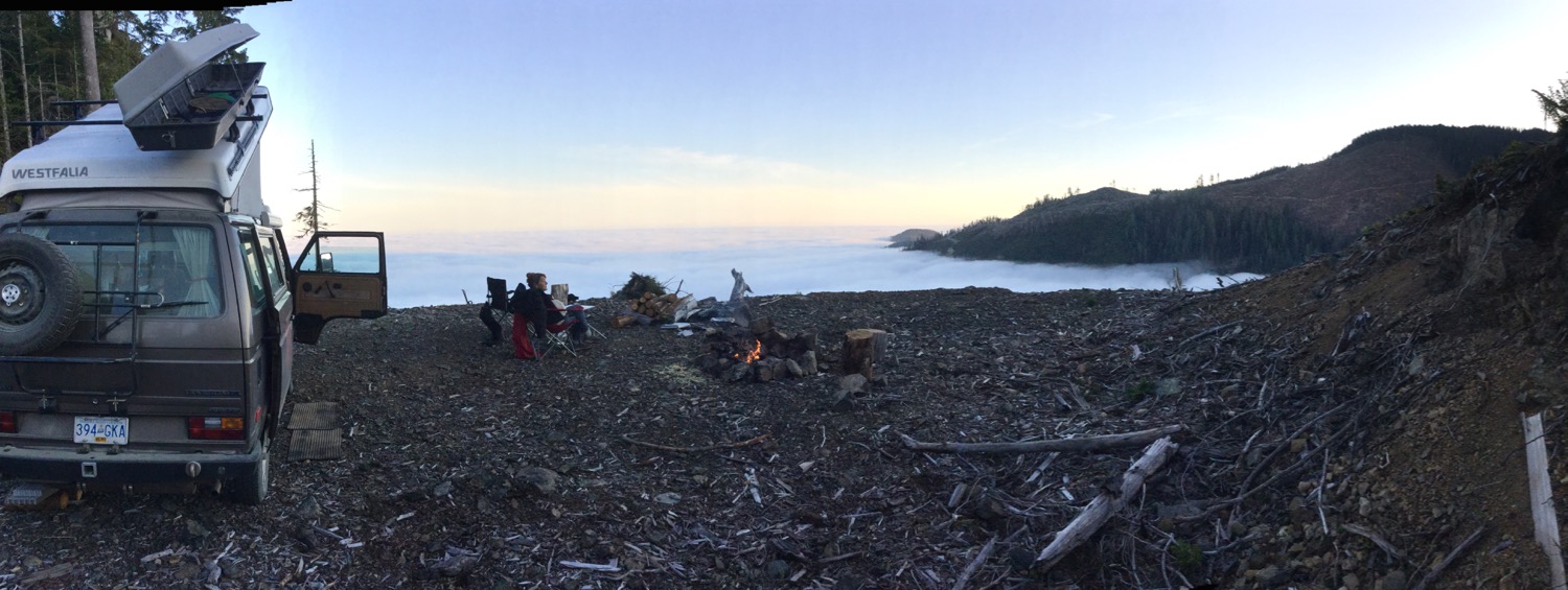
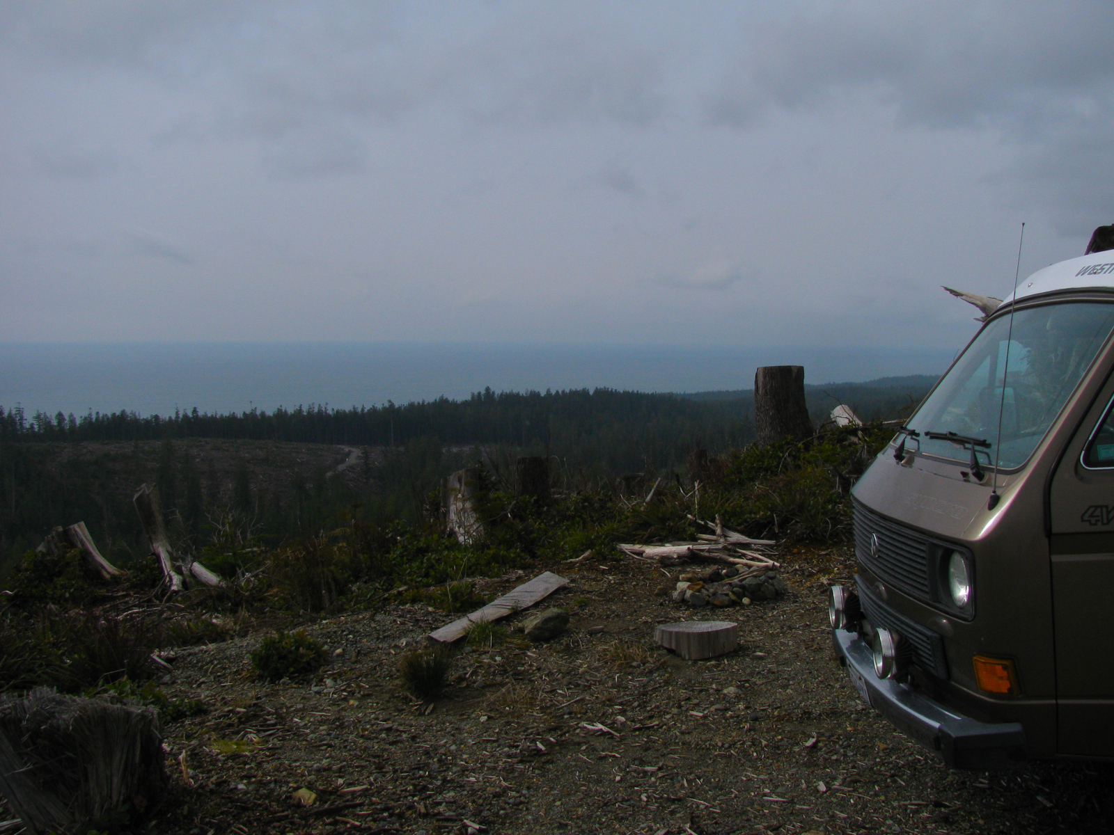
I shouldn’t have been surprised, but the fog from the Pacific was thick the next morning. Dripping wet and chilly. So off we went further west into the fog and found a hill to climb out of it.
About 450 meters elevation we broke through the fog.

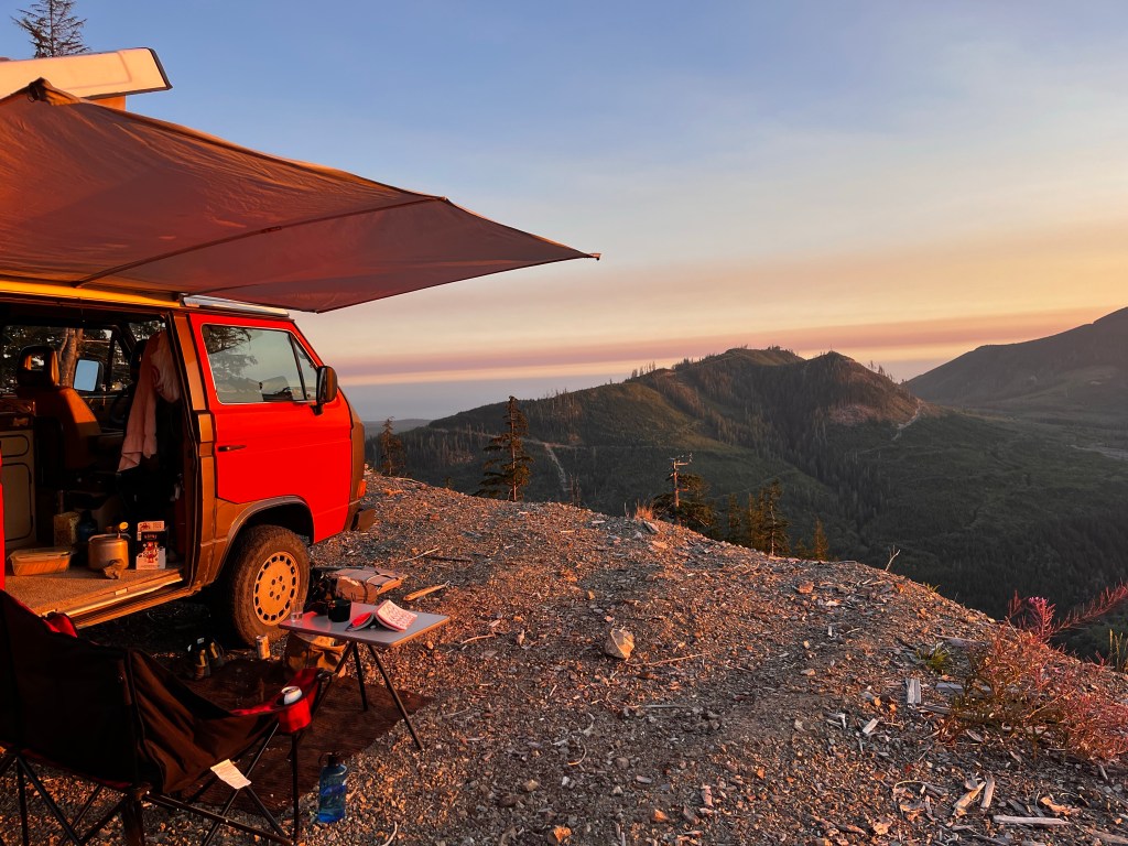
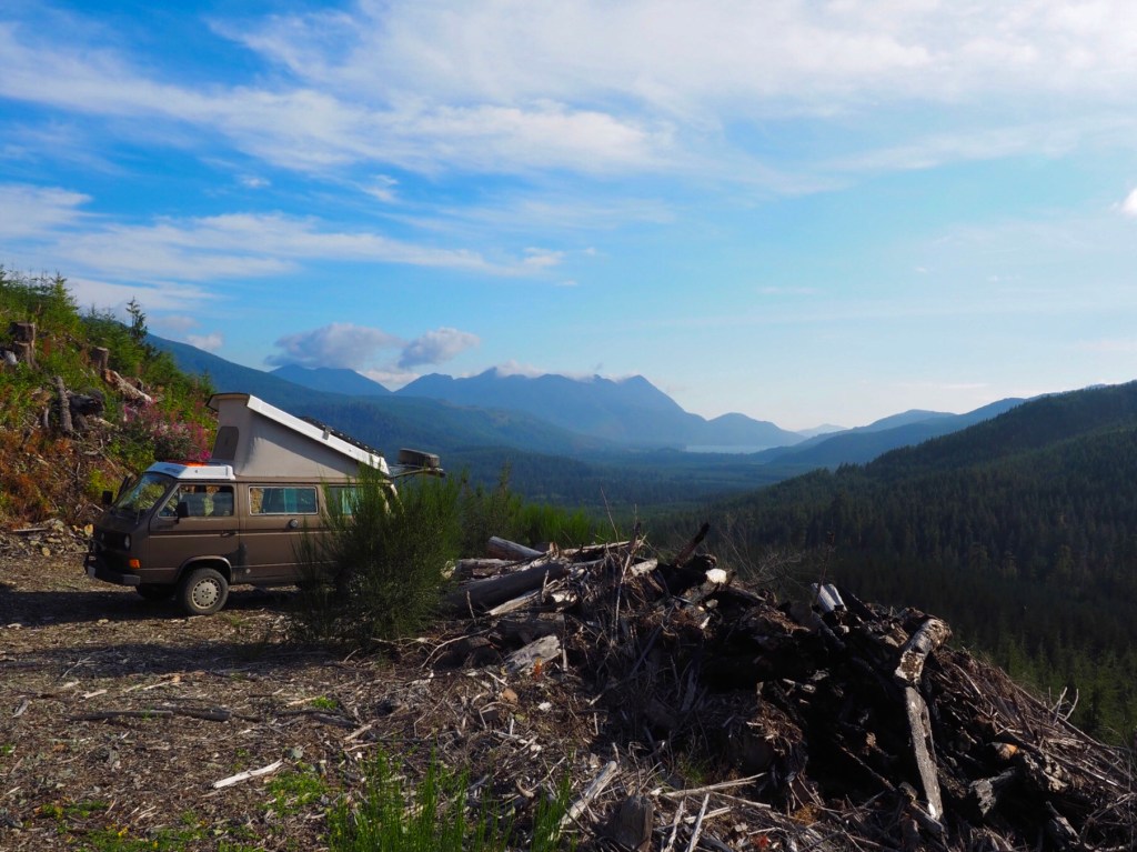
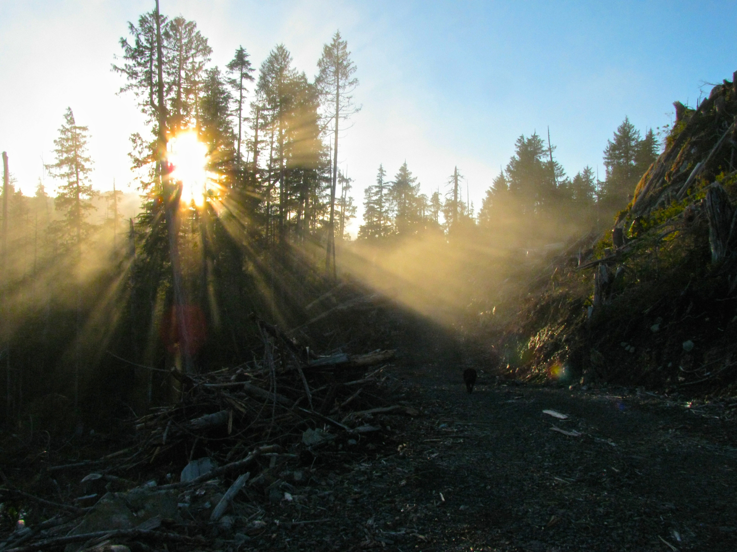
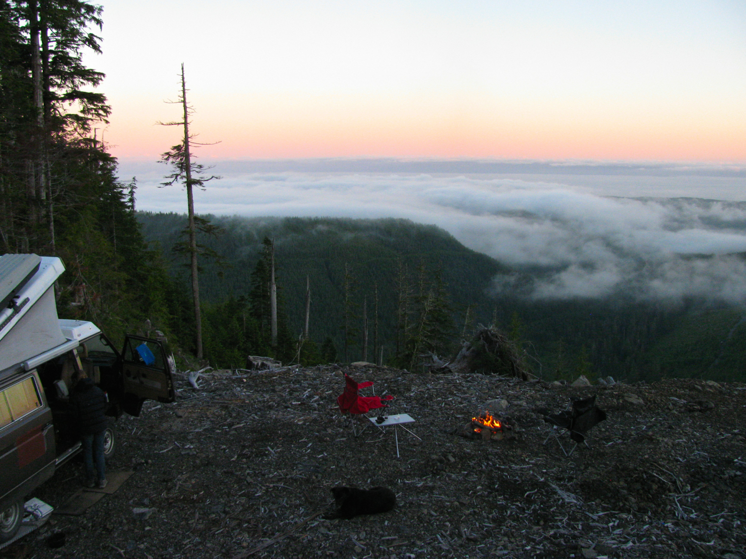
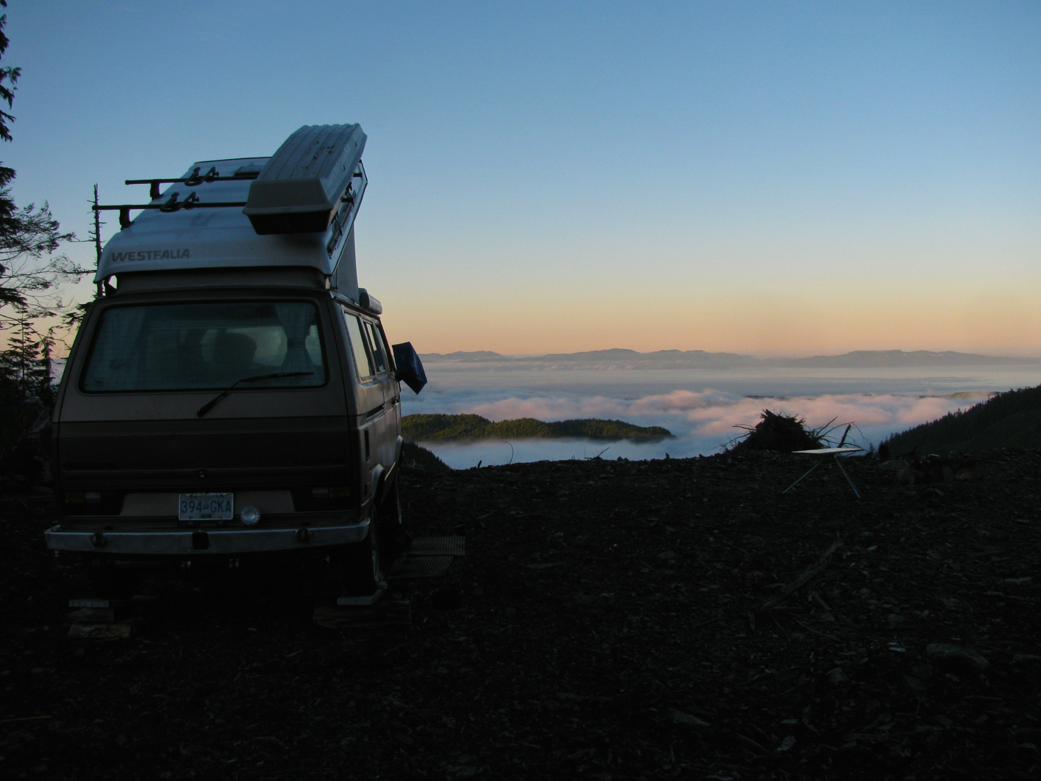
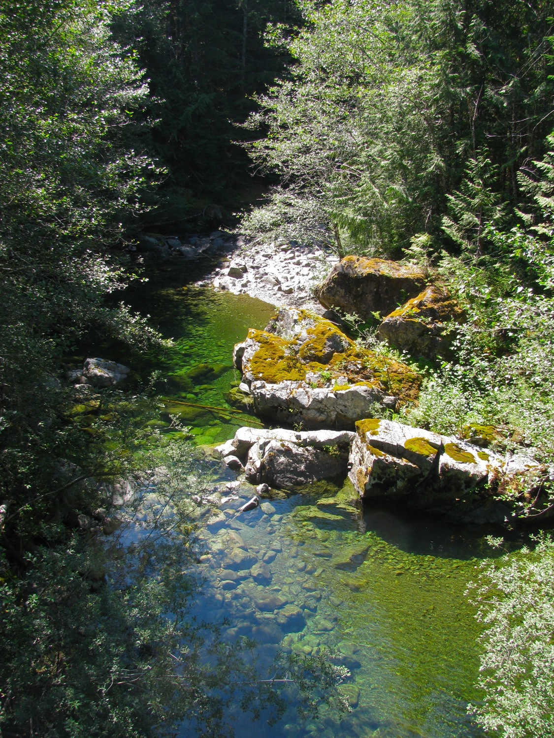
We parked on the side of the hill, facing south. By about 2 pm the fog retreated back to the coast. We got too hot, drove down to the Tsocowis river/creek and cooled off. This creek never seems to warm up, its not head numbing cold but it’s not “let’s just float around and enjoy life” warm either.

Than back up the hill and set up for the night.
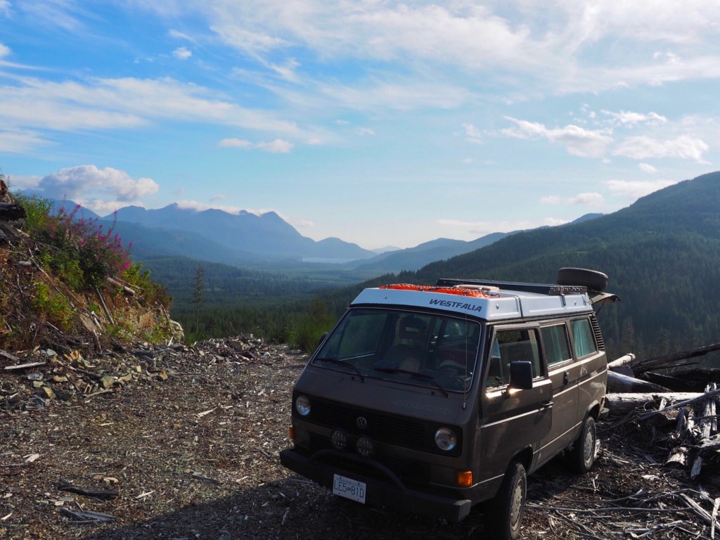
The road went a bit higher but no better southern view up there. Spot the van?
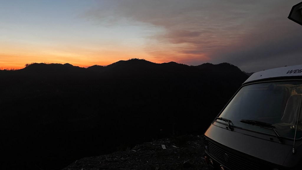
Yup, the fog/cloud creep back in the evening.
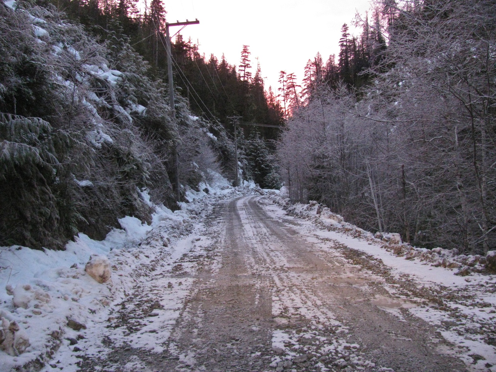
We smelled propane that day, I tried (soapy water) to find the leak. Somewhere at the tank I thought. No luck at detecting it. Ran out of propane during that night. Sheesh. So on Monday we packed up and drove into Bamfield to fill up with propane. Also took the guard off the tank and was able to get a bit of tightening on one fitting. Or maybe it was the spit valve leaking? In any event the leak didn’t re occur. Thought about staying at the campsite at Pacheena Bay, but decided to go back to our spot on the hill after some unsuccessful exploring for the other perfect spot. Do you get the idea we like high places with no one else around?

Yup, fog back in the morning. Actually I forget which morning.

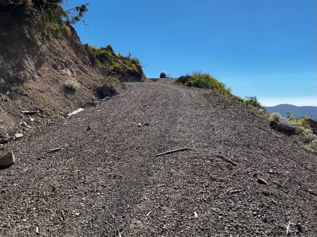
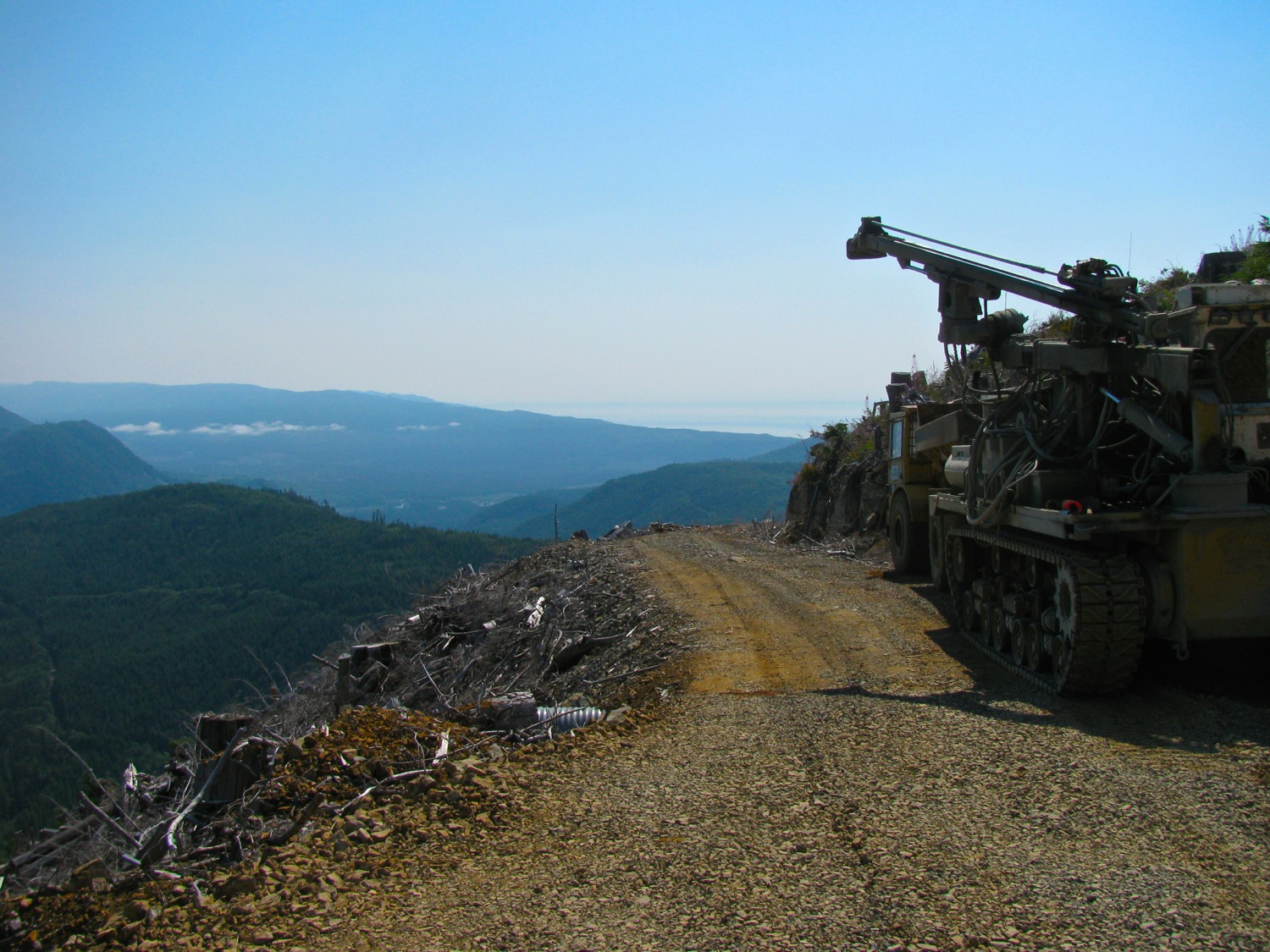
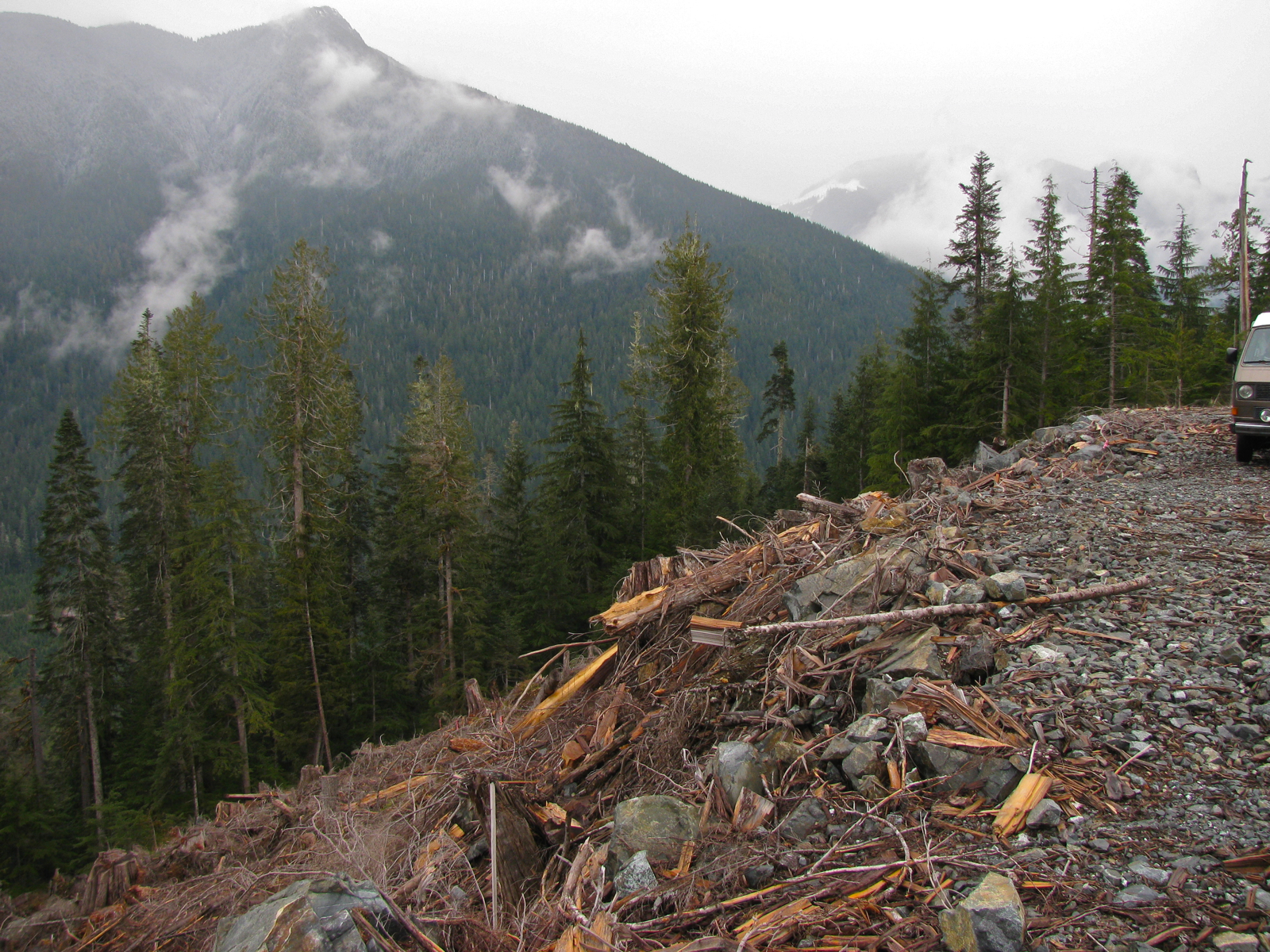
Next day we drove back down into the clouds ( to be honest, the entire valley cleared up around 12 pm). This shot gives you an idea of the maximum grade of most of the roads. I think this is about 18, maybe 20%. Sometimes you find it steeper, and often it’s quite a bit steeper around the switch back corners.

Well that’s it, short report. To be honest it all seems much of a muchness and pretty dull stuff. But the pics don’t do justice at all to how spectactular the area is, and really how much fun it is to explore.


Trip – last weekend
Weather great, didn’t get lost, only one thing broke* on the van. The main logging roads were rougher than usual, seems that a lot of the gravel has gone and the bigger rocks underneath are exposed. It’s like driving on very rough cobble.

*a leak on the fresh water line from the new pump to faucet. Manifested itself by a little drip under the sliding door. Didn’t do a field repair, the leak seemed to be in part of line behind the fridge. Wasn’t bad enough to go to all the bother of pulling fridge. But at home, pulled fridge, and I lifted the entire floor (to get it dry). Found the tiny leak at a section of hose that ran adjecent to the fridge combustion chamber. It’s my fault, I secured the line back there with tie downs but too close to that chamber. I’m guessing that the new water pump made enough pressure to weaken the hose that was softened by the heat. Was just a pinhole leak, but still…
Trip – warm and clear weekend in June
Posted by albell in trips, vanagon mods on June 8, 2016
Last weekend was quite warm, but unlike later in the year there was no fog or even haze in the west coast. The air was clear enoug that you could make out the buildings on Tattoosh Island.

Again, just to bug Simon, a shot of the super useful “Swellegant” table mod.

Syncro and lions in Botswana
Some more great shots from John B. in South Africa. Pictures a friend of his took while in Botswana.

Trip – another wekender
nothing much to report, no bears seen ( lots and lots of salal berry bear poop though), but did see some elk.


Trip – relaxation in sun
Departed last Saturday morning and both of us were tired from work week. So we headed to favourite spot, set up camp, and dozed off. No inspirational slogans or hipster hashtags on this trip 🙂 Supper of cold chicken wings, wine, bread, olives, etc. Smoke in the sky, Washington or Vern California fires? Certainly made a spectacular sunset. Next day we forced ourselves to do some exploring, scratched up the van some more, saw a bear. By the way, not as much bear poop on the trails as on previous trips. The berry crops change, the heat, the after sources, all must influence their behaviour. We both love bears and despise the poaching that goes on around here. There is no good reason that these coastal Vancouver island bears should be killed. Oh oh, sounds like a hashtag. Them on up to another favourite site, higher, back form the coast, and with an excellent little swimming lake. On the way found an abandoned truck. The mentality of some people, defies understanding. Signs of elk up there, poop and tracks. More longing, swimming, drinking, eating. Next day the fog and marine cloud closed in and didn’t burn off until about 2pm. Had one last swim and headed home. At Jordan River I noticed a familiar van at coffe shop. We had met years before in the road to the kluhdak, but right now I’ll be damned if I can recall names. All in all it was a great trip even if we were lazy and tired. 

And exciting video of a bear. Hey, it takes time to get the camera out…


Trip – Cor, what a scorcher!
Headed out Saturday morning with thoughts of the high spot campsite to catch a breeze and maybe see the Fourth of July fireworks over on Neah Bay. It has been an incredibly dry and hot summer here and the forecast was for mid 30C in the area we were heading to.

Started looking for fireworks early
It was hot and for some reason there were a lot of horseflies and deer flies around. I have to get one of the those electric fly swatters. Nearby pond was so nice, warm, peat infused water. Left you feeling very clean and refreshed. We were back and forth to the lake for a dip a few times.
Still looking for fireworks. Well no, actually we could smell smoke when we arrived, we were wondering where the fire was.

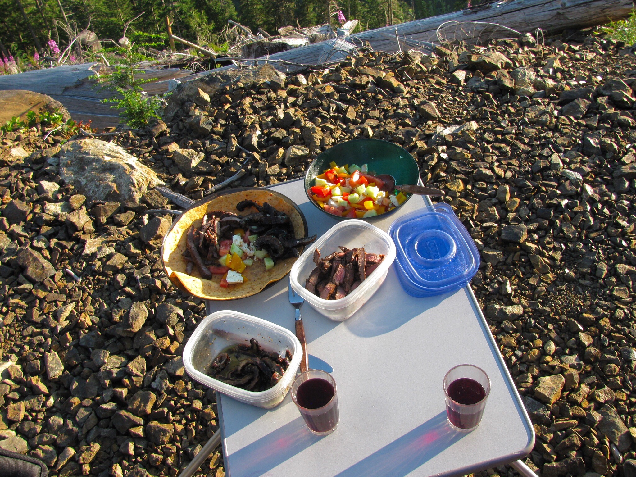
There was, and I think still is, a complete fire and BBQ ban in the back country, so we had pre cooked the food for supper. Grilled meat, grilled and marinated porcini mushrooms, a simple salad, all on a store bought tortilla.
After dinner walk and then back for the fireworks. Yeah, you probably are expecting pictures of the fireworks, but Neah Bay is 20+km from where we were and while we could see them, and believe it or not we could hear them, I couldn’t get a picture.

So I put up some battery powered Xmas lights for a small attempt at acknowledging the southern neighbour’s celebration.

In the middle of the night we noticed the moon was hazy, was it fog or smoke?
Next morning about 6:30 am, eastern sky was reddish.
Nice shot of Jake.

The smoke haze was moving in form the east.

And got worse.
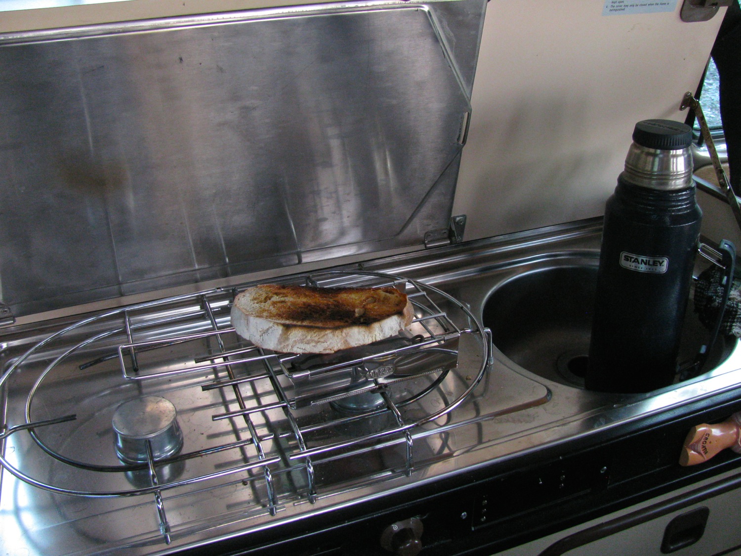
At times like this, toast is the answer.

We packed up and decided to go exploring. The smoke haze changed the light in a strange way. Some things took on a sepia tone, but the greenery really popped out. Explored along Braden Creek, Loup Creek, got tuned back at the gate on the road near the abandoned Gordon River logging camp, doubled back to Port Renfrew and stopped at the Gordon River a few km upstream of the marina. The point and shoot camera really exaggerated the sepia tone. The iPad Air II not so much.
Braden Creek

And the very low Gordon River

Canon PowerShot camera really made a meal of the tinted light.


On the way home we stopped at “Shirley Delicious” coffee shop in… Shirley. Good stuff. The new wheel and tire combo worked outs great. The tires have a much, much smoother and less jarring ride than the old ones. Traction was better although on some stretches of road it is like driving on ball bearings. I didn’t notice the slight gearing handicap with the larger (5 or so percent?) diameter tires on the rough roads, but did notice it a little on some steep paved grades.
Oh, and once home we found out where the smoke was coming from. Most of it was from Pemberton over on the mainland. Some might have been from the fire at Sproat Lake near Port Alberni here on the island. An inversion layer in the atmosphere kept the smoke contained. I found this, and I admit it looks a bit dubious, satellite pic taken yesterday, Sunday the fifth.

Trip – Much of the same
Another weekend trip to favourite places. A little different this time as there was little fog. I hope the residents of Neah Bay across the straits took the opportunity to hang laundry.

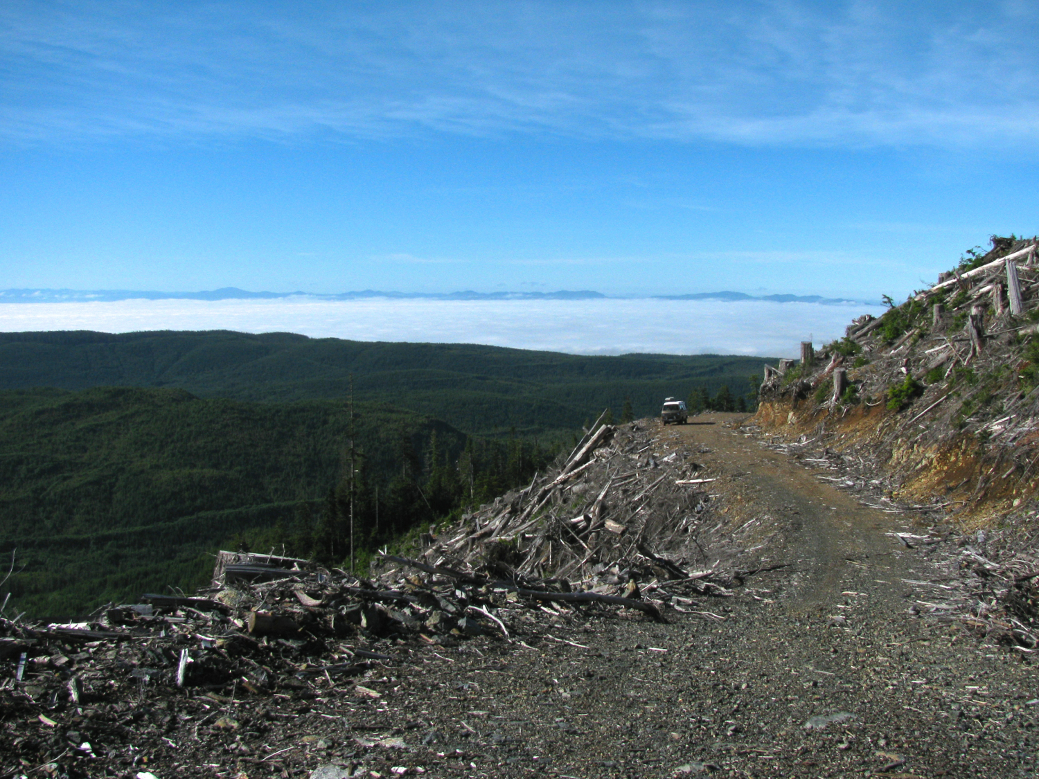
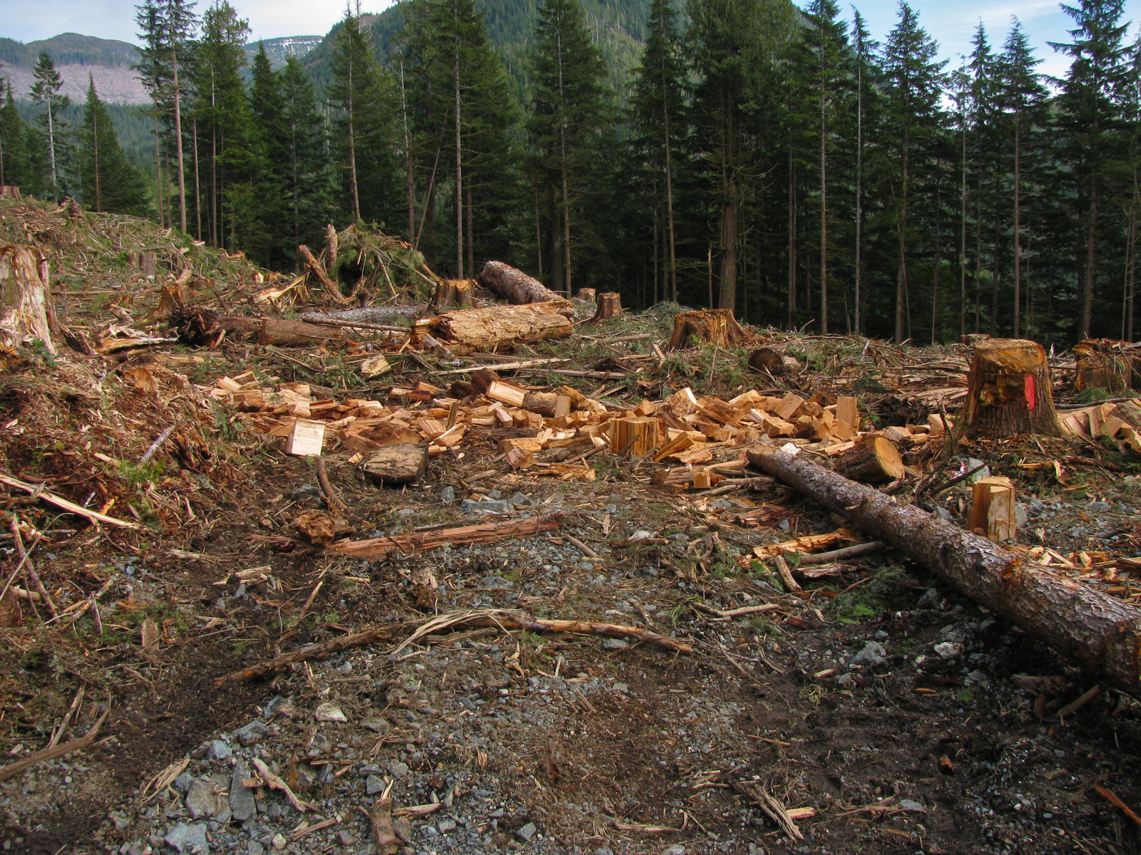
Obligatory clear cut shots.


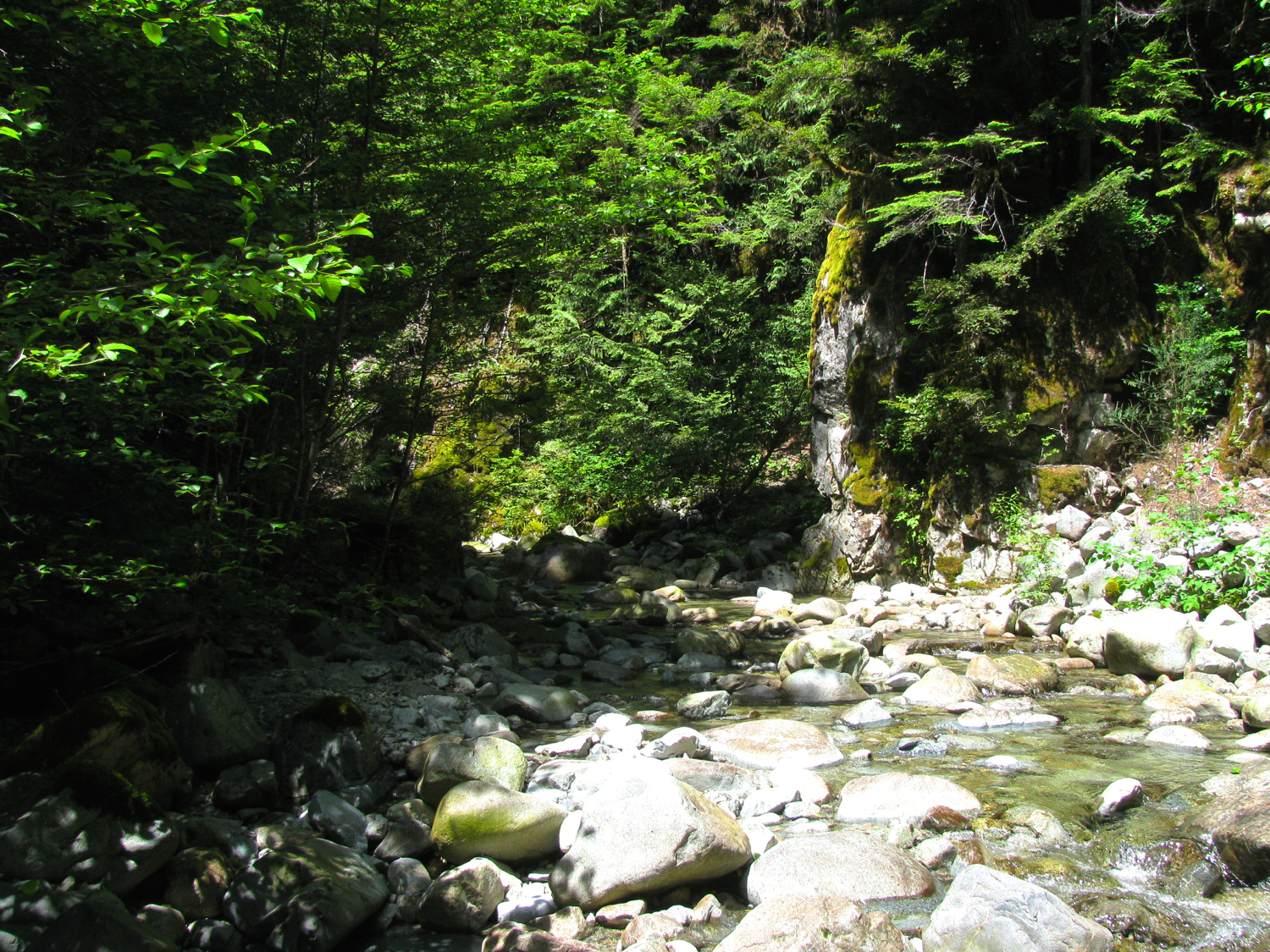
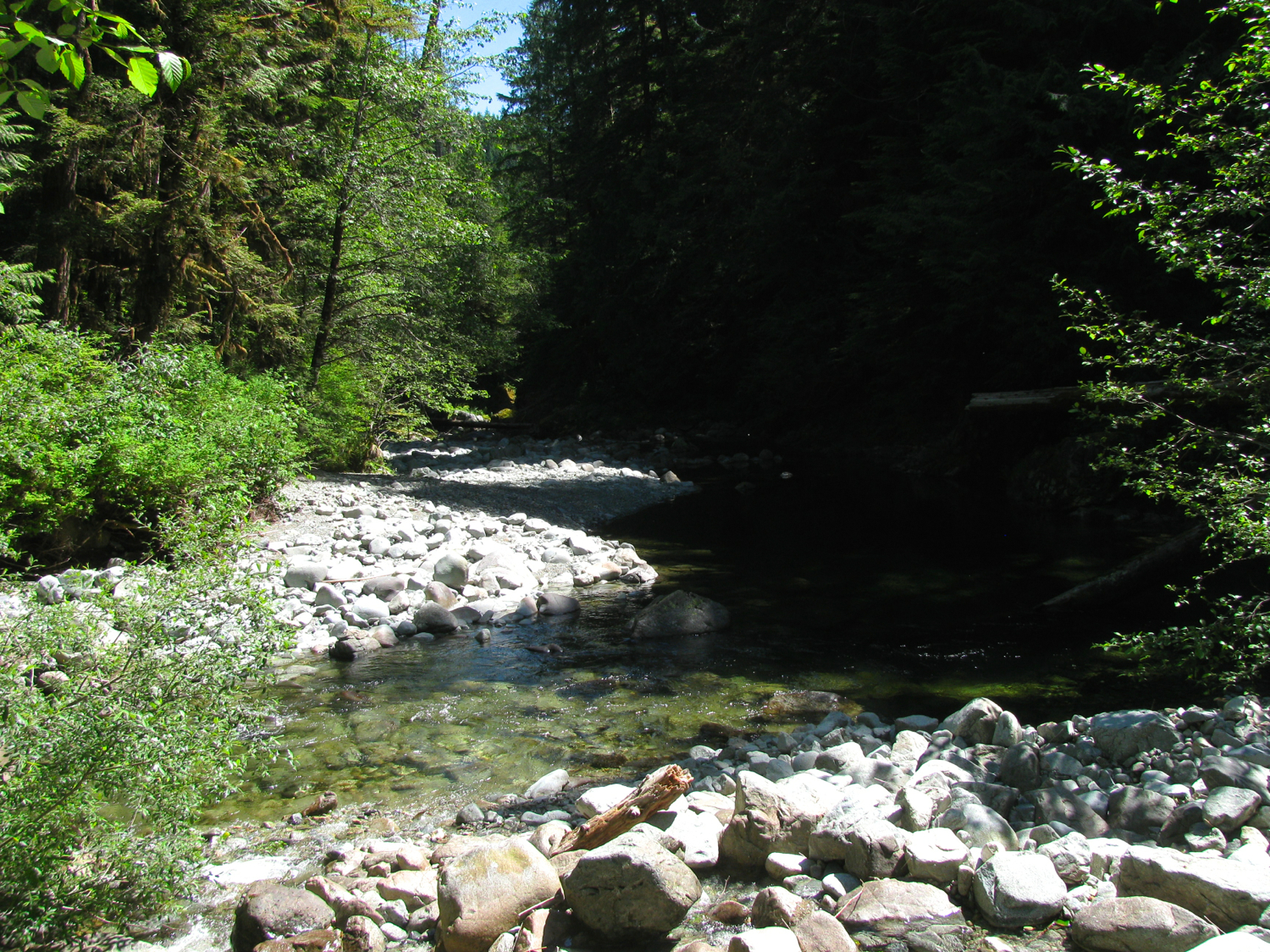
And one of our favourite creeks.
Saw lots of shipping with the lack of fog. Cruise ships, oil tankers, and container ships. a few of this kind went past. I like how the containers are stacked in a subtle wedge shape.

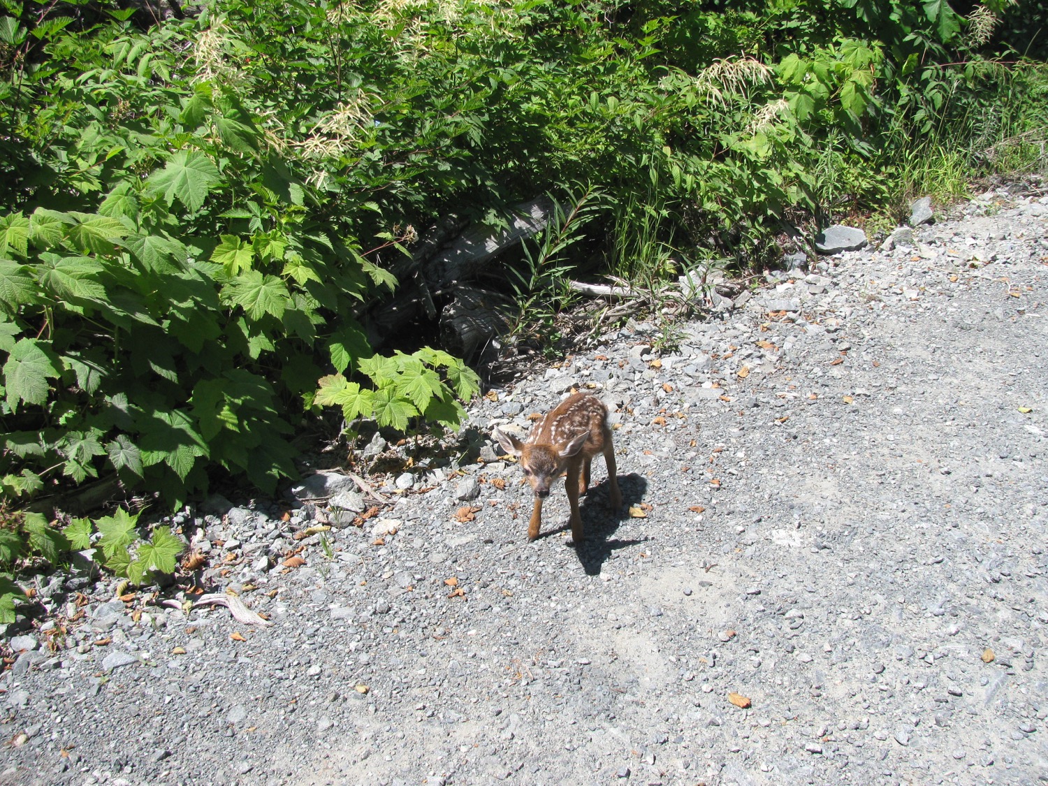
Came across a doe and new born fawn. Fawn was very shaky and wouldn’t get out of the way.

“and my axe”
Mmm, chicken
ok, another cheesy vid, this time the creek
Trip – same old same old, but finally the first trip of the year
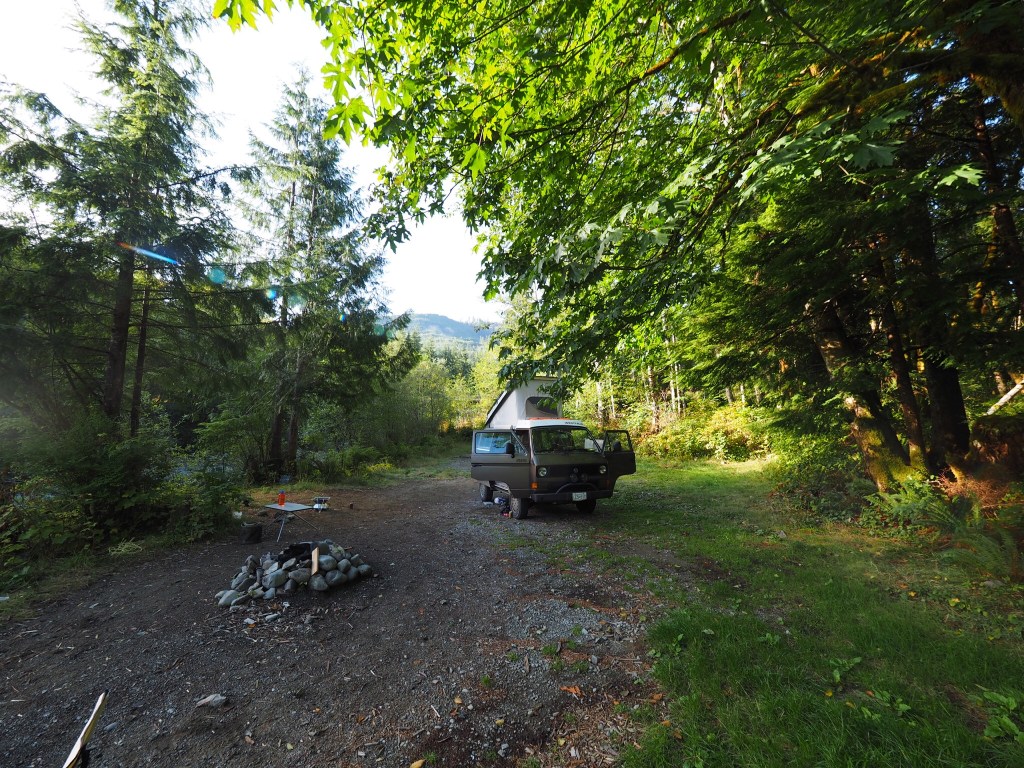
For various reasons we haven’t managed to get out using the van for its intended purpose until this last weekend. It was just an overnighter to familiar places, but still a fun outing.
Driest May on record here this year, and the Thursday and Friday before we left felt like August. It wasn’t quite August out on the west coast, the wind was coolish, but the sun was warm.
The syncro was a champ, hauling us up loose gravel and rock logging spurs, and the newly installed big assed auxilliary battery didn’t even blink about the amount of electricity we used. The battery truly is way bigger than we will ever need, its both daft and kinda fun to have it.
And yes, we camped beside clearcuts 🙂

On our way, we realized we had left the Thai themed marinated chicken thighs back at home, so we picked up some meat strips in Sooke.

Where’s Waldo?

Trips – a couple from August
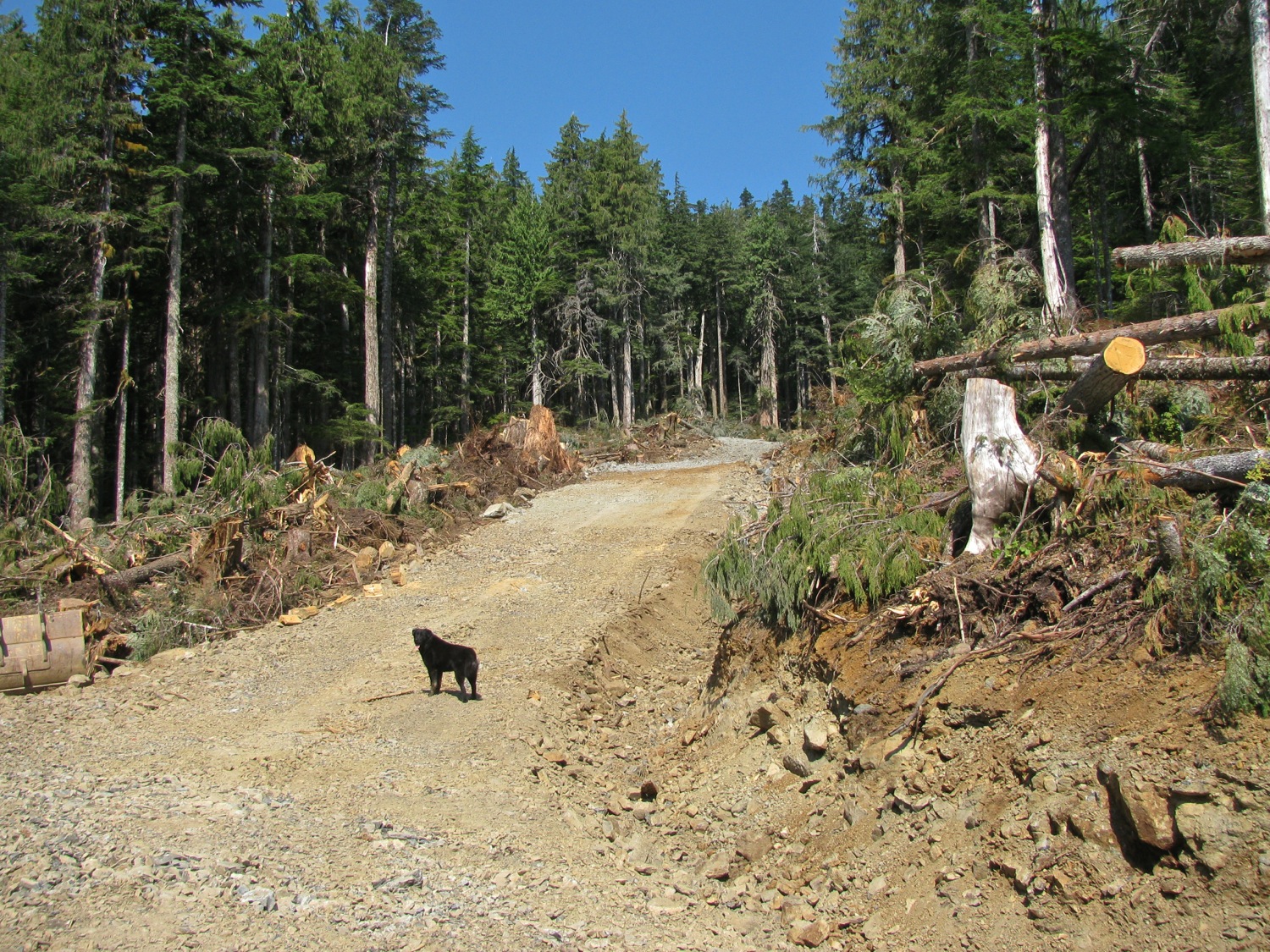
Instead of boring you with text I’ll just post some pics from a couple of trips made in August. The road building is at about 750m elevation, mostly Yellow Cedar, some Red Cedar (that rotten stump was about 10′ across, some fir and a little spruce. Logging road building now seems to use just a drilling rig, some sort of dump truck, and an excavator. No cat involved. Arrow pointing to the hoosegow above Clallam Bay Washington. Deck cloud makes it look like it is lower on the hills than it actually is. 

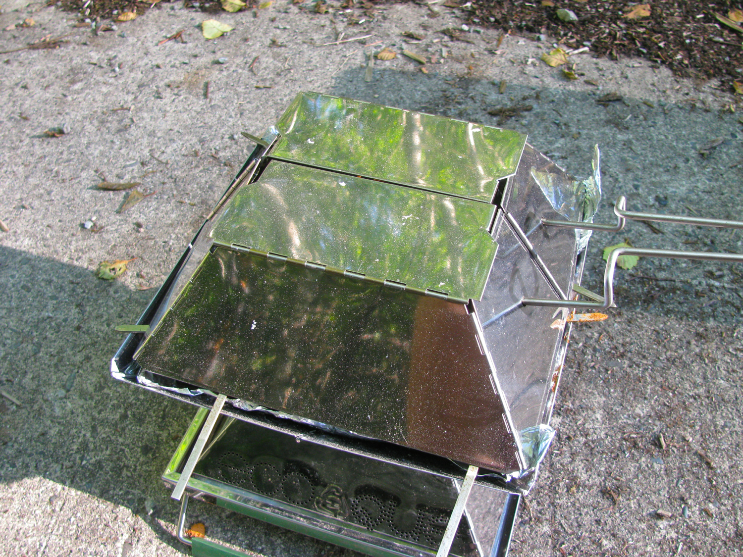
 What’s this, a new toaster? I couldn’t resist, here is MEC link. It works quite well.

 You can just make out the beach at Port Renfrew in this pic.


ok, got some vid clips, left over from personal stuff, of these two trips. Really not very well done or exciting but I thought I throw them up here. The fast motion part was trying out a not very successful dash mount for the GoPro.
Trip – turned out to be more of the same
We were planning on exploring some new areas when we left late Sunday afternoon but were thwarted by closed gate on the access road. Where there is active logging the contractor usually restricts access to the area by locking a hefty steel gate across the road or even just a steel cable with signage. I think they do that mainly to reduce chances of vandalism or theft of machinery or equipment left on site during non working days. So we headed up to one of our fall back view point spots while there was still heat in the day and we could sit back and enjoy the view and some beverages.
So there we were, again.

Bridging ladder used to level the van. My van is a rolling advertisement for my slowness in finishing things. Sliding door skin repair, rear bumper build (well it is getting closer), still no tires for the 15″ alloys I bought a while back.
Took a walk, into newly logged area. I was taken by this cloud on the hill.

And took a bunch of pics for a pano. If you click on image it comes up in new tab/window, at my default image size of 1500 pixel max dimension. You might be able to make out the beach at Port Renfrew.

Then suddenly it seemed like someone turned on the smoke machine to film some post apocalyptic movie.
And almost as quickly turned it off.


You know, i never get tired of the view looking over to Washington, summer sunset. You notice the orange haze? Could be from a forest fire somewhere. A couple of summers ago we had amazing sunsets when camping in same general area that were due to forest fires in Russia. Hard to believe eh?
Next morning I got up early and took some more pics to stitch.

We left at about 0930 and made a few exploratory trips up roads like this. But we didn’t find a good spot to camp.
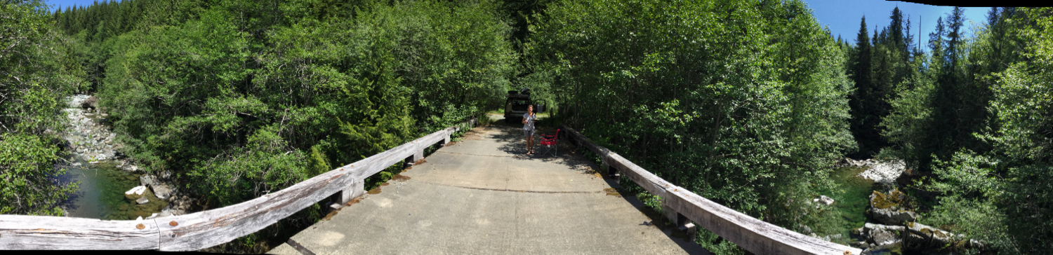
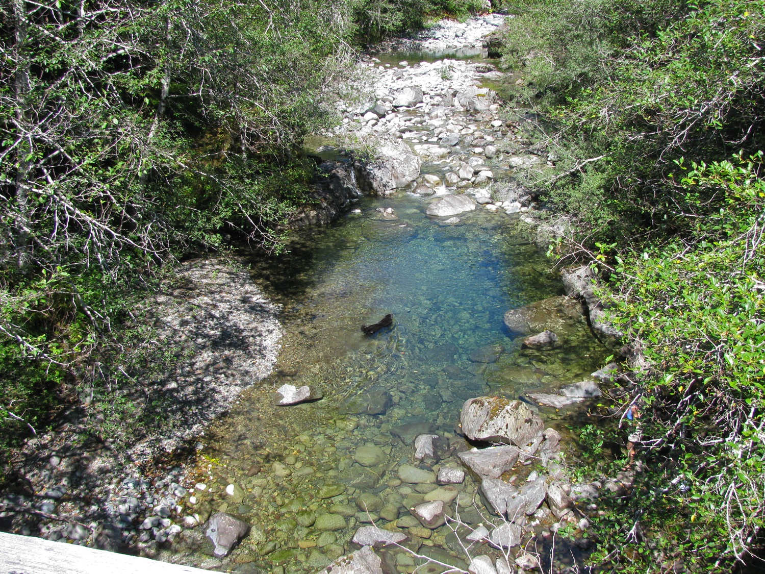
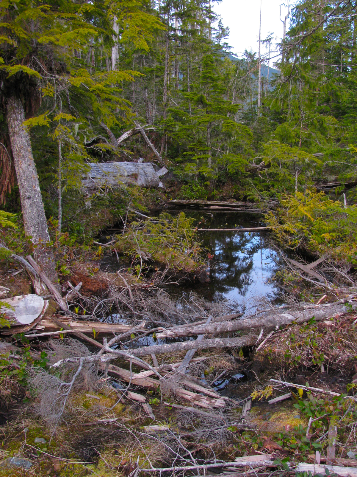
So it was a fall back to Loup Creek. It is pretty isolated, I don’t think many would make the effort over the moderately rough and slightly overgrown road just to be able to sit on a bridge. No, I’m not picking my nose.

The creek is beautiful, but quite cold. We hiked around, exploring a few km upstream and a little ways downstream. Here are a couple of pics of a little feeder stream, posted to point out a couple of things. First is that I find it really hard to take a pic of theses streams during mid-day. The river rock reflects light, the shadows and greenery suck the light up. I think i would have to set the camera on a tripod and take a series of pics with varying exposures/aperture and sam them together for an HDR image.
Second is that these short steep streams on the west coast of the island vary in flow tremendously.
You’ll find debris high up on the rocks or the bank that was deposited during floods.

All that white rock would be underwater during winter spate.
Supper time on the bridge. Chairs now on south end to catch the sun.

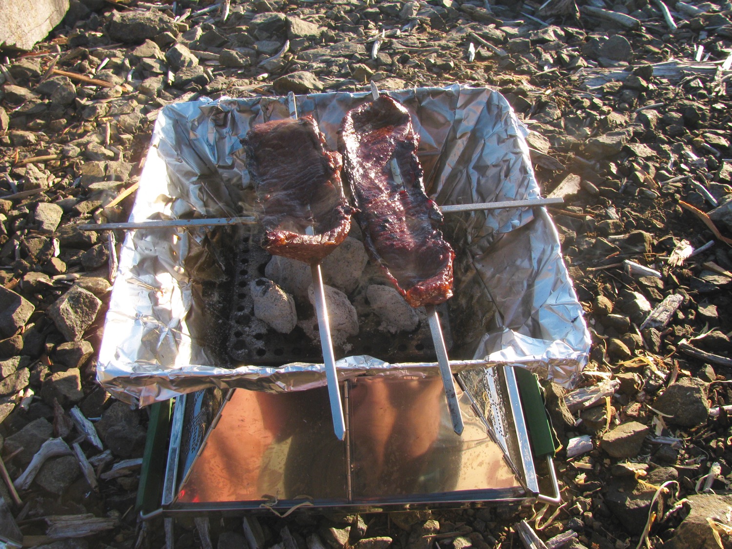
Eco-Que being used. Marinated chicken on flat steel skewers. Still haven’t used the grill surface of the Eco-Que. Yeah, just nine briquets.

Lid on to finish cooking.
Had this canvas bucket for years, US Army issue, one of the most useful accessories.

Next day we explored more, sunbathed more, read more, drank more, ate more, dunked in the frigid creek more, and then drove home in the late afternoon, early evening. Van ran like a champ, fridge worked from when it was lit at leaving on trip to when we got home. Garmin Glo and iPad mini remain a superb navigation combo – I should do a post on the software I use.
Trip – finally out for an overnighter
What with one thing and another we haven’t got out for a vanagon camping trip this year until this last weekend. Was just a quick overnight trip to, once again, the Port Renfrew area. Here are some pics.


Marine cloud started to move in around 5 pm. By sunset it was at our camp (654m elevation).


Cloud in the valleys next morning.

Finally, a bit of a bumper project update. You might notice i have the unfinished aluminum bumper on the van during this trip. It’s on and off as I fiddle with things. My most recent fiddling was making some tow hook brackets. These will screw onto the bumper where the steel framework for the hitch attaches to the van. The brackets are made from some 1/2″ stainless steel disks, 3″ in diameter. They were water jet off cuts. I cut one disk in half, drilled a hole in each semicircle. Two disks had a hole drilled in them and I cut the head off a pair of M16X1.5 bolts and welded them into the holes in the disks. I then welded the semicircle parts onto he disks. Picture shows one with a shackle attached.
Trip – Klanawa river again
Update: fixed access problem with the alder road video.
Last Friday we took off for a 4 day exploration of the Klanawa watershed here on Vancouver Island. Was a repeat of a trip we made last year, same people, same dogs, same van. One difference was we did not stop at Nitinat Falls, we drove on and camped west of Blue Lake, about 2.5 km from the ocean.

Long exposure makes the fire look larger than it really was.
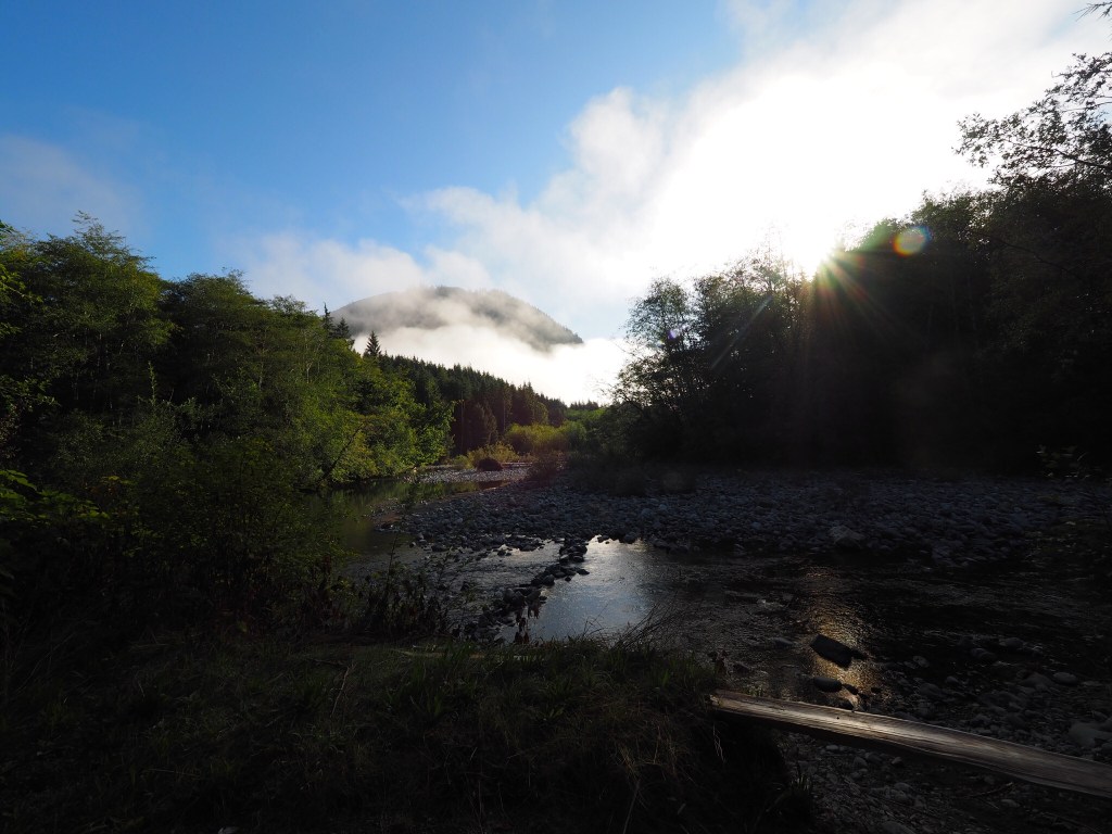
And the next morning, weather was good. We were hoping the weather was going to be good – after a month of dry warm weather the rain had started a week before. Pretty heavy rain at times and we hoped that the forecast of a fair weekend was accurate. The recent rain had filled the rivers, we noticed that as we drove in. Our plan for this day, Saturday, was to head down to the Klanawa river and we were a little concerned that the river might be to high to wade across.
Got down through the alder choked trail around noon. There is bear poop everywhere, the bears are gorging on red huckleberries and salal berries.

Down at the river and it is higher than on last year’s trip.

My son had convinced me that we should bring along a little inflatable dinghy. That was a good idea.

You might think it would be foolhardy to mess around in these little rapids with no PFDs or helmets. Maybe you’d be right. But the guys had fun.
(I stupidly left the GoPro back in the van, movie shot with the little Canon Powershot with a dirty lens)
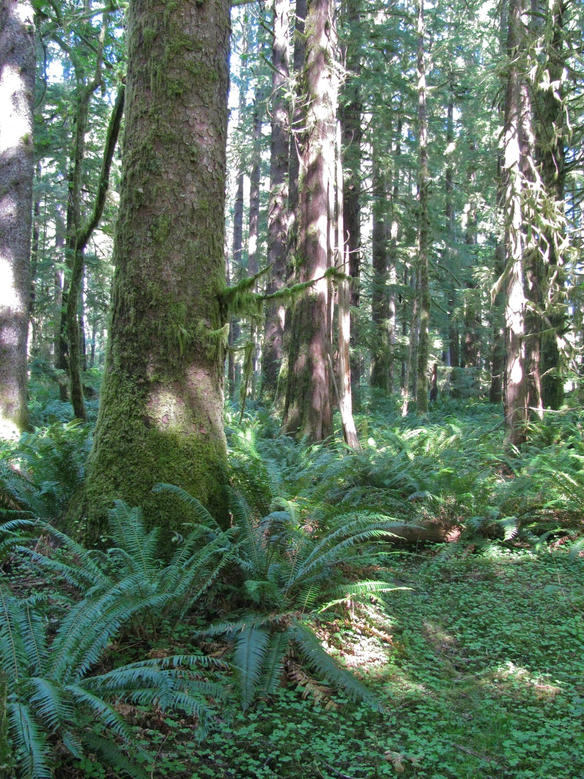
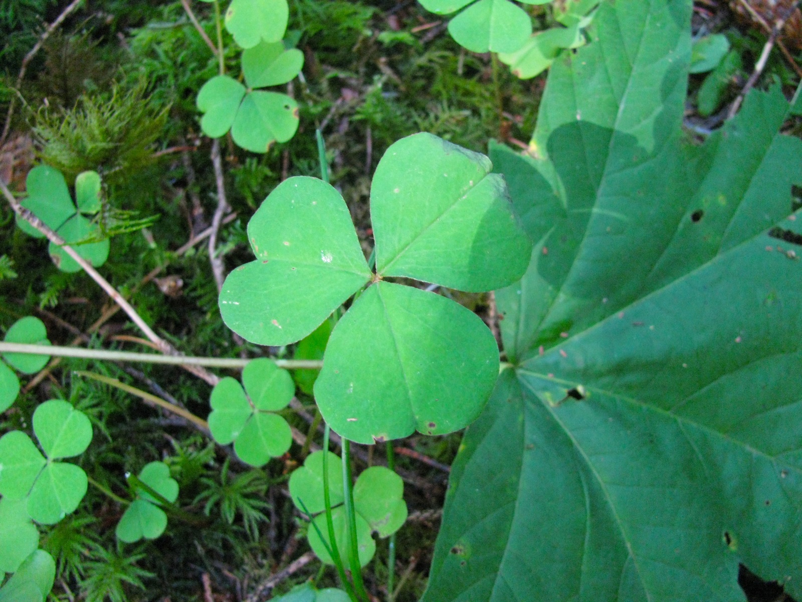
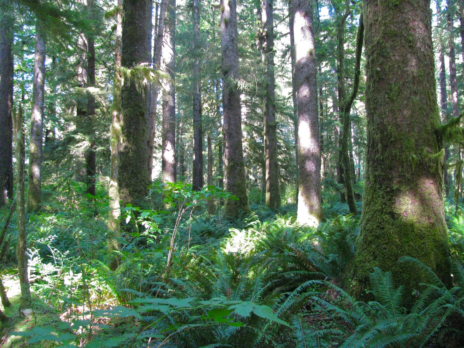
We managed to wade across the river to get to an area that is old growth, untouched, river bottom forest. The trees in this spot are Sitka Spruce, Western Hemlock, Red Cedar, and a few Bigleaf Maples. More info here. Impressive place, the pics do not come anywhere close to how it looks in reality.


Then back to the van and up the alder choked road which was a bit less choked after the van’s trip down it. For some reason I had a heck of a time processing this vid shot with the GoPro. Must have been slightly corrupted or something. The vid is sped up, but try selecting the 720p option to reduce the blockiness.
This kind of road is one of the reasons I don’t worry too much about the condition of the van’s paint.
All four of us agreed that we wanted this evening’s campsite to have a view, and we got one.

We’re looking down the edge of the island, Washington State way in the distance.

For a little perspective, here is the picture of previous night’s spot and arrow points to approximate location of viewpoint campsite. Why didn’t we try for the higher ground? Access was more difficult and would have taken more time. We really wanted to set up camp before the sun disappeared so we could enjoy the spot.
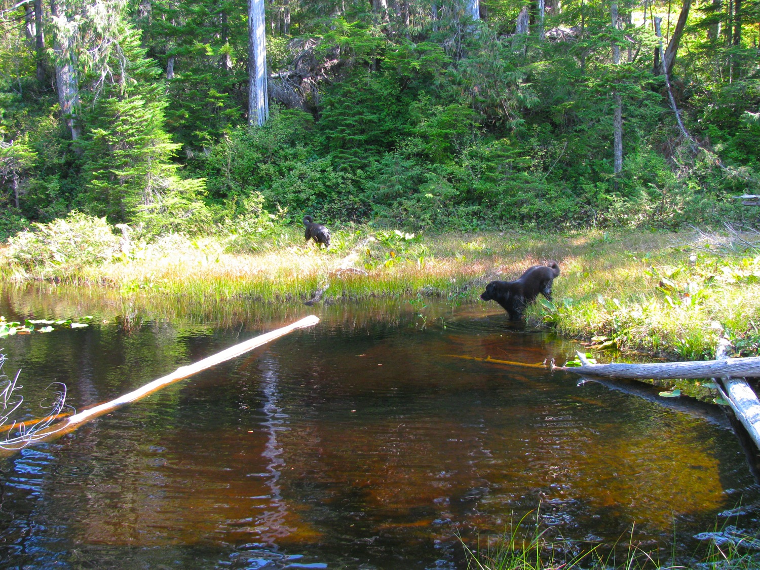
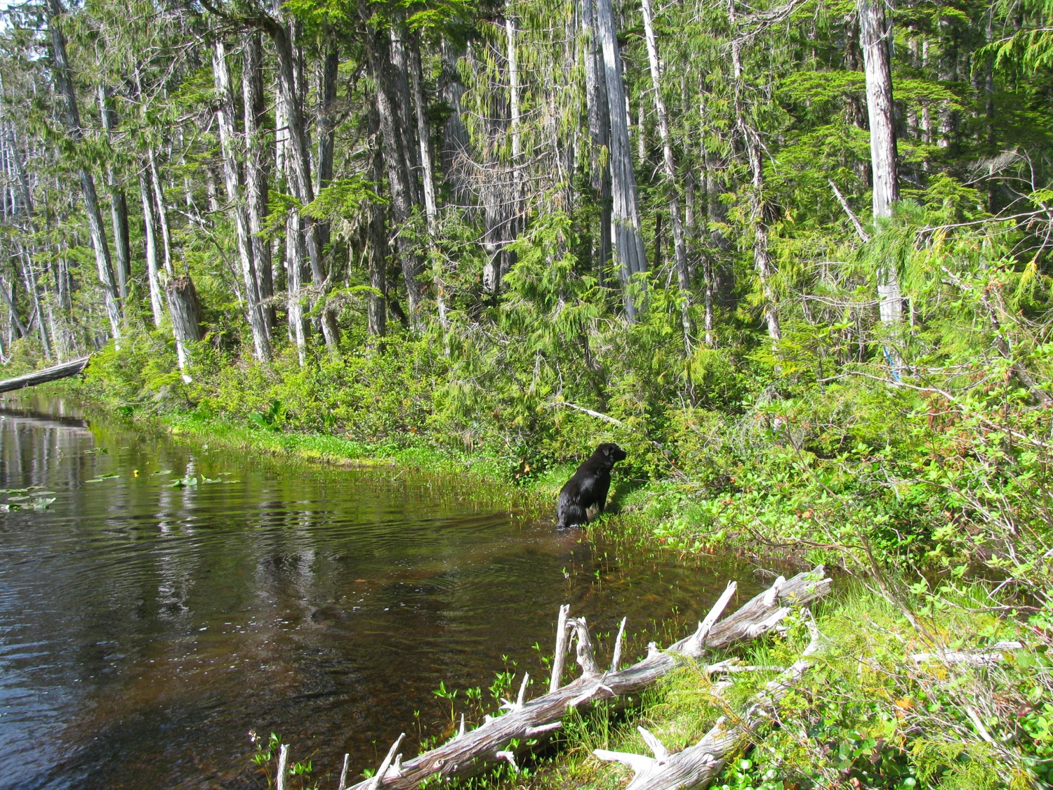
We wanted to explore more around Blue Lake, we had this idea we could get closer to it. So that is what we did the next day. No luck getting closer than about 300 metres to the lake. We did run into a bear when we were walking an old road – the dogs took off after it. When we caught up to them they were barking at the bear from the edge of the road. The bear was against a tree. Got the dogs under control and tried to get a video of the bear. Not very exciting vid, par for the course for this type of thing.
We camped that night at the little gem of a lake that we camped at last year. I’m not saying the name.

Next day was our last day. We stopped for lunch and afternoon exploring at a spot further upstream on the Klanawa. It is the nature of these short freestone west coast rivers – they go from a stream to a full grown river in a short distance. And you can judge by the gravel bars just how much the water level changes.
We did some exploring, sans camera, doh! Big Sitka spruce, Western Hemlock and moss covered Bigleaf Maple. At one point, the boys went off upstream with the dogs and ran into a large male elk. Much excitement ensued, but thankfully no creature was hurt.
The westy table mod was used throughout this trip. We came up with a name for it- “Swelegent”
It was one of the best trips ever.
Trip – quick look at Loup Creek
Just back from a short overnight trip. Our goal was to see if we could find a camping spot on Loup Creek (a tributary of the Gordon River). I’ll leave it up to the reader to discover just exactly where we ended up.
July set records here for the lack of rain (it did shower for a couple of days at the end of the month) and we were worried that gates would be closed on some logging roads. Turned out many gates were closed and that stopped us from exploring some other spots before we got to Loup Creek. We drove up some fairly steep and rough roads, but at the end of them there was neither a good view or a creek or lake. For some reason I didn’t take any pics of the steep roads, I guess I was distracted by the search and the road conditions. I have to say that the little mods to add some more ground clearance on the van really paid off. No more scraping the spare tire carrier or the trailer hitch when going over the ditches cut across some of the minor logging roads. Those roads can be fairly steep (+20%) and the road surface is loose sharp rock.
The only pic I took of this part of the trip (not steep and not rough)
So off we went northwest alongside the Gordon until we found the old, abandoned Forest Service road. Moderately steep climb, loose rock, few over hanging alders. Toodled along until we came to the first bridge over the Loup. This was a bridge built to last – large concrete abutments, 2 giant I-beams spanning, and precast concrete sections as deck. Deck about 30 feet above creek. Other side of the bridge was pretty well alder choked, and the roads led to nowhere interesting so we decided to continue upstream to find the second bridge. There was this sign just up the road.

Then there was a steep section and the surface of the road was made up of larger than normal loose rock. At this point the van started to miss and buck, just the same thing it did at the end of our last trip. We barely made it up the steep section, van bouncing, tires slipping. Not that much fun with a ditch on one side and a very steep drop down to Loup Creek on the other side. We had to drive on a kilometre or so before we could find a level spot to stop. I won’t go into any thoughts about why the van was missing and bucking in this post, but we let the engine cool down (it was a hot day and we had been working it hard) to see if that made any difference. Well it didn’t and even thought I really wanted to go on to find the second bridge we decided to turn back and camp at the first bridge.
It really wasn’t a bad place to camp. Secluded, beside a creek, bugs not *that* bad.
So here I am sitting and thinking. Am I marvelling at how good the classic Thule Combibox 250 looks on the van? (that’s for you Phil Z.). Am I enjoying using the table mod? Am I enjoying a drink and some potato chips? Or am I wondering why the van engine is acting up?
All of the above 🙂
As the creek runs pretty well north – south at this section, and as the sun was in the west, I couldn’t get very good pics of the creek from the bridge. I did get a pic of the van lit up by all the led strips later that evening, for Jerome.

About 11 am next morning, sun made it down into the creek. Still hard to get a shot, the river rocks reflect a lot of light
Looking upstream (north).

And downstream.
We packed some food and drink and clambered down to the creek and walked up stream a short distance. My wife and Jake found the way down.
There are some small trout, and perhaps salmon fry?

You might be able to make out the bridge.

And about 6pm we packed up and drove home. Van bucking came and went, no rhyme or reason. Ah well, that’s something to figure out later. It didn’t spoil a nice little trip.
Trip – again to Port Renfrew area
Can’t waste a sunny weekend staying at home, so off we went Saturday morning for an o/n trip to the area NW of Port Renfrew. Yeah, we go there a lot is seems, but it is secluded and pretty.
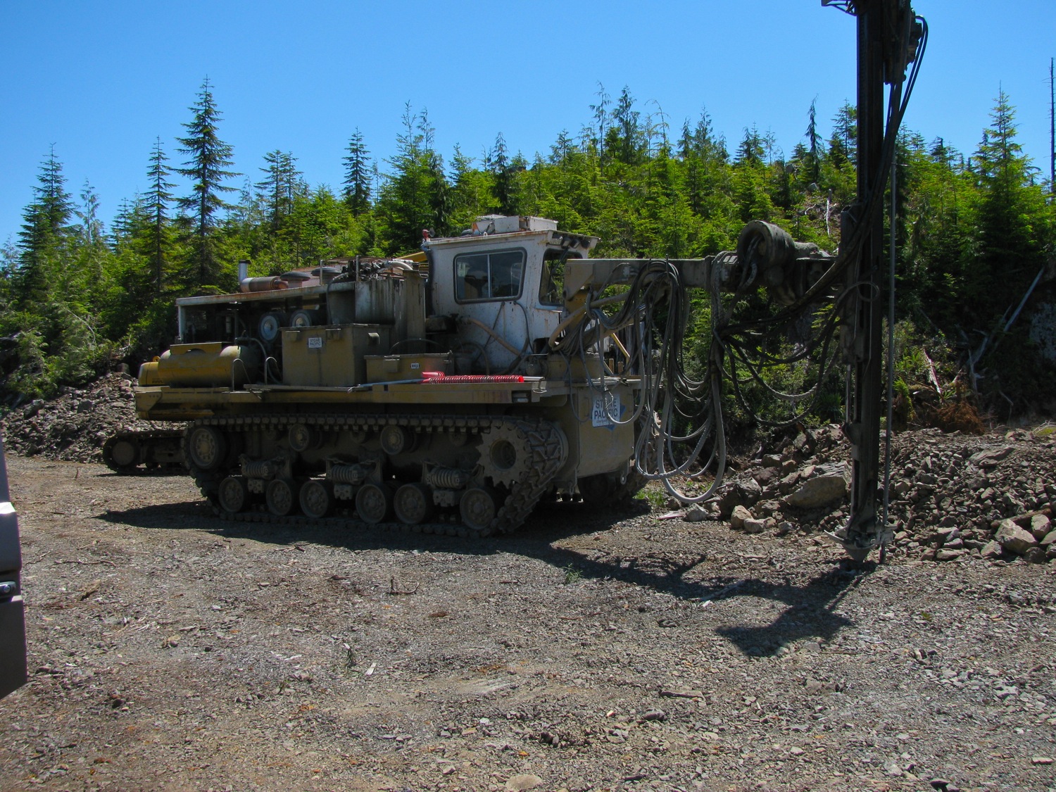
Before setting up camp we did some exploring on the Sad Lake main logging road. BTW, there is no Sad Lake in that area, no idea why the logging company gave the road that name. We got close (less than 1 km) to the southern boundary of the Carmanah-Walbran provincial park, and ran out of road at about 615 meters elevation. Most of the hills in this immediate area have been logged below this elevation and now we found construction of a new road to log some of the smaller trees (about 1 meter diameter and less). A fair amount of Yellow Cedar, lovely wood. I wonder what the market is for this species now that wooden boats aren’t very popular?


Nice view of the ocean fog from up there.

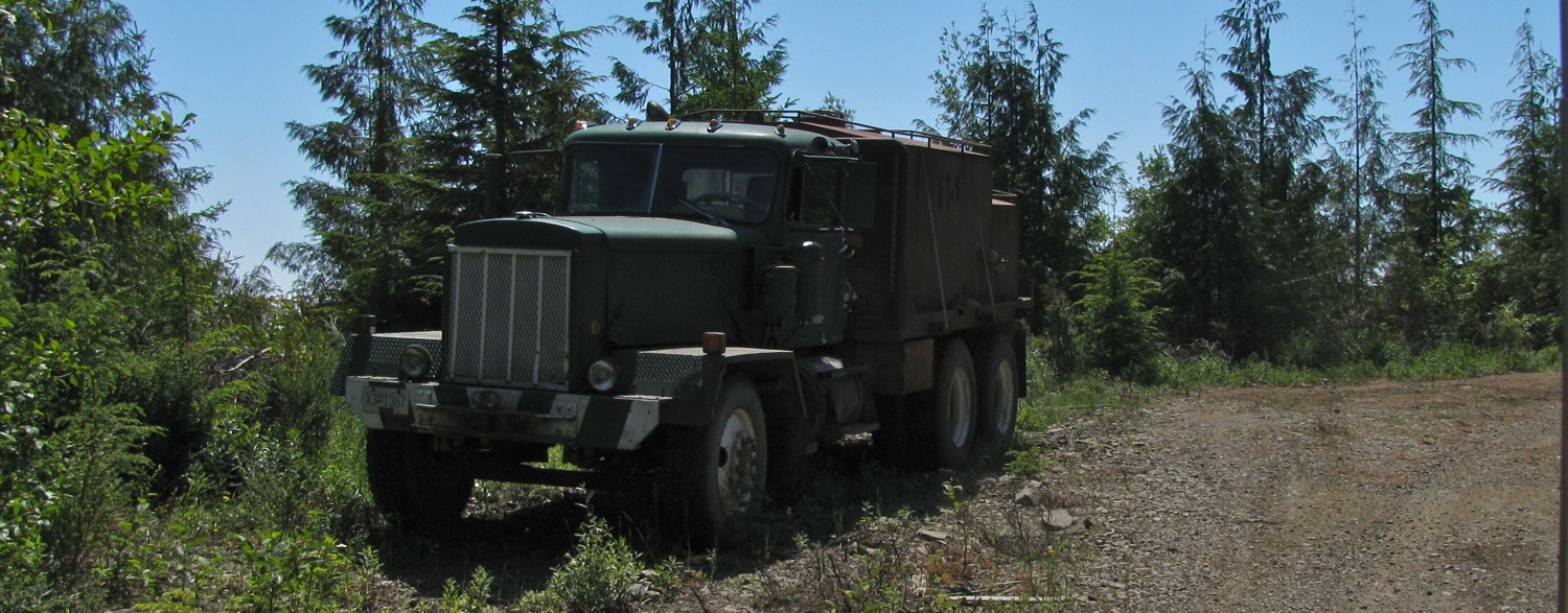
Oldish truck being used as a fuel tanker
A little further west. This is about as thick the trees get in this area. Combo of elevation and rocky ground. No shortage of rain here.

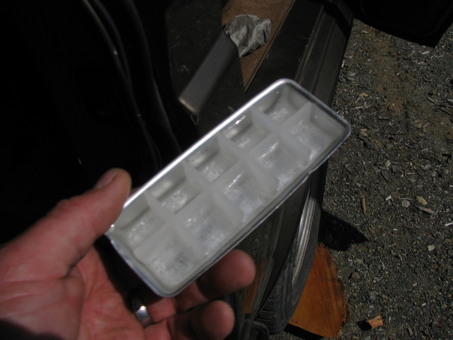
And then we headed to our old campsite. I’m telling you, the Dometic engineers just nailed the design specs for the Westy propane fridge, well at least for us up in the temperate rainforest 🙂 Yes, solid ice in the Barbie sized ice cube trays. A rather poor surface area to volume ratio with these cubes, they don’t last long in the G&T.
Yup, same spot, same picture. Poptop canvas different though.

Just about then the dogs started casting about, some scent got them alert. Looking down from our campsite, 3 bears. Look to be 2 yearlings and what I presume to be the mother.
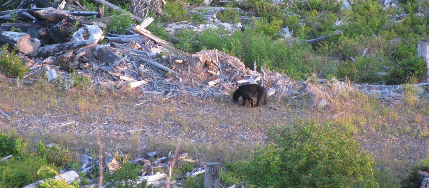

Mum?
Ok, all the LED lights on.

Next day we explored further. Nothing much to report except coming across a bear carcass. Been shot, hind legs were a few feet away, the paws cut off. Bear hunting pisses me off. The fuckers who buy bear paws and gall bladders should be… well, I won’t say.

So on the way back we took a few side tracks, exploring. On one track the van started to lurch and miss. This got worse so I stopped in Port Renfrew to fiddle with the engine. Nothing looked amiss, no vacuum leak or bad connection.O2 sensor was disconnected, no differance. At the worst point (and it was not consistent) when I moved the throttle valve just off fully closed, I mean *just* off, the van would miss, stumble, almost die. This was me moving throttle by hand. I replaced relays, checked evap/emissions tubes. Nothing seemed amiss. Then it would run well enough to get going again. For minutes it would be normal, then it would buck and die. For most of the trip I either had to have the pedal full down, or else coasting. I suspect the throttle position switch. Will check it out.
Trip – stopped by snow but fun anyway
This past weekend my wife and I headed off for a quick overnight trip. We didn’t plan a destination, but ended up, again, in the area north of Port Renfrew. Snow level was much higher than it was back in January, and we managed to get up Grierson main and we had hopes of getting to the viewpoint we visited last May.
But the combo of thick crusty snow and a steep final approach thwarted us.

No really, it was steep.

We really wanted to get to the end of this spur, but no way. Just above that steep section the road flattens out.
What it looked like last May.

And this time.

And the spur we wanted to camp at, as it was last May.
And this time.
Our fire pit was still there.

So we went back down the road about 200 metres.
Wasn’t too bad, sunshine and a nice view.

Walked down the road a ways and looked at the desolation after logging.

If you look closely you might be able to see the yellow shoots of Skunk Cabbage poking up at edge of the water.

Pretty little oasis amongst the logging.
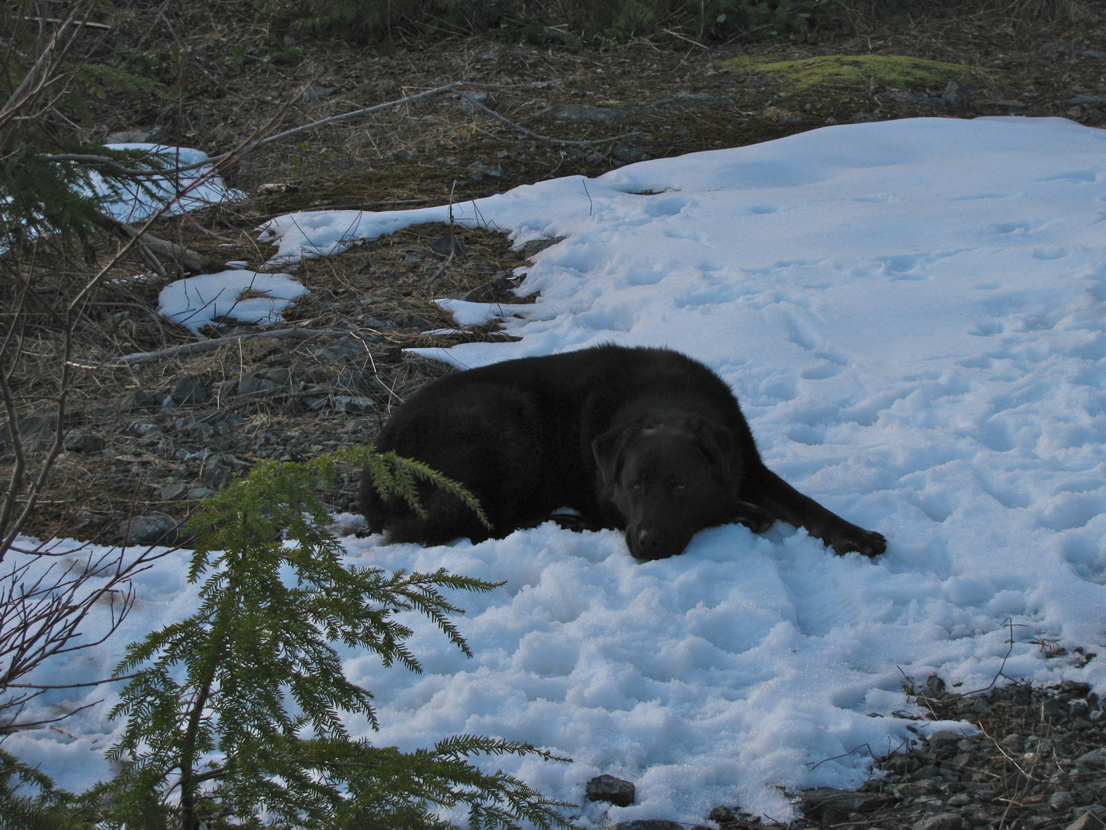
One of our dogs, loves the snow.
Cape Flattery, Olympic Peninsula, Wash. State.

We had the Go-Westy rainfly up, and the Westy pop top insulation blanket installed inside. We also brought along the Olympian Plat Cat heater (not used when sleeping). The set up worked very well, and with the pop top vent cracked overnight, we have very little condensation on the windows in the morning. Must have had some sort of chimney effect going.

A little bit of snow falling next morning.

Breakfast, and the tell-tale sign that someone in the family is a Molecular Biologist.
The old “Excelsior” at work again.

The dogs taking up space.

Then off we drove to explore more of the area. The weather cleared a little, if it wasn’t for the wind it could almost be described as mild.
Nice little lake, second growth forest.
Edinburgh Mt. in the background, steep logging in the foreground.
And wouldn’t you know it, we even checked out the Camper Creek area campsite that we spent so much time at last summer.
Ooh, kindling!
Notice how the mirrors take a bit of a lashing on these trips?
Came back home via Gordon River and Cowichan Lake (a round trip we have done many times before). Saw signs of kayakers along the Gordon – crazy folk who paddle down the canyons.
Trip – overnighter, or looking for snow in all the wrong places
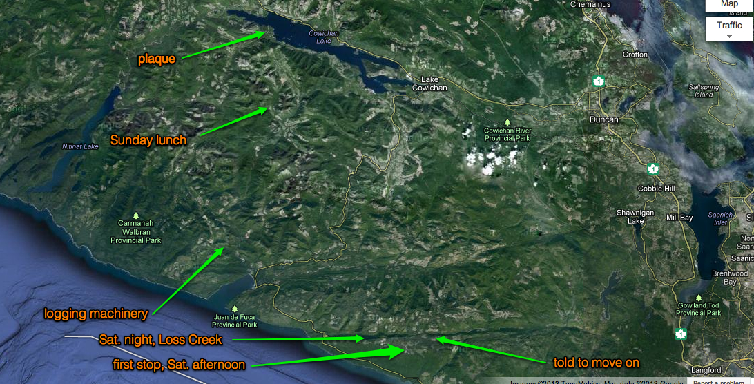
Edit: I forgot to post up some sort of map to give you an idea of where I was.
Google map ref to general area.
Rough placement of stops.
This past Saturday afternoon I decided to head off for an overnighter. I wanted to park in the snow, on some viewpoint, and relax. I headed to the area north of China Beach Park, just NW of Jordan River where I had a nice night there a couple of winters ago. The approach is logged much more than it was back then.

I hit snow, deep hard rutted tracks, past some parked cars (day trippers: X-country skiing and snowshoeing) and on until the ruts came to an end. Met a snowshoe wearing hiker who told me that trees were down further up, road was impassable. Ok, back down the road but turning left (east) before the hwy. Road wound along the side of the hill, came to this spur going up. It doesn’t look like it and the camera always seems to flatten things, but it is as steep a spur as you get, probably 25% slope.

No real view at top, so back down.
Kept on going, turned out I was heading up the west side of the Jordan river canyon.
On up to the dam and reservoir (view from the other side of this canyon in this trip).

Was getting darker, I thought if I couldn’t get a sunset, then I would find a spot for a sunrise. Went up a spur… ladder?

Turned around so sliding door facing east, got out to look around, and… dammit, voices from above me. Some guys yelling down from spur above that the gate would be locked tonight. The gate way back where I “turning left (east) before the hwy”. Was truly dark now, got down onto the hwy and headed towards Port Renfrew. I don’t know why, but both my headlights and aux. lights seemed feeble on the logging roads. I’ve used 100/80 W bulbs in my H4 headlights in the past, I might switch back to them. My H1 bulbs in the aux. lights are only 55W, maybe I’ll up the wattage in those too. Don’t worry, all of them are relayed 🙂
Came to Loss Creek, ah, hell with it, I’ll go on up a kilometre or two. Turned out the road had been bulldozed (I won’t say it was engineered) further than I got before. Found a fairly flat spot, popped the top and snacked, drank, read, and slept.
Grey reality of morning – I was looking for a sunset view and I ended up here.

It really does look like the road (which years ago, used run up to the aforementioned reservoir) was just bulldozed. No ditching or culverts. I wonder if it is being put in to service a mining claim rather than for logging. As bad as some logging roads are, they are much better made than this road.

See the pop top?

Was a good thing I stopped where I did, road got a bit sketchy 50 metres on.
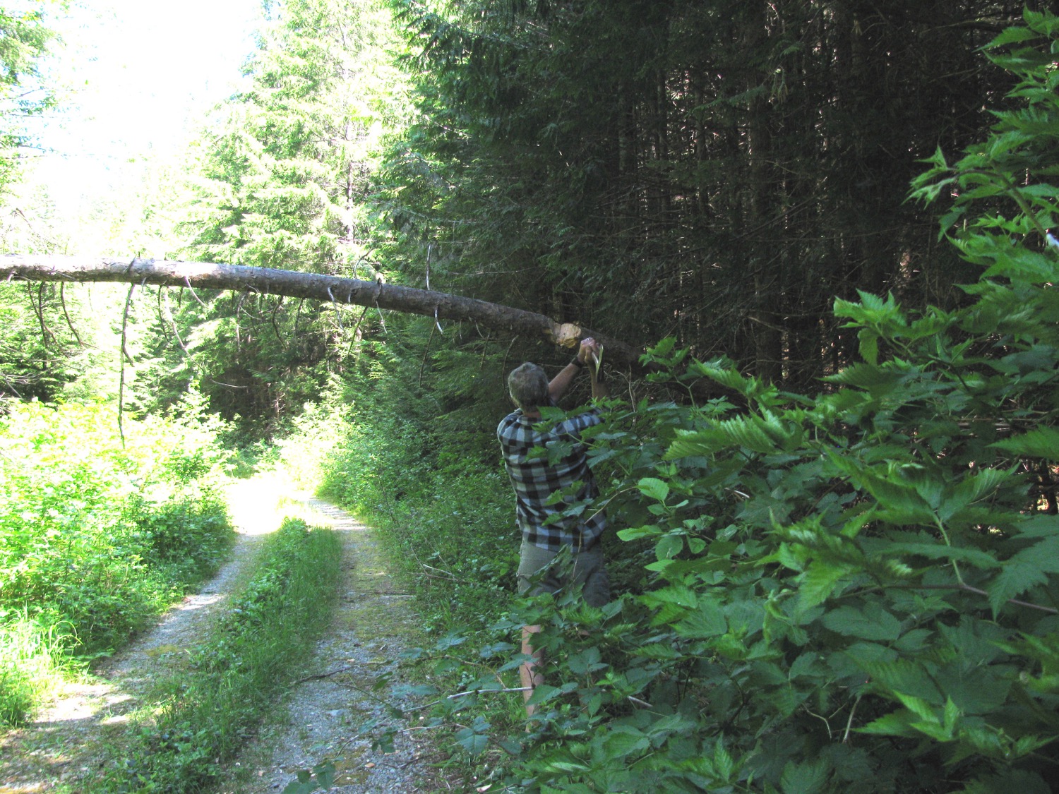
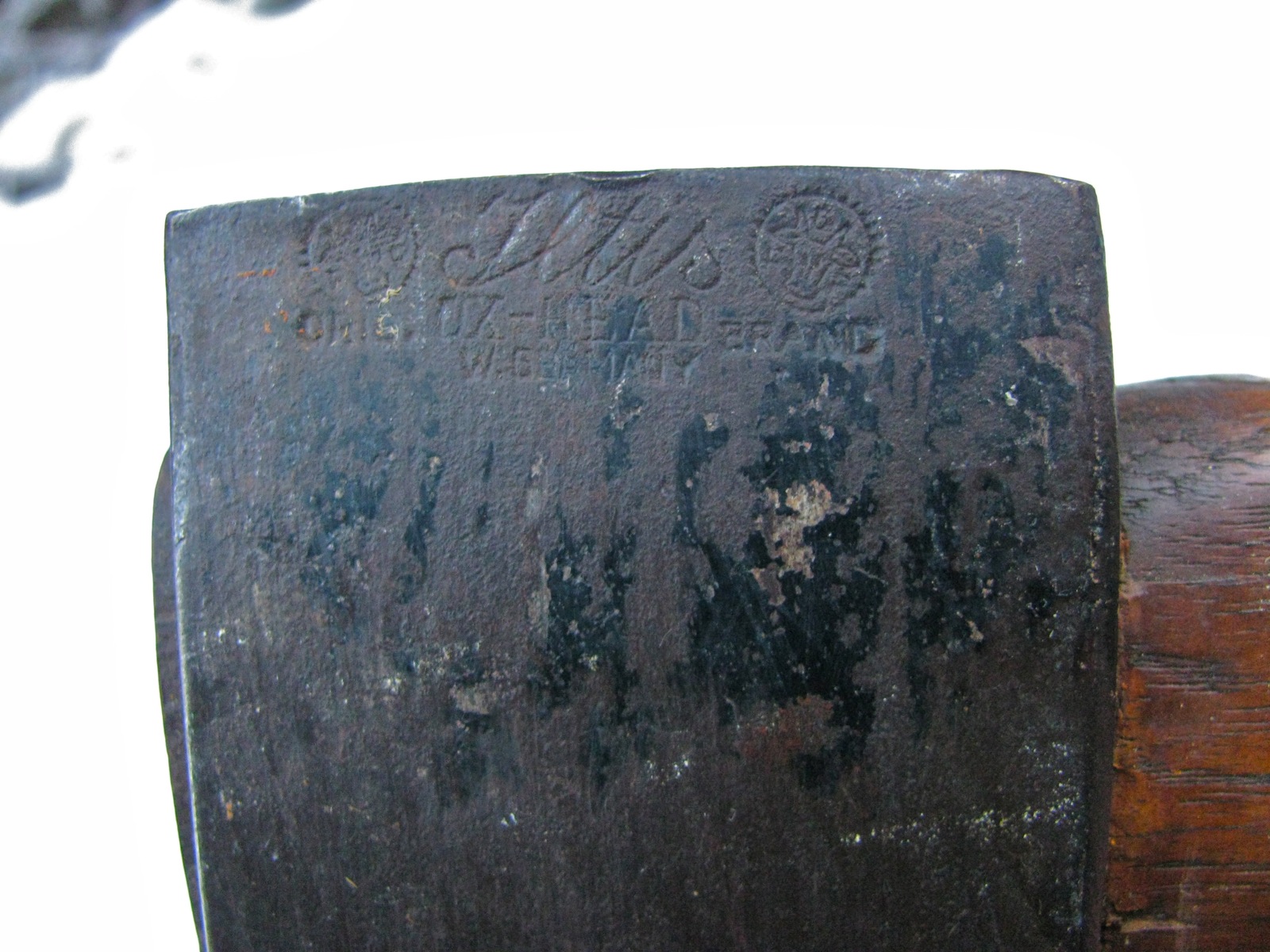
Before turning around and heading out I had to move a small fallen tree – hey Peter in Austria, it’s not a Stubai axe, but rather an Iltis Ox-Head.


I now remembered I had the GoPro with me. How to make the wrong diagonal across a ditch. BTW, vids can be viewed in HD.
Loss Creek never seems to get the sun in the wintertime.
Hoarfrost galore.
Exciting video!
Couple of things: first, the front spring install seems to be working out fine. I think I can say the added height has helped in the ditches, and certainly the van handles no worse than before. Second, you really appreciate the short length of the Vanagon when you have to turn around on these roads. Even though it sometimes feels like you are doing 16 point turns, I can’t imagine attempting some of the turn arounds in a larger vehicle.
Back in the sun and on the hwy heading to Port Renfrew. New road work is finished, eliminating a nasty single lane and corkscrew climb section. A view point was put in. Looking south to the USA.
Then on into and through Port Renfrew.
I decided to go up to the Gordon River watershed and make my way to Cowichan Lake that way. I drove past the turn off to Grierson main, then thought why not have a look. Back and up the Grierson, the way we went during the summer trips to Camper Creek etc. One thing, tracked machinery have left hard grooves in the frozen ground, much like rumble strips. You might notice the vibrations in the video.

Gordon river down there, I think that’s Edinburgh mt. with the snow.
Combo grapple and highline.
Pulley on the excavator must have something to do with a choker/highline arrangement.

Teeny tiny Vanagon.
I drove around them.
And about a kilometer or so further on, end of the ploughed road. Actually, ended at a “Y”, the van is facing the road that goes on to Camper and Sandstone creeks, picture taken from road that goes north and access to this area we visited in May. The unploughed snow was only about 1.5 ft deep, but it had a heavy crust and soft under – very hard to drive through.
You’ll be pleased to hear that the GoPro cam battery had run down and that I forgot a spare or even a charging system. No more tedious videos!

So back on down the road. I stopped to look at the grader and the truck.

Is this a Pacific P500 series truck?

V-12 diesel?
Really tough trucks. Has a lowboy attached for the machinery.

Back onto Gordon M/L and heading east. Took a couple of side roads, some with bridges.


Smooth section of the M/L.

Turned north at the old Gordon Camp site and parked for lunch.

Then on to Cowichan Lake. Took a little diversion to find this on an un-marked spur.

Plaque is out of shot to the right, this is on the south side of Cowichan Lake.
Then it was east to Duncan and back south on Island Hwy to Victoria. Despite not finding any fun snow it was a fun trip, and after all, that is why I have this van.
Trip – yes, once more to Camper Creek area


Trip – Camper Creek watershed again
My wife and I revisited the Camper Creek watershed that we went to a month ago. We had it in mind to see if we could find the trail down to Camper Creek, near the park boundary. So we set of on Thursday afternoon and arrived at our campsite around 3 pm. Funny thing about my stitched panoramas, the centre portion of the pic ends up narrower than it appears in real life. A bit of fog on Juan de Fuca strait, Neah Bay is over there on the other side, close to the middle of the picture and some smoke from (I think) slash burning up the hillside to the right of Neah Bay. Cap Flattery to the far right.

This fog evaporated as the afternoon wore on and we could see some of the marine traffic in the strait.

Neah Bay is behind the leftmost ship.

I’m guessing you get the idea that we didn’t do much once we got to the campsite, not much except sip cocktails, look out over the strait, and read mystery novels. Oh and then before you know it, it was dinner time.

And three Nighthawks appeared, diving and buzzing. Very hard to get a picture of them.

A bit of an apocalyptic sunset.

Next morning the fog was back.

I took us half the day to pry our selves out of the chairs and stop reading long enough to do some exploring. We found what we think is the trial down to Camper Creek, but the dogs were acting excited and we decided not to go down it for fear of running into something that the dogs would chase. There are lots of bears around this area, no shortage of bear poop, and our dogs have a history of going after them. So we decided to drive as far northwest as the logging roads would allow, heading to where Walbran/Carmanah Park “T’s” into Pacific Rim National park. It is a logged area between Cullite Creek to the north, and Sandstone Creek to the south. Interesting area but no great campsites so back we headed to the original spot. On the way back we had a dip in a nice pond in a gravel pit (often find blasted areas at the side of the roads. The rock used for logging road construction). I’d give this pit 4 out of 5 stars.

Back to the book. I was reading “Voices” by Arnaldur Indridason. The fog never did lift form the straits that day. We wondered about the number of fog days Neah Bay must have. Here is a link with some weather data. Seems that Neah Bay has at least 14 days per month of fog.

As the sun set, the fog crept up towards us.


But then the wind changed to a land breeze and the fog was pushed back a little.

Following morning was pretty darn nice.

We packed up around noon and headed back out towards Port Renfrew. We did explore some logging spurs, nothing much to report except to say that expect some bugs when going down dank, alder lined roads like this.

There was one productive side trip, up Braden main a few kilometres. A couple of female elk trotted across the road, finding and fumbling with camera got me this “Bigfoot spotted in PNW” class picture.

Then we found a nice spot where a bridge crosses Braden Creek.


We had a dip in the (cold) water then headed home. The van ran fine throughout the trip, but I’m really starting to get tired of the front springs – I still have the originals (tin top) on, and they are just not up to the task of supporting a westy conversion. I’d like a little more lift up front and I had been thinking about spring spacers, but now I’m wondering if those 2wd westy springs I have might be worth a try. I’ll need to look over the spring data again.
Trip – Nitinat and Klanawa
A few days exploring the Klanawa river watershed, this general area – from Nitinat falls on the upper right, to Blue Lake on the lower left.
First night spent on Nitinat river, near the falls. It was raining on and off, plus their were other campers 300 metres downriver, we headed off next morning to find a better spot.

We had brought along the GoPro Hero 2 cam, and the only even close to worthwhile vid we shot was this less than exciting “vanagon in puddle” sequence on the road out of the campsite.
We headed northwest, over into the Klanawa watershed, and followed the river downstream. We stopped here and there, looking for a nice spot. An example of a side track – grey skies but it was mild and not raining.

My son trying “logging parkour”.

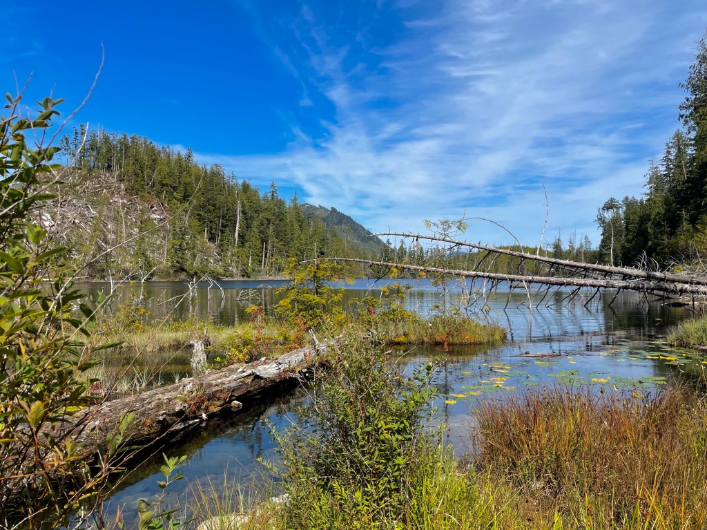
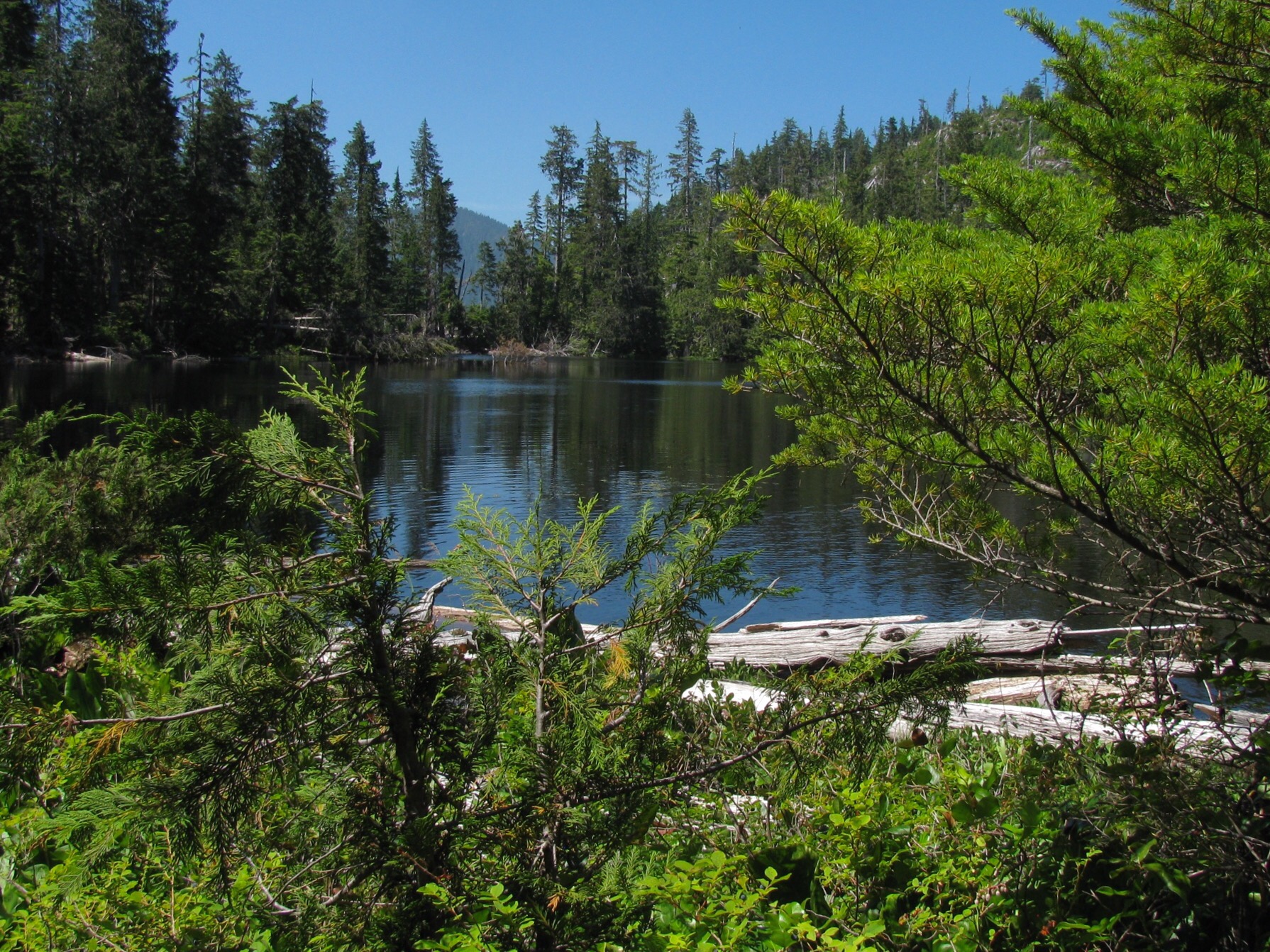
And at last we found a spot, secluded lake, not logged.


Nice big bear poop close by.

Next day was sunny.


And off we went again, further west, looking for a spot on the Klanawa river and no, we didn’t want to camp under the bridge. We did swing past the spot on the Tsucowis that we camped at 2 years ago, but it was occupied. We went part way around Darling main loop, and took one spur that led down through an old (1960’s?) logged area and found a skidder. I’m thinking that someone took it down there to salvage cedar logs for shake block cutting.


We didn’t find any nice spots, so back east to the bridge across Klanawa and then west again on south side of river. Finally found an OK spot west of Blue lake. Slash camping again, but a nice view.

Plenty signs of elk.


And bear, of course. Dogs are tired out.


As the sun went down, the marine cloud formed. That’s the west coast trail way down there in the cloud.

The moon was pretty, sky red with smoke from Russian and Alaskan fires?


The lads slept in the tent that night.

Nice sunny morning.

After breakfast we packed up and made a concerted effort to find a trail down to the Klanawa. Some false leads and a lot of bushwhacking later, we got there.


It was a lovely spot, virgin forest and clear water. At five pm we headed back to van, and then home. Van ran fine, but we were heavily loaded and the stock tintop syncro springs are not stiff enough for this sort of thing. Perhaps my old ’82 westy springs might be installed in the front and coil over shocks to help the rear?
Trip – Camper Creek watershed
Just back from a couple of days exploring the area NW of Port Renfrew. My wife and I made a trip there back in May but bad weather limited how much exploration we did. This time it looked like our summer had finally arrived so we headed out there to see what was what. Turned out the gate on Grierson main was locked so we could not make it up to the nice view point we camped at back in May, so we headed west on Camper main and found a spot just on the southern edge of Walbran Provincial Park. Yup, another campsite on a logged off area – we joked about writing a book “Slash Camping on Southern Vancouver Island”.
But the view was magnificent, looking over the logged area of Camper Creek watershed, to the south and west the virgin forest of Pacific Rim National Park (West Coast Trail), and Juan de Fuca Strait and Washington to the far south. This panorama doesn’t show the park boundaries, but just to orient you, Port Renfrew is pretty well behind that dip on the left.

I’m not going to go on and on trying to defend our habit of camping on logging spurs, we’re just different, ok?

A bit of haze was coming in over the straits as the sun set.

Next morning, thick marine cloud had arrived.


We packed up and headed down the slope and further west, exploring spurs and dead ends. All the way to the Pacific Rim National Park boundary. On the way we found another logged view point. You almost can see our first night spot back up on the ridge to the left, middle of pic, narrow vertical grey logged area.

About 950 metres further west is the National Park boundary, it is logged right up to it.

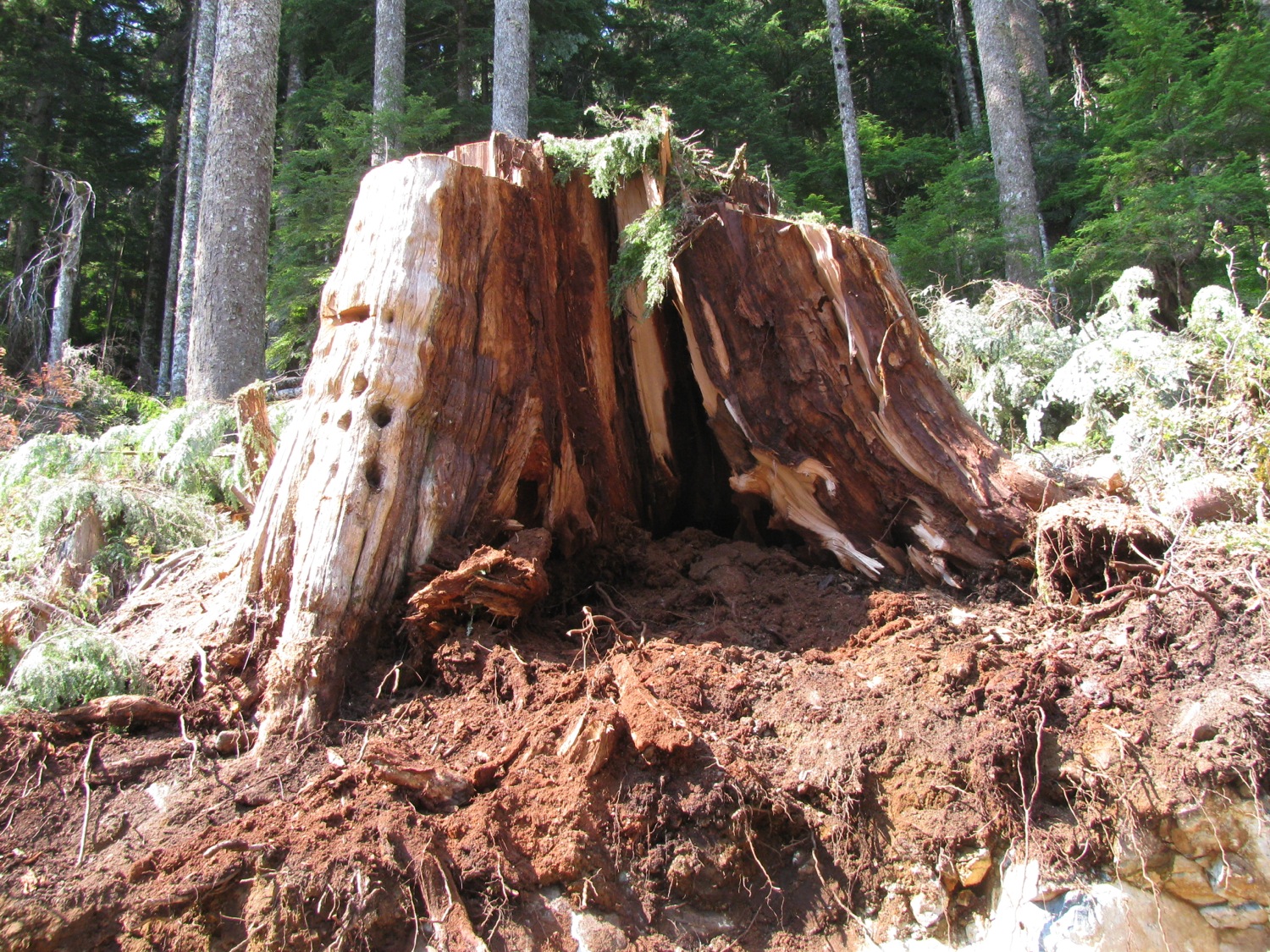
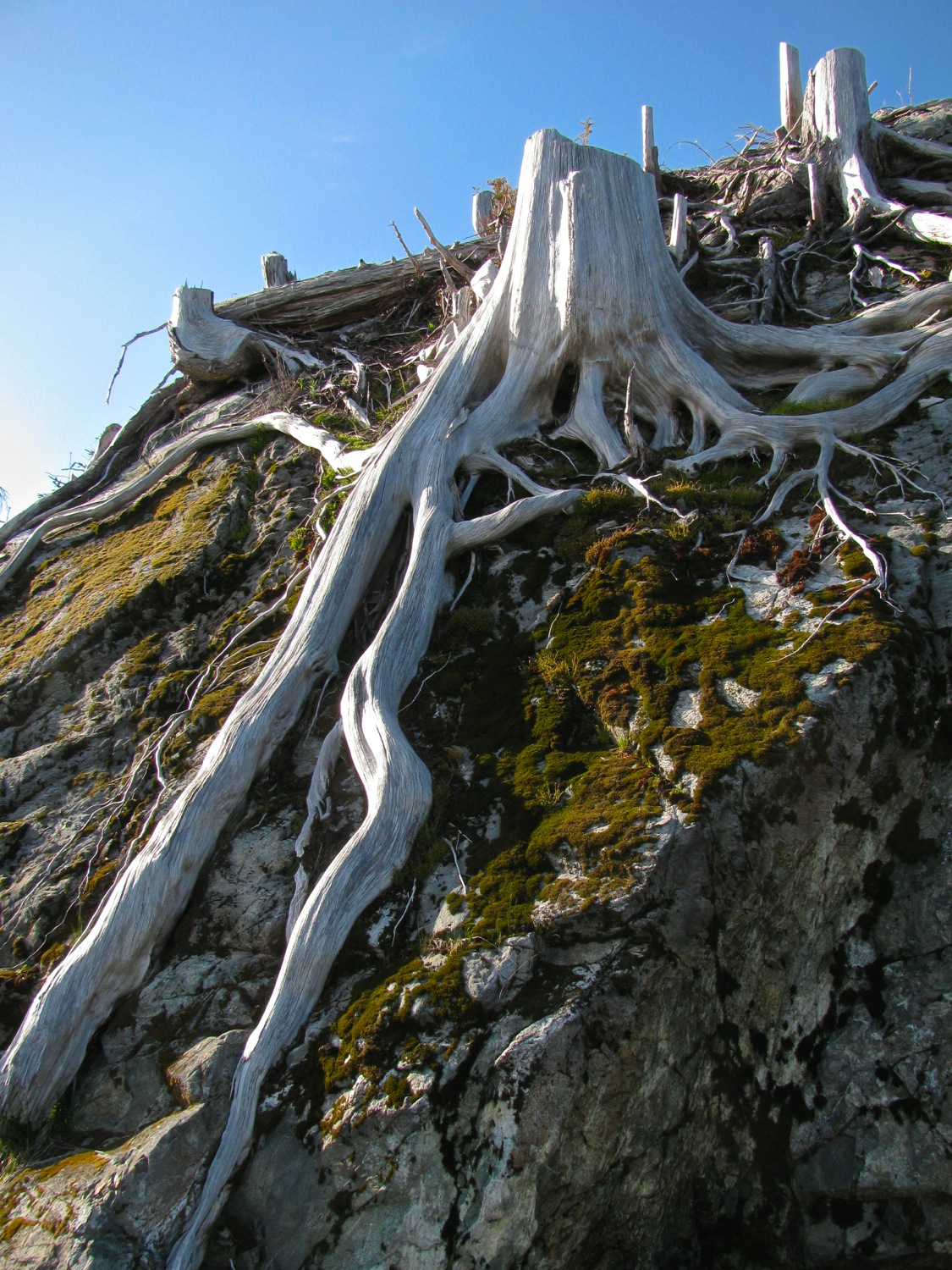
I don’t know why I take pictures of giant stumps without some object in frame to give an idea of size, but I do. This cedar stump really is bigger than you think.

Had a look at Sandstone creek.


And then back up to to the previously scouted campsite.

It really wasn’t that bad. See the cloud still on the deck in the background?


The low cloud made the sunset quite spectacular.


The cloud started to form around us after the sun went down.

And in the morning, we got the cloud full on. Damp and chilly.

On our way back home, we stopped at a spot on the Gordon River, a few km upstream of the marina.

All in all a pretty good trip. No one got hurt, no van problems, no run ins with bears (plenty of bear poop around), and plenty of food and drink. What more can you ask for?
Addendum: some more pics from trip.
We often came across signs of cedar shake block cutting, folk salvaging something from left over wood. On this trip it was all Red Cedar, on our previous trip in the area we saw Yellow Cedar shake block cutting too.


Apart from locked gates (mostly to restrict access to active logging areas – protecting machinery), many roads are “decommissioned”. Can take the form of large ditches and gravel berms across road, or taking out bridges. The latter shown in this pic, and a tree across the road to stop folk before they go over the edge.

My quick and dirty levelling ramps worked fine.

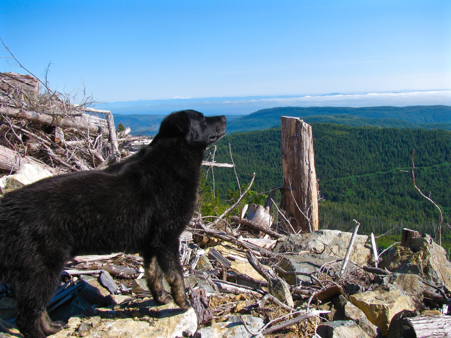
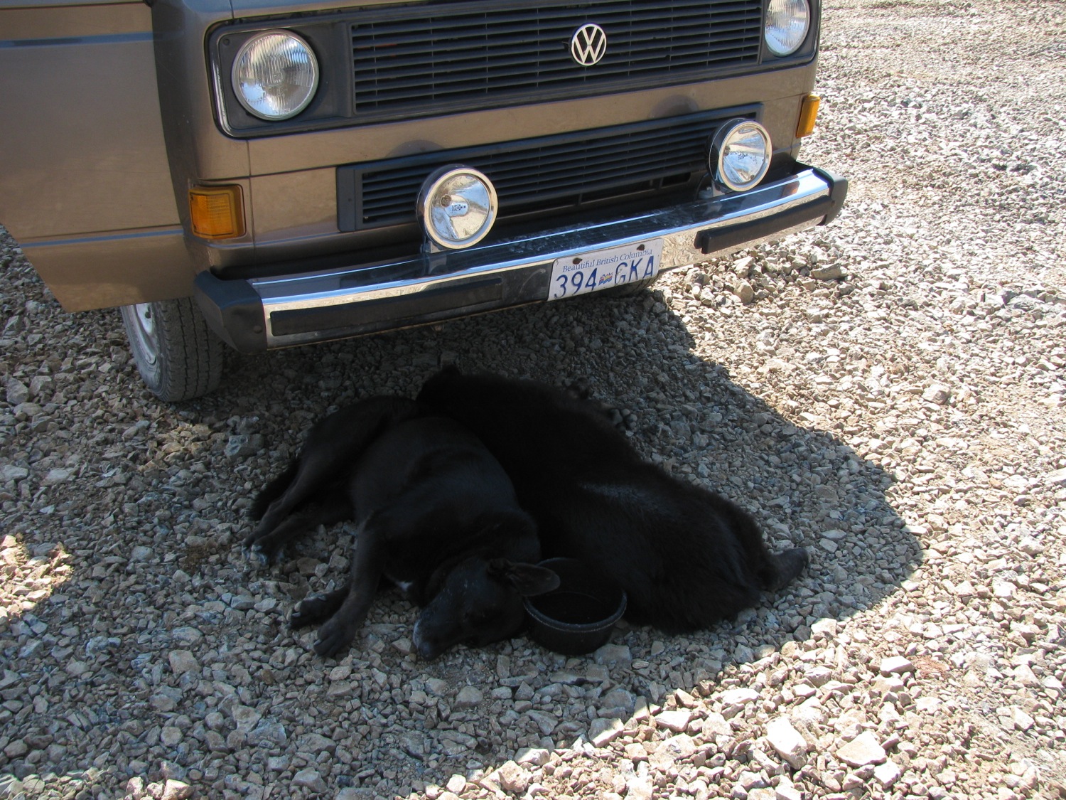
One of our two dogs looking noble. We don’t usually have any problems with them and the local wildlife but they have chased off a bear on another trip.

And here he is, dog tired.

As I mentioned before, lots of bear poop around. I think the bears are feeding on Salmon Berries.

Another shot of the marine cloud and West Coast Trail boundary. Where I took the pic the temperature was in the mid to upper 20’s C. Next day when we were in the cloud it was around 14 C. We were sympathetic for the hikers on the trail, they probably had no idea it was so nice and warm 150 metres higher.

Not the biggest slugs in the world, but pretty big.

Some of the sandstone outcrops.

Overnighter NW of Port Renfrew
We grabbed the chance to do a little exploring on the south end of the island (Vancouver Island), specifically just northwest of Port Renfrew. The area you get to if you hang a left instead of a right after the high bridge over the Gordon River.
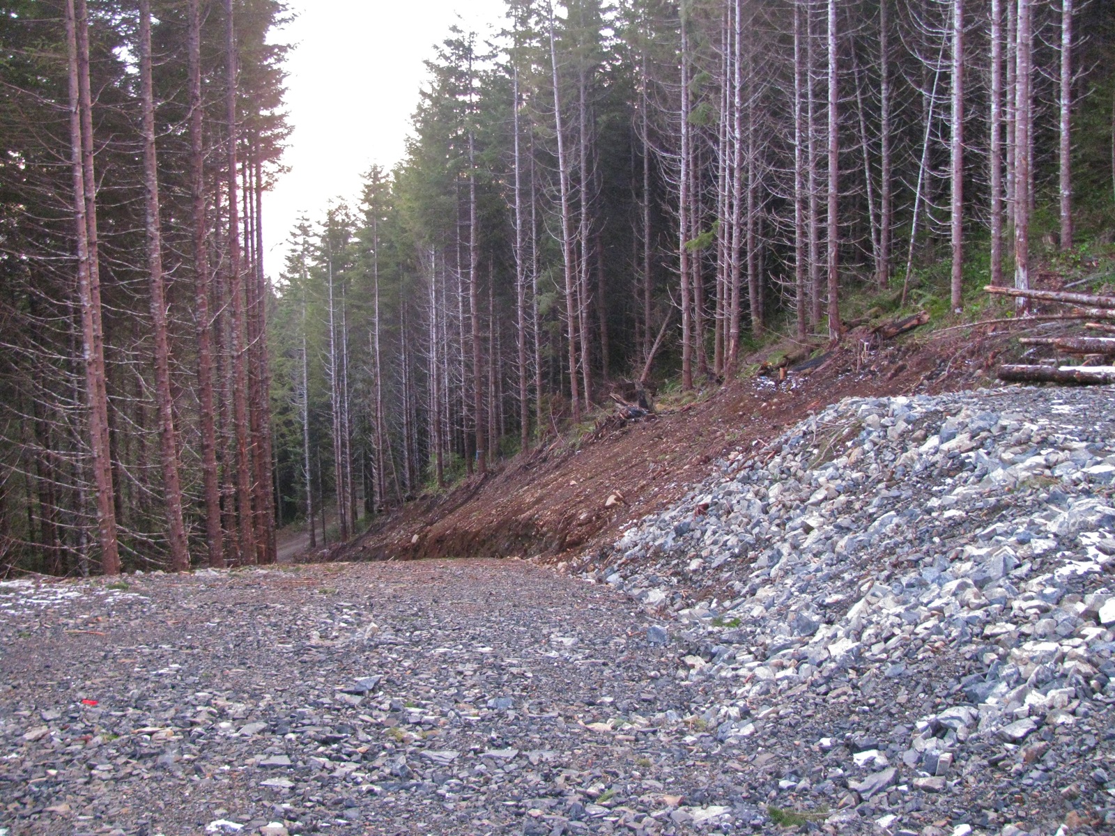
Typical, secondary and not heavily used logging road.


Further on, around 680 meters elevation, some old growth but mostly second growth (guessing old growth cut in the 60’s-70’s, perhaps later). Lots of Yellow Cedar, one down across road but a section at end cut and easily moved to get past (yes, patch of snow there).


And found a nice viewpoint to camp.

Olympic Peninsula (USA) in the distance, Cape Flattery on extreme right.

Like a bad haircut, or having a hightop on the van, the campsite was fine looking out, not so bucolic looking in. Still, no one around and plenty of firewood (felt like a millionaire burning Yellow Cedar, the scent is divine).


Tired dogs.


A couple of little lakes close by, here is a glimpse of one.

The clouds and rain moved in next day.

The “Excelsior” proved its worth at breakfast time.

Typical view when rain comes, looking north east.

We spent the wet day exploring the roads a little, but the low cloud made it a silly exercise. couldn’t see much. Headed back home via long loop up via Gordon River watershed and Cowichan valley (some pics of Gordon River area in this post). All in all a great little trip.
Oh, forgot to include one of those “same place, different time” shots. Side road on Gordon Main (TR4 I think), again on slash, where my son and I camped overnight while exploring region last year.
Then:

And now:

Addendum: I was asked about pressure cooker beside “The Excelsior”. It is my EKCO model I use winter camping and in the van, had it for 30+ years. I bought it second hand and it seems the model at least, dates from the ’40’s. Found an ad at this site.

Carriacou, Mayreaux, aerial pic of Clifton etc
Bit of a catch up, most of last week was spent taking underwater vid of reefs around Union island, Tobago Keys, Carriacou, and Cannouan, Here are some misc. snaps including boat drain plug held between Willis’ toes, boat rides with fairly heavy winds and respectable waves, bun with salt cod salad filling, small plane flight over area, dolphin fish (mahi-mahi/dorado), loggerhead turtle model.
On my way home, in St. Vincent now, flying out to Barbados then on to Canada later this morning.
Fri/Sat/Sun – Union Island
A snippet of what we were up to. Not shown are the equipment failures (leaky camera housings and fickle batteries), but we did manage to take a couple of hours of vid and record some transects of the sick coral reefs around Ashton Lagoon. We got towed round the area a fair distance using a manta board, deadly for sunburn on the back of legs and the back.
